TopoQuest Logo
Do you find TopoQuest useful?
Help keep TopoQuest running and adding new maps/features by donating!
Bitcoin:  19c7KJd3qBynnjoSw5npx9KScwjBe4ifkT
Litecoin:  LXs6TkuXGGXo1vDsWCkWVdjQX94eUKd6ui
Home View Maps Find Maps Find Places Resources & Links


Silver City, Idaho Topographic Map

USGS Map Title: Silver City, ID
USGS Map MRC: 43116A6
DRG (GeoTIFF) Download: o43116a6.tif


Neighboring USGS Topographic Map Quads:


  Rooster Comb Peak, ID  
43116B7
 

  Reynolds, ID  
43116B6
 

  Murphy, ID  
43116B5
 

  De Lamar, ID  
43116A7
 

  Silver City, ID  
43116A6
 

  Sinker Canyon, ID  
43116A5
 

  Flint, ID  
42116H7
 

  Cinnabar Mountain, ID  
42116H6
 

  Toy Pass, ID  
42116H5


Map MRC Location:

N44°
W117°
N44°
W116°
H8 H7 H6 H5 H4 H3 H2 H1
G8 G7 G6 G5 G4 G3 G2 G1
F8 F7 F6 F5 F4 F3 F2 F1
E8 E7 E6 E5 E4 E3 E2 E1
D8 D7 D6 D5 D4 D3 D2 D1
C8 C7 C6 C5 C4 C3 C2 C1
B8 B7 B6 B5 B4 B3 B2 B1
A8 A7 A6 A5 A4 A3 A2 A1
N43°
W117°
N43°
W116°

Silver City, ID USGS 1:24K Topographic Map Preview:
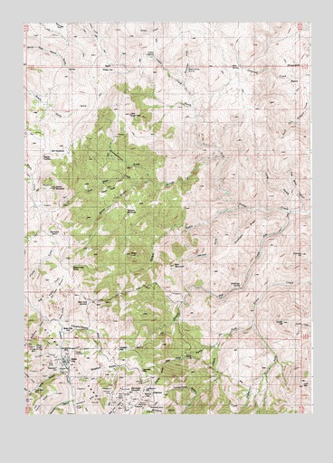
Silver City, ID USGS Topographic Map
Click on map above to begin viewing in our Map Viewer.

This topographic map contains these locations and features:
Feature Name Type Latitude Longitude GNIS ID View Map
Avondale BasinBasinN43.0571°W116.7376°371316View Map
Bald MountainSummitN43.0474°W116.6848°376210View Map
Black Horse SpringSpringN43.1096°W116.6785°371572View Map
Blackrock GulchValleyN43.0307°W116.7412°371590View Map
Blacksmith GulchValleyN43.0032°W116.7282°371592View Map
Bluejacket MineMineN43.0035°W116.6968°371626View Map
Bull Frame CreekStreamN43.0335°W116.7446°371776View Map
Bull Frame ReservoirsReservoirN43.0440°W116.7323°371777View Map
Bull MeadowFlatN43.0835°W116.7379°371779View Map
Cape Horn MineMineN43.0140°W116.6990°371885View Map
Castangetta Halfway HouseLocaleN43.0154°W116.7090°400345View Map
Cavaney HillSummitN43.0507°W116.6296°376209View Map
Cemetery GulchValleyN43.0193°W116.7357°371948View Map
Chariot GulchValleyN43.0157°W116.6898°371970View Map
China PointRidgeN43.0215°W116.7462°376213View Map
Coffee GulchValleyN43.0072°W116.7481°397564View Map
Coffee GulchValleyN43.0085°W116.7482°398578View Map
Cosmopolitan CreekStreamN43.0746°W116.6960°372144View Map
Cumberland GulchValleyN43.0063°W116.6757°372288View Map
Cumberland MillLocaleN43.0077°W116.6976°400346View Map
Drollinger RidgeRidgeN43.0577°W116.6543°376205View Map
Drollinger SpringSpringN43.0402°W116.6487°376029View Map
FairviewLocaleN43.0063°W116.6910°376340View Map
French GulchValleyN43.0279°W116.6954°372785View Map
Gerdie HillSummitN43.0293°W116.6382°400739View Map
Gertie GulchValleyN43.0290°W116.6515°396545View Map
Ghost RanchLocaleN43.0091°W116.6551°372838View Map
Gray Eagle CreekStreamN43.0735°W116.7023°372916View Map
Half Moon GulchValleyN43.0643°W116.6290°376204View Map
Horse Ranch CreekStreamN43.0821°W116.6648°373148View Map
Johnson GulchValleyN43.0607°W116.6718°376208View Map
Lead MountainSummitN43.0096°W116.6290°376427View Map
Leviathan GulchValleyN43.0099°W116.7457°373561View Map
Linehan FlatFlatN43.0188°W116.7140°373601View Map
Little Sugar LoafPopulated PlaceN43.0960°W116.7046°396808View Map
Long GulchValleyN43.0140°W116.7348°397868View Map
Mahogany GulchValleyN43.0004°W116.6829°373800View Map
Milk SpringSpringN43.1107°W116.6598°376036View Map
Morning Star MineMineN43.0227°W116.7323°374026View Map
New York SummitSummitN43.0377°W116.7268°374132View Map
Newsome GulchValleyN43.0196°W116.7337°374136View Map
North Sinker FlatFlatN43.1113°W116.7160°374230View Map
Nugent MeadowsFlatN43.0663°W116.7040°376207View Map
Oro Fino GulchValleyN43.0229°W116.6660°374273View Map
Oro Fino MineMineN43.0096°W116.6957°374274View Map
Peters PointRidgeN43.0718°W116.7123°376206View Map
Picnic GulchValleyN43.0304°W116.7351°376211View Map
Pioneer CemeteryCemeteryN43.0205°W116.7284°374415View Map
Placer MineMineN43.0054°W116.7448°374433View Map
Poorman MineMineN43.0043°W116.7110°374495View Map
Potosi RidgeRidgeN43.0032°W116.7446°376214View Map
Ruby CityLocaleN43.0252°W116.7376°376354View Map
Sawpit GulchValleyN43.0052°W116.7304°374911View Map
Scotch Bob CreekStreamN43.0643°W116.6348°374930View Map
Sheepherder SpringSpringN43.0477°W116.7312°376212View Map
Silver CityPopulated PlaceN43.0168°W116.7332°398130View Map
Silver City Fire and Rescue StationBuildingN43.0184°W116.7312°2619211View Map
Silver City MineMineN43.0138°W116.7337°398600View Map
Sinker TunnelTunnelN43.0196°W116.6810°375041View Map
Slacks CornerPopulated PlaceN43.0818°W116.7421°398137View Map
Slacks MountainSummitN43.0727°W116.7365°375059View Map
Slaughterhouse GulchValleyN43.0260°W116.7332°375064View Map
Stobie GulchValleyN43.0660°W116.6568°376430View Map
Stormy HillSummitN43.0052°W116.6957°398495View Map
Sugar LoafSummitN43.0518°W116.7040°400350View Map
Telegraph HillPopulated PlaceN43.0154°W116.7476°398221View Map
Tiddie CreekStreamN43.0968°W116.6754°375514View Map
Tiddie SpringSpringN43.1152°W116.6965°375515View Map
Trade Dollar MineMineN43.0082°W116.7387°375563View Map
War Eagle MountainSummitN43.0068°W116.7046°375725View Map
Webfoot GulchValleyN43.0124°W116.7301°375781View Map
West Fork Sinker CreekStreamN43.0660°W116.6568°375817View Map
Winchester GulchValleyN43.1060°W116.6793°375956View Map

Note: Coordinates in the location and feature list above are referenced to NAD83 datum.


Copyright (C) 2008-2024 Ryan Niemi / Sunset Dynamics ... All Rights Reserved