TopoQuest Logo
Do you find TopoQuest useful?
Help keep TopoQuest running and adding new maps/features by donating!
Bitcoin:  19c7KJd3qBynnjoSw5npx9KScwjBe4ifkT
Litecoin:  LXs6TkuXGGXo1vDsWCkWVdjQX94eUKd6ui
Home View Maps Find Maps Find Places Resources & Links


Cinnabar Mountain, Idaho Topographic Map

USGS Map Title: Cinnabar Mountain, ID
USGS Map MRC: 42116H6
DRG (GeoTIFF) Download: o42116h6.tif


Neighboring USGS Topographic Map Quads:


  De Lamar, ID  
43116A7
 

  Silver City, ID  
43116A6
 

  Sinker Canyon, ID  
43116A5
 

  Flint, ID  
42116H7
 

  Cinnabar Mountain, ID  
42116H6
 

  Toy Pass, ID  
42116H5
 

  Combination Ridge, ID  
42116G7
 

  Triangle Flat, ID  
42116G6
 

  Triangle Reservoir, ID  
42116G5


Map MRC Location:

N43°
W117°
N43°
W116°
H8 H7 H6 H5 H4 H3 H2 H1
G8 G7 G6 G5 G4 G3 G2 G1
F8 F7 F6 F5 F4 F3 F2 F1
E8 E7 E6 E5 E4 E3 E2 E1
D8 D7 D6 D5 D4 D3 D2 D1
C8 C7 C6 C5 C4 C3 C2 C1
B8 B7 B6 B5 B4 B3 B2 B1
A8 A7 A6 A5 A4 A3 A2 A1
N42°
W117°
N42°
W116°

Cinnabar Mountain, ID USGS 1:24K Topographic Map Preview:
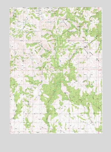
Cinnabar Mountain, ID USGS Topographic Map
Click on map above to begin viewing in our Map Viewer.

This topographic map contains these locations and features:
Feature Name Type Latitude Longitude GNIS ID View Map
Afterthought MineMineN42.9996°W116.6985°371192View Map
Boone PeakSummitN42.9154°W116.6748°371646View Map
Burnam FlatFlatN42.9879°W116.6504°371801View Map
China ButteSummitN42.9474°W116.7304°372001View Map
Cinnabar MountainSummitN42.9741°W116.6573°396289View Map
Driscol SpringSpringN42.9888°W116.6440°398527View Map
Empire City (historical)Populated PlaceN42.9782°W116.7112°399033View Map
French CreekStreamN42.9538°W116.6901°372784View Map
Hayden PeakSummitN42.9807°W116.6587°373024View Map
Lightning CreekStreamN42.9710°W116.6871°376201View Map
Mammoth RidgeRidgeN42.9485°W116.7004°376202View Map
Murphy DivisionCivilN42.9917°W116.7056°1936769View Map
Owyhee MountainsRangeN42.9807°W116.6587°374291View Map
Pickett Creek SaddleGapN42.9613°W116.6512°374388View Map
Quicksilver MountainSummitN42.9477°W116.6332°374552View Map
Sawpit PeakSummitN42.9910°W116.7407°374912View Map
Silver City RangeRangeN42.9727°W116.6668°375027View Map
Silver Cord GulchValleyN42.9988°W116.7271°375028View Map
Snow CabinLocaleN42.9557°W116.7215°375091View Map
Snow CreekStreamN42.9385°W116.6807°375094View Map
Thomas LakesLakeN42.9932°W116.6549°375489View Map
Turntable MountainSummitN42.9877°W116.6768°375610View Map

Note: Coordinates in the location and feature list above are referenced to NAD83 datum.


Copyright (C) 2008-2025 Ryan Niemi / Sunset Dynamics ... All Rights Reserved