TopoQuest Logo
Do you find TopoQuest useful?
Help keep TopoQuest running and adding new maps/features by donating!
Bitcoin:  19c7KJd3qBynnjoSw5npx9KScwjBe4ifkT
Litecoin:  LXs6TkuXGGXo1vDsWCkWVdjQX94eUKd6ui
Home View Maps Find Maps Find Places Resources & Links


Silver Peak, Oregon Topographic Map

USGS Map Title: Silver Peak, OR
USGS Map MRC: 42123D8
DRG (GeoTIFF) Download: o42123d8.tif


Neighboring USGS Topographic Map Quads:


  Agness, OR  
42124E1
 

  Brandy Peak, OR  
42123E8
 

  Hobson Horn, OR  
42123E7
 

  Horse Sign Butte, OR  
42124D1
 

  Silver Peak, OR  
42123D8
 

  York Butte, OR  
42123D7
 

  Big Craggies, OR  
42124C1
 

  Tincup Peak, OR  
42123C8
 

  Pearsoll Peak, OR  
42123C7


Map MRC Location:

N43°
W124°
N43°
W123°
H8 H7 H6 H5 H4 H3 H2 H1
G8 G7 G6 G5 G4 G3 G2 G1
F8 F7 F6 F5 F4 F3 F2 F1
E8 E7 E6 E5 E4 E3 E2 E1
D8 D7 D6 D5 D4 D3 D2 D1
C8 C7 C6 C5 C4 C3 C2 C1
B8 B7 B6 B5 B4 B3 B2 B1
A8 A7 A6 A5 A4 A3 A2 A1
N42°
W124°
N42°
W123°

Silver Peak, OR USGS 1:24K Topographic Map Preview:
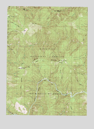
Silver Peak, OR USGS Topographic Map
Click on map above to begin viewing in our Map Viewer.

This topographic map contains these locations and features:
Feature Name Type Latitude Longitude GNIS ID View Map
Bald MountainSummitN42.4390°W123.9131°1137449View Map
Bald Mountain CampLocaleN42.4357°W123.9145°1155729View Map
Bald Mountain PrairieAreaN42.4387°W123.9142°1155728View Map
Deadman BarBarN42.4121°W123.9295°1140730View Map
Dick CreekStreamN42.4818°W123.9040°1154415View Map
Fantz RanchLocaleN42.4884°W123.9984°1142013View Map
Florence CreekStreamN42.4026°W123.8826°1142261View Map
Illinois River TrailTrailN42.4359°W123.9206°1143994View Map
Klondike CreekStreamN42.3962°W123.9017°1144671View Map
Little Bald Mountain PrairieFlatN42.4298°W123.9801°1145076View Map
Middle Bald PrairieFlatN42.4384°W123.9448°1639319View Map
North Fork Silver CreekStreamN42.4565°W123.8867°1146997View Map
Polar SpringSpringN42.4303°W123.9683°1147834View Map
Silver PeakSummitN42.4793°W123.9593°1149504View Map
Silver PrairieFlatN42.4701°W123.9737°1149505View Map
Siskiyou National ForestForestN42.3787°W123.9379°1639198View Map
South Bend MountainSummitN42.3968°W123.9772°1149902View Map
South Fork Silver CreekStreamN42.4523°W123.8790°1150013View Map
Sulphur CreekStreamN42.4090°W123.9262°1150575View Map
The WildAreaN42.4226°W123.9404°1155935View Map
West Ridge CampLocaleN42.4332°W123.9795°1155727View Map
Yukon CreekStreamN42.3915°W123.9034°1152765View Map

Note: Coordinates in the location and feature list above are referenced to NAD83 datum.


Copyright (C) 2008-2024 Ryan Niemi / Sunset Dynamics ... All Rights Reserved