TopoQuest Logo
Do you find TopoQuest useful?
Help keep TopoQuest running and adding new maps/features by donating!
Bitcoin:  19c7KJd3qBynnjoSw5npx9KScwjBe4ifkT
Litecoin:  LXs6TkuXGGXo1vDsWCkWVdjQX94eUKd6ui
Home View Maps Find Maps Find Places Resources & Links


York Butte, Oregon Topographic Map

USGS Map Title: York Butte, OR
USGS Map MRC: 42123D7
DRG (GeoTIFF) Download: o42123d7.tif


Neighboring USGS Topographic Map Quads:


  Brandy Peak, OR  
42123E8
 

  Hobson Horn, OR  
42123E7
 

  Mount Peavine, OR  
42123E6
 

  Silver Peak, OR  
42123D8
 

  York Butte, OR  
42123D7
 

  Chrome Ridge, OR  
42123D6
 

  Tincup Peak, OR  
42123C8
 

  Pearsoll Peak, OR  
42123C7
 

  Eight Dollar Mountain, OR  
42123C6


Map MRC Location:

N43°
W124°
N43°
W123°
H8 H7 H6 H5 H4 H3 H2 H1
G8 G7 G6 G5 G4 G3 G2 G1
F8 F7 F6 F5 F4 F3 F2 F1
E8 E7 E6 E5 E4 E3 E2 E1
D8 D7 D6 D5 D4 D3 D2 D1
C8 C7 C6 C5 C4 C3 C2 C1
B8 B7 B6 B5 B4 B3 B2 B1
A8 A7 A6 A5 A4 A3 A2 A1
N42°
W124°
N42°
W123°

York Butte, OR USGS 1:24K Topographic Map Preview:
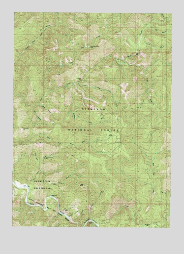
York Butte, OR USGS Topographic Map
Click on map above to begin viewing in our Map Viewer.

This topographic map contains these locations and features:
Feature Name Type Latitude Longitude GNIS ID View Map
Briggs CreekStreamN42.3757°W123.8081°1138627View Map
Briggs Creek Recreation SiteLocaleN42.3776°W123.8031°1155693View Map
Brushy BarBarN42.3762°W123.7737°1158146View Map
Chance CreekStreamN42.4807°W123.7770°1139562View Map
Chinaman HatSummitN42.4315°W123.8692°1139693View Map
Clear CreekStreamN42.3926°W123.8484°1139775View Map
Dasher MeadowAreaN42.3768°W123.7642°1155691View Map
Dorr CanyonValleyN42.4443°W123.8626°1141197View Map
East Fork Pine CreekStreamN42.4118°W123.8579°1141590View Map
Flat TopSummitN42.4295°W123.7927°1142244View Map
Hayden CreekStreamN42.3812°W123.8340°1143400View Map
Lake CreekStreamN42.4932°W123.7698°1144764View Map
Little Silver CreekStreamN42.4518°W123.8531°1145255View Map
Little Silver Creek LakeLakeN42.4804°W123.8165°1155689View Map
Little Todd CreekStreamN42.4587°W123.8279°1145280View Map
Moon CreekStreamN42.3873°W123.7901°1154847View Map
Mud SpringsSpringN42.4262°W123.8008°1146589View Map
Nobles HouseParkN42.3929°W123.8462°1155692View Map
Old Glory MineMineN42.4601°W123.8237°1147195View Map
Panther BarBarN42.3759°W123.8104°1147385View Map
Panther CreekStreamN42.3790°W123.8145°1147388View Map
Phillips CreekStreamN42.4576°W123.8348°1147634View Map
Pine CreekStreamN42.3984°W123.8659°1147683View Map
Pine Creek Shelter (historical)LocaleN42.4146°W123.8534°1147702View Map
Pine FlatFlatN42.3971°W123.8667°1147706View Map
Rawhide CreekStreamN42.4957°W123.7567°1155690View Map
Red Dog CreekStreamN42.3857°W123.7520°1148292View Map
Silver FallsFallsN42.4753°W123.7801°1149494View Map
Soldier CreekStreamN42.3771°W123.7623°1149865View Map
Todd CreekStreamN42.4665°W123.7734°1151294View Map
Trail CanyonValleyN42.4459°W123.8573°1151364View Map
Weaver Ranch (historical)LocaleN42.3998°W123.8717°1151986View Map
West Fork Pine CreekStreamN42.4118°W123.8576°1152102View Map
York ButteSummitN42.3991°W123.8199°1152747View Map
York CreekStreamN42.3829°W123.8398°1152748View Map
York Creek Botanical AreaAreaN42.3890°W123.8070°1155932View Map

Note: Coordinates in the location and feature list above are referenced to NAD83 datum.


Copyright (C) 2008-2025 Ryan Niemi / Sunset Dynamics ... All Rights Reserved