TopoQuest Logo
Do you find TopoQuest useful?
Help keep TopoQuest running and adding new maps/features by donating!
Bitcoin:  19c7KJd3qBynnjoSw5npx9KScwjBe4ifkT
Litecoin:  LXs6TkuXGGXo1vDsWCkWVdjQX94eUKd6ui
Home View Maps Find Maps Find Places Resources & Links


Horse Sign Butte, Oregon Topographic Map

USGS Map Title: Horse Sign Butte, OR
USGS Map MRC: 42124D1
DRG (GeoTIFF) Download: o42124d1.tif


Neighboring USGS Topographic Map Quads:


  Soldier Camp Mountain, OR  
42124E2
 

  Agness, OR  
42124E1
 

  Brandy Peak, OR  
42123E8
 

  Quosatana Butte, OR  
42124D2
 

  Horse Sign Butte, OR  
42124D1
 

  Silver Peak, OR  
42123D8
 

  Collier Butte, OR  
42124C2
 

  Big Craggies, OR  
42124C1
 

  Tincup Peak, OR  
42123C8


Map MRC Location:

N43°
W125°
N43°
W124°
H8 H7 H6 H5 H4 H3 H2 H1
G8 G7 G6 G5 G4 G3 G2 G1
F8 F7 F6 F5 F4 F3 F2 F1
E8 E7 E6 E5 E4 E3 E2 E1
D8 D7 D6 D5 D4 D3 D2 D1
C8 C7 C6 C5 C4 C3 C2 C1
B8 B7 B6 B5 B4 B3 B2 B1
A8 A7 A6 A5 A4 A3 A2 A1
N42°
W125°
N42°
W124°

Horse Sign Butte, OR USGS 1:24K Topographic Map Preview:
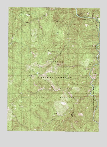
Horse Sign Butte, OR USGS Topographic Map
Click on map above to begin viewing in our Map Viewer.

This topographic map contains these locations and features:
Feature Name Type Latitude Longitude GNIS ID View Map
Black Rock CreekStreamN42.4826°W124.0020°1155725View Map
Bluff CreekStreamN42.4673°W124.0006°1155726View Map
Brandon CampLocaleN42.4754°W124.0604°1155732View Map
Burt CampLocaleN42.4284°W124.0470°1155733View Map
Buzzards RoostSummitN42.4945°W124.0284°1139085View Map
Collier BarBarN42.4165°W124.0109°1139996View Map
Conners PlaceLocaleN42.4618°W124.0062°1140045View Map
Forest CreekStreamN42.4876°W124.0054°1155730View Map
Fry PlaceLocaleN42.4915°W124.0998°1142518View Map
Game LakeLakeN42.4332°W124.0856°1142564View Map
Game Lake Lookout (historical)LocaleN42.4301°W124.0937°1142565View Map
Game Lake Recreation SiteLocaleN42.4321°W124.0862°1926243View Map
Horse Sign ButteSummitN42.4425°W124.0561°1143788View Map
Horse Sign CreekStreamN42.4934°W124.0331°1143789View Map
Horse Sign Creek RapidsRapidsN42.4923°W124.0318°1155731View Map
Hurt CabinLocaleN42.3921°W124.0631°1143964View Map
Illinois National Wild and Scenic RiverParkN42.4373°W124.0054°1155703View Map
Indian FlatFlatN42.4987°W124.0007°1144055View Map
Indigo CreekStreamN42.4901°W124.0112°1144088View Map
Lawson ButteSummitN42.4859°W124.0611°1144890View Map
North Fork Collier CreekStreamN42.4057°W124.0279°1146934View Map
Pine Flat CreekStreamN42.4551°W124.0548°1147709View Map
Silver CreekStreamN42.4546°W124.0004°1149488View Map
Sizeable StreamStreamN42.4471°W124.0634°1155734View Map
Sourdough Camp (historical)LocaleN42.4004°W124.1090°1149886View Map
South Fork Collier CreekStreamN42.3768°W124.0790°1149957View Map

Note: Coordinates in the location and feature list above are referenced to NAD83 datum.


Copyright (C) 2008-2025 Ryan Niemi / Sunset Dynamics ... All Rights Reserved