TopoQuest Logo
Do you find TopoQuest useful?
Help keep TopoQuest running and adding new maps/features by donating!
Bitcoin:  19c7KJd3qBynnjoSw5npx9KScwjBe4ifkT
Litecoin:  LXs6TkuXGGXo1vDsWCkWVdjQX94eUKd6ui
Home View Maps Find Maps Find Places Resources & Links


Silver Spur Ridge, Idaho Topographic Map

USGS Map Title: Silver Spur Ridge, ID
USGS Map MRC: 45115E5
DRG (GeoTIFF) Download: o45115e5.tif


Neighboring USGS Topographic Map Quads:


  North Pole, ID  
45115F6
 

  Orogrande, ID  
45115F5
 

  Moose Butte, ID  
45115F4
 

  Buffalo Hump, ID  
45115E6
 

  Silver Spur Ridge, ID  
45115E5
 

  Dixie, ID  
45115E4
 

  Cottontail Point, ID  
45115D6
 

  Mackay Bar, ID  
45115D5
 

  Fivemile Bar, ID  
45115D4


Map MRC Location:

N46°
W116°
N46°
W115°
H8 H7 H6 H5 H4 H3 H2 H1
G8 G7 G6 G5 G4 G3 G2 G1
F8 F7 F6 F5 F4 F3 F2 F1
E8 E7 E6 E5 E4 E3 E2 E1
D8 D7 D6 D5 D4 D3 D2 D1
C8 C7 C6 C5 C4 C3 C2 C1
B8 B7 B6 B5 B4 B3 B2 B1
A8 A7 A6 A5 A4 A3 A2 A1
N45°
W116°
N45°
W115°

Silver Spur Ridge, ID USGS 1:24K Topographic Map Preview:
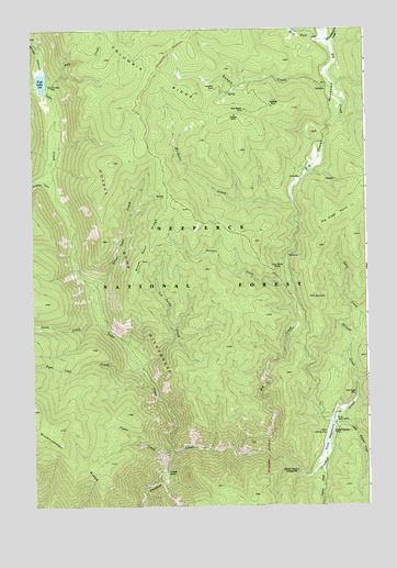
Silver Spur Ridge, ID USGS Topographic Map
Click on map above to begin viewing in our Map Viewer.

This topographic map contains these locations and features:
Feature Name Type Latitude Longitude GNIS ID View Map
Big CreekStreamN45.5138°W115.5471°377476View Map
Big Creek MeadowsFlatN45.6038°W115.5112°377492View Map
Big Creek PointSummitN45.5760°W115.5112°397437View Map
Calendar CanyonValleyN45.6207°W115.6232°378709View Map
Cape HornCapeN45.5088°W115.5768°378893View Map
Columbia RidgeRidgeN45.6082°W115.5660°379592View Map
Dixie Royal MineMineN45.5288°W115.5057°380650View Map
Dixie USFS AirportAirportN45.5194°W115.5151°400804View Map
Dixie Work CenterLocaleN45.5213°W115.5115°380653View Map
Eutopia CreekStreamN45.6096°W115.5121°381502View Map
Eutopia MineMineN45.6027°W115.5504°381503View Map
Fawn CreekStreamN45.5471°W115.5993°381622View Map
Fawn Lake CreekStreamN45.5366°W115.5865°381629View Map
Fish LakeLakeN45.6112°W115.6213°381763View Map
Gold Master MineMineN45.6041°W115.5465°382388View Map
Goldbug MineMineN45.6046°W115.5362°382401View Map
Halfway House CampgroundLocaleN45.5094°W115.5276°382821View Map
Hay ForkStreamN45.6241°W115.5157°399909View Map
Hematite MineMineN45.6094°W115.5579°383083View Map
Herman CreekStreamN45.5552°W115.5296°383116View Map
Jim Sandy CreekStreamN45.5366°W115.5854°383917View Map
Johnson CabinLocaleN45.6105°W115.6196°383971View Map
Jumbo CanyonValleyN45.5855°W115.6207°384045View Map
Lake CreekStreamN45.5146°W115.5751°384368View Map
Lemon CreekStreamN45.5094°W115.5196°384575View Map
Little Blowout CreekStreamN45.5221°W115.5129°384741View Map
McGuire CreekStreamN45.5788°W115.5285°386624View Map
Moose Meadow CreekStreamN45.6216°W115.5137°387193View Map
Nut HillSummitN45.5546°W115.5204°387893View Map
Pete CreekStreamN45.6099°W115.6204°388357View Map
Power CreekStreamN45.5135°W115.5757°388842View Map
Silver Spur CreekStreamN45.5568°W115.6035°390457View Map
Silver Spur RidgeRidgeN45.5668°W115.5821°390458View Map
Straight CreekStreamN45.5327°W115.5040°391519View Map
Union Group MinesMineN45.5619°W115.5351°392609View Map
West Fork Big CreekStreamN45.6221°W115.5151°393049View Map
Whistling Pig CanyonValleyN45.6102°W115.6246°393306View Map
Whistling Pig CreekStreamN45.6102°W115.6224°399710View Map

Note: Coordinates in the location and feature list above are referenced to NAD83 datum.


Copyright (C) 2008-2025 Ryan Niemi / Sunset Dynamics ... All Rights Reserved