TopoQuest Logo
Do you find TopoQuest useful?
Help keep TopoQuest running and adding new maps/features by donating!
Bitcoin:  19c7KJd3qBynnjoSw5npx9KScwjBe4ifkT
Litecoin:  LXs6TkuXGGXo1vDsWCkWVdjQX94eUKd6ui
Home View Maps Find Maps Find Places Resources & Links


Alberta, Michigan Topographic Map

USGS Map Title: Alberta, MI
USGS Map MRC: 46088F4
DRG (GeoTIFF) Download: o46088f4.tif


Neighboring USGS Topographic Map Quads:


  Bear Town, MI  
46088G5
 

  L'Anse, MI  
46088G4
 

  Aura, MI  
46088G3
 

  Baraga Plains, MI  
46088F5
 

  Alberta, MI  
46088F4
 

  Herman, MI  
46088F3
 

  Covington, MI  
46088E5
 

  Vermilac, MI  
46088E4
 

  Nestoria, MI  
46088E3


Map MRC Location:

N47°
W89°
N47°
W88°
H8 H7 H6 H5 H4 H3 H2 H1
G8 G7 G6 G5 G4 G3 G2 G1
F8 F7 F6 F5 F4 F3 F2 F1
E8 E7 E6 E5 E4 E3 E2 E1
D8 D7 D6 D5 D4 D3 D2 D1
C8 C7 C6 C5 C4 C3 C2 C1
B8 B7 B6 B5 B4 B3 B2 B1
A8 A7 A6 A5 A4 A3 A2 A1
N46°
W89°
N46°
W88°

Alberta, MI USGS 1:24K Topographic Map Preview:
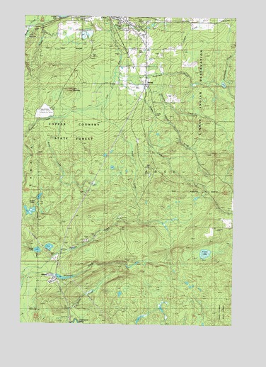
Alberta, MI USGS Topographic Map
Click on map above to begin viewing in our Map Viewer.

This topographic map contains these locations and features:
Feature Name Type Latitude Longitude GNIS ID View Map
AlbertaPopulated PlaceN46.6435°W88.4796°619905View Map
Baraga County Memorial HospitalHospitalN46.7318°W88.4251°2129155View Map
Baraga County Sheriff's OfficeBuildingN46.7489°W88.4408°2129145View Map
Bishop Baraga ShrineChurchN46.7483°W88.4819°2129327View Map
BovinePopulated PlaceN46.7225°W88.4278°2099892View Map
Burns CreekStreamN46.7091°W88.4765°622295View Map
Burns LakeLakeN46.6547°W88.4906°622299View Map
Daults CreekStreamN46.6708°W88.3751°624321View Map
Daults FallsFallsN46.7097°W88.4217°2099891View Map
Denomie CreekStreamN46.7263°W88.4460°1617003View Map
Henry Ford Alberta Village MuseumBuildingN46.6417°W88.4822°2129333View Map
Jackson LakesLakeN46.6765°W88.4899°629174View Map
Kontio LakeLakeN46.6543°W88.3916°1618844View Map
L'Anse Golf ClubLocaleN46.7214°W88.4333°2129137View Map
L'Anse Mobile Home CourtPopulated PlaceN46.7431°W88.4319°2129142View Map
L'Anse Township CemeteryCemeteryN46.7467°W88.4432°2129378View Map
L'Anse-Lac Vieux Desert Trail Historical MarkerParkN46.7489°W88.4831°2129382View Map
Little MountainSummitN46.7203°W88.4719°2099893View Map
Menge CreekStreamN46.7466°W88.4957°632099View Map
Middle Falls River FallsFallsN46.7449°W88.4497°2117735View Map
Pekkala CreekStreamN46.7174°W88.4196°1623141View Map
Plumbago FallsFallsN46.6502°W88.4392°2117739View Map
Power Dam FallsFallsN46.7353°W88.4425°2117740View Map
Power House FallsFallsN46.7371°W88.4443°2117741View Map
Roubillard CreekStreamN46.7274°W88.4465°636264View Map
Taylor CreekStreamN46.7155°W88.4524°1614618View Map

Note: Coordinates in the location and feature list above are referenced to NAD83 datum.


Copyright (C) 2008-2024 Ryan Niemi / Sunset Dynamics ... All Rights Reserved