TopoQuest Logo
Do you find TopoQuest useful?
Help keep TopoQuest running and adding new maps/features by donating!
Bitcoin:  19c7KJd3qBynnjoSw5npx9KScwjBe4ifkT
Litecoin:  LXs6TkuXGGXo1vDsWCkWVdjQX94eUKd6ui
Home View Maps Find Maps Find Places Resources & Links


Siren East, Wisconsin Topographic Map

USGS Map Title: Siren East, WI
USGS Map MRC: 45092G3
DRG (GeoTIFF) Download: o45092g3.tif


Neighboring USGS Topographic Map Quads:


  Yellow Lake, WI  
45092H4
 

  Webster, WI  
45092H3
 

  Birch Island Lake, WI  
45092H2
 

  Siren West, WI  
45092G4
 

  Siren East, WI  
45092G3
 

  Hertel, WI  
45092G2
 

  Frederic, WI  
45092F4
 

  Clam Falls, WI  
45092F3
 

  Indian Creek, WI  
45092F2


Map MRC Location:

N46°
W93°
N46°
W92°
H8 H7 H6 H5 H4 H3 H2 H1
G8 G7 G6 G5 G4 G3 G2 G1
F8 F7 F6 F5 F4 F3 F2 F1
E8 E7 E6 E5 E4 E3 E2 E1
D8 D7 D6 D5 D4 D3 D2 D1
C8 C7 C6 C5 C4 C3 C2 C1
B8 B7 B6 B5 B4 B3 B2 B1
A8 A7 A6 A5 A4 A3 A2 A1
N45°
W93°
N45°
W92°

Siren East, WI USGS 1:24K Topographic Map Preview:
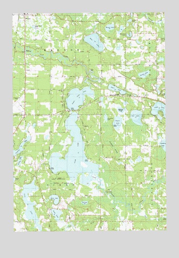
Siren East, WI USGS Topographic Map
Click on map above to begin viewing in our Map Viewer.

This topographic map contains these locations and features:
Feature Name Type Latitude Longitude GNIS ID View Map
Bass LakeLakeN45.8583°W92.3079°1561281View Map
Burnett CountyCivilN45.8627°W92.3676°1581066View Map
Burnett County AirportAirportN45.8217°W92.3690°1582209View Map
Burnett County JailBuildingN45.8225°W92.3662°2759836View Map
Burnett County Sheriff's OfficeBuildingN45.8225°W92.3665°2759698View Map
Clam LakeReservoirN45.8416°W92.3152°1792746View Map
Clam LakeLakeN45.7930°W92.3254°1563103View Map
Clam Lake 2WP1065 DamDamN45.8416°W92.3152°1792745View Map
Clam Lake CemeteryCemeteryN45.8311°W92.3355°1563104View Map
Cranberry LakeLakeN45.7983°W92.2511°1563495View Map
Crooked LakeLakeN45.7959°W92.3709°1563549View Map
Dongola SchoolSchoolN45.8597°W92.2538°1564054View Map
Horseshoe LakeLakeN45.8616°W92.2795°1566745View Map
Kent CreekStreamN45.7611°W92.2735°1567418View Map
Kruger SchoolLocaleN45.8427°W92.3663°1567655View Map
LaFollette TownhallBuildingN45.7911°W92.2830°1843139View Map
Larson LakeLakeN45.7903°W92.3698°1567862View Map
Long LakeLakeN45.7658°W92.3612°1568570View Map
Lower Clam LakeLakeN45.8264°W92.3219°1568720View Map
Lyman Bridge Public AccessParkN45.7722°W92.3002°1843147View Map
Mallard SloughLakeN45.8192°W92.2868°1843148View Map
Meenon TownhallBuildingN45.8424°W92.3641°1843149View Map
Money LakeLakeN45.8665°W92.2952°1569651View Map
North Fork Clam RiverStreamN45.7647°W92.2919°1570432View Map
Owl LakeLakeN45.8149°W92.2740°1570968View Map
Pike LakeLakeN45.8309°W92.2905°1571383View Map
Put LakeLakeN45.7661°W92.3170°1571981View Map
Sand LakeLakeN45.7598°W92.3402°1573685View Map
Sand Lake TownhallBuildingN45.8597°W92.2532°1843176View Map
Silver LakeLakeN45.7684°W92.3414°1574149View Map
Sleighbell SloughGutN45.7955°W92.2952°1574270View Map
Sunfish LakeLakeN45.8703°W92.2789°1843193View Map
Tamarack LakeLakeN45.8145°W92.2992°1575244View Map
Taylor LakeLakeN45.8119°W92.2898°1575278View Map
Town of MeenonCivilN45.8584°W92.3431°1583687View Map
Town of SirenCivilN45.7710°W92.3437°1584165View Map
Tucker LakeLakeN45.8394°W92.2679°1575702View Map
Viola LakeLakeN45.8178°W92.2513°1576110View Map
Viola Lake Alliance ChurchChurchN45.8272°W92.2674°1576112View Map
Viola Lake CemeteryCemeteryN45.8272°W92.2782°1576111View Map
Webster Elementary SchoolSchoolN45.8750°W92.3627°2713280View Map

Note: Coordinates in the location and feature list above are referenced to NAD83 datum.


Copyright (C) 2008-2024 Ryan Niemi / Sunset Dynamics ... All Rights Reserved