TopoQuest Logo
Do you find TopoQuest useful?
Help keep TopoQuest running and adding new maps/features by donating!
Bitcoin:  19c7KJd3qBynnjoSw5npx9KScwjBe4ifkT
Litecoin:  LXs6TkuXGGXo1vDsWCkWVdjQX94eUKd6ui
Home View Maps Find Maps Find Places Resources & Links


Six Lakes, Michigan Topographic Map

USGS Map Title: Six Lakes, MI
USGS Map MRC: 43085D2
DRG (GeoTIFF) Download: o43085d2.tif


Neighboring USGS Topographic Map Quads:


  Altona, MI  
43085E3
 

  Mecosta, MI  
43085E2
 

  Blanchard, MI  
43085E1
 

  Lakeview, MI  
43085D3
 

  Six Lakes, MI  
43085D2
 

  Edmore, MI  
43085D1
 

  Trufant, MI  
43085C3
 

  Langston, MI  
43085C2
 

  Stanton, MI  
43085C1


Map MRC Location:

N44°
W86°
N44°
W85°
H8 H7 H6 H5 H4 H3 H2 H1
G8 G7 G6 G5 G4 G3 G2 G1
F8 F7 F6 F5 F4 F3 F2 F1
E8 E7 E6 E5 E4 E3 E2 E1
D8 D7 D6 D5 D4 D3 D2 D1
C8 C7 C6 C5 C4 C3 C2 C1
B8 B7 B6 B5 B4 B3 B2 B1
A8 A7 A6 A5 A4 A3 A2 A1
N43°
W86°
N43°
W85°

Six Lakes, MI USGS 1:24K Topographic Map Preview:
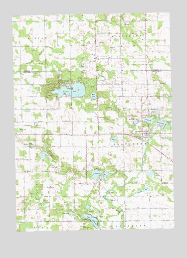
Six Lakes, MI USGS Topographic Map
Click on map above to begin viewing in our Map Viewer.

This topographic map contains these locations and features:
Feature Name Type Latitude Longitude GNIS ID View Map
Basin LakeLakeN43.4340°W85.2468°620675View Map
Bass Beach CampgroundLocaleN43.4533°W85.2083°2561562View Map
Bass LakeLakeN43.4526°W85.1870°620690View Map
Belvidere ChurchChurchN43.3870°W85.1636°621079View Map
Belvidere Post Office (historical)Post OfficeN43.4300°W85.1833°2560210View Map
Belvidere Township Fire DepartmentBuildingN43.4304°W85.1467°2636005View Map
Bible Missionary ChurchChurchN43.4444°W85.1508°2561543View Map
Big Brimmer LakeLakeN43.4187°W85.2287°621298View Map
Brimmer CreekStreamN43.4084°W85.1897°622000View Map
Cato CemeteryCemeteryN43.4172°W85.2472°622881View Map
Church of the Gentle ShepherdChurchN43.4303°W85.1394°2561544View Map
Clear LakeLakeN43.4941°W85.1628°623416View Map
Evergreen CemeteryCemeteryN43.4017°W85.1353°625696View Map
First LakeLakeN43.4380°W85.1430°626014View Map
First Lake ParkParkN43.4358°W85.1436°2561541View Map
Fouts SchoolSchoolN43.4961°W85.1842°626352View Map
Hillcrest CemeteryCemeteryN43.4434°W85.1470°628296View Map
Horseshoe CreekStreamN43.4011°W85.1631°628602View Map
Horseshoe LakeLakeN43.4070°W85.1839°628614View Map
Lake ForestLakeN43.3850°W85.2068°626284View Map
Lake MontcalmLakeN43.3811°W85.1907°632596View Map
Lakeview Seventh Day Adventist ChurchChurchN43.4314°W85.2456°2561591View Map
Little Bass LakeLakeN43.4373°W85.1539°630547View Map
Little Brimmer LakeLakeN43.4246°W85.2363°630578View Map
Little Penny LakeLakeN43.4071°W85.1432°630722View Map
Montabella Community SchoolSchoolN43.4317°W85.1447°2561540View Map
Morton CemeteryCemeteryN43.4894°W85.2142°2519049View Map
Mud LakeLakeN43.4271°W85.1711°632966View Map
Penny LakeLakeN43.3975°W85.1487°634596View Map
Pleasant View ChurchChurchN43.4775°W85.1294°2513620View Map
Pleasant View United Brethren ChurchChurchN43.4494°W85.1442°2561542View Map
Schmied ParkParkN43.4608°W85.1958°2560223View Map
Second LakeLakeN43.4364°W85.1344°637520View Map
Six LakesPopulated PlaceN43.4250°W85.1500°638021View Map
Six Lakes Post OfficePost OfficeN43.4322°W85.1442°2561539View Map
Six Lakes Station (historical)LocaleN43.4283°W85.1461°2561538View Map
Third LakeLakeN43.4343°W85.1313°1614733View Map
Townline CreekStreamN43.4261°W85.1436°1615003View Map
Townline LakeLakeN43.4558°W85.2041°1615010View Map
Township of BelvidereCivilN43.4232°W85.1444°1625911View Map
Wolf CreekStreamN43.4353°W85.1592°1616681View Map
Wolf LakeLakeN43.4456°W85.1720°1616697View Map

Note: Coordinates in the location and feature list above are referenced to NAD83 datum.


Copyright (C) 2008-2024 Ryan Niemi / Sunset Dynamics ... All Rights Reserved