TopoQuest Logo
Do you find TopoQuest useful?
Help keep TopoQuest running and adding new maps/features by donating!
Bitcoin:  19c7KJd3qBynnjoSw5npx9KScwjBe4ifkT
Litecoin:  LXs6TkuXGGXo1vDsWCkWVdjQX94eUKd6ui
Home View Maps Find Maps Find Places Resources & Links


Lakeview, Michigan Topographic Map

USGS Map Title: Lakeview, MI
USGS Map MRC: 43085D3
DRG (GeoTIFF) Download: o43085d3.tif


Neighboring USGS Topographic Map Quads:


  Stanwood, MI  
43085E4
 

  Altona, MI  
43085E3
 

  Mecosta, MI  
43085E2
 

  Howard City, MI  
43085D4
 

  Lakeview, MI  
43085D3
 

  Six Lakes, MI  
43085D2
 

  Coral, MI  
43085C4
 

  Trufant, MI  
43085C3
 

  Langston, MI  
43085C2


Map MRC Location:

N44°
W86°
N44°
W85°
H8 H7 H6 H5 H4 H3 H2 H1
G8 G7 G6 G5 G4 G3 G2 G1
F8 F7 F6 F5 F4 F3 F2 F1
E8 E7 E6 E5 E4 E3 E2 E1
D8 D7 D6 D5 D4 D3 D2 D1
C8 C7 C6 C5 C4 C3 C2 C1
B8 B7 B6 B5 B4 B3 B2 B1
A8 A7 A6 A5 A4 A3 A2 A1
N43°
W86°
N43°
W85°

Lakeview, MI USGS 1:24K Topographic Map Preview:
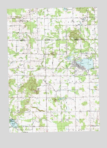
Lakeview, MI USGS Topographic Map
Click on map above to begin viewing in our Map Viewer.

This topographic map contains these locations and features:
Feature Name Type Latitude Longitude GNIS ID View Map
Birchwood Golf CourseLocaleN43.3917°W85.3611°2561634View Map
Blanchard DrainCanalN43.3986°W85.2947°2106622View Map
Brady HillsSummitN43.4181°W85.3381°621862View Map
Brandy CreekStreamN43.4406°W85.3269°2106625View Map
Bright Start Elementary SchoolSchoolN43.4358°W85.2739°2561600View Map
Brockway LakeLakeN43.4988°W85.2945°622019View Map
Cato Post Office (historical)Post OfficeN43.4097°W85.2631°2560205View Map
Dickerson CemeteryCemeteryN43.4534°W85.3228°624660View Map
Hinton ChurchChurchN43.4823°W85.2739°628348View Map
Holy Trinity Lutheran ChurchChurchN43.4358°W85.2667°2561586View Map
Kelsey Care CenterHospitalN43.4417°W85.2778°2561596View Map
Krampe ParkParkN43.3861°W85.3725°629869View Map
LakeviewPopulated PlaceN43.4464°W85.2742°630046View Map
Lakeview Baptist ChurchChurchN43.4317°W85.2753°2561599View Map
Lakeview Baptist SchoolSchoolN43.4317°W85.2753°2561598View Map
Lakeview CemeteryCemeteryN43.4467°W85.2739°630052View Map
Lakeview District Fire DepartmentBuildingN43.4440°W85.2824°2636192View Map
Lakeview Elementary SchoolSchoolN43.4389°W85.2769°2561601View Map
Lakeview Free Methodist ChurchChurchN43.4381°W85.2836°2561585View Map
Lakeview High SchoolSchoolN43.4361°W85.2811°2561602View Map
Lakeview Homes Mobile Home ParkPopulated PlaceN43.4331°W85.2631°2561595View Map
Lakeview Middle SchoolSchoolN43.4403°W85.2778°2561603View Map
Lakeview Police DepartmentBuildingN43.4429°W85.2788°2561592View Map
Lakeview Station (historical)LocaleN43.4372°W85.2653°2561563View Map
Lakeview-Griffith FieldAirportN43.4531°W85.2647°1623999View Map
Living Waters Pentecostal ChurchChurchN43.4308°W85.2828°2561590View Map
Pickerel LakeLakeN43.4084°W85.3022°634786View Map
Pickerel Lake DrainCanalN43.4194°W85.3133°2106623View Map
Rustford CemeteryCemeteryN43.4972°W85.3433°2106884View Map
Saint Francis de Sales ChurchChurchN43.4403°W85.2714°2561587View Map
Son Shine Worship CenterChurchN43.4383°W85.2744°2561588View Map
Spectrum Health United Memorial Hospital - Kelsey CampusHospitalN43.4400°W85.2780°2561597View Map
Strang and Bournstead DrainCanalN43.4439°W85.3528°2106626View Map
Tamarack District LibraryBuildingN43.4394°W85.2733°2561594View Map
Tamarack LakeLakeN43.4435°W85.2662°1614569View Map
Tamarack Post OfficePost OfficeN43.4417°W85.2797°2561593View Map
Tamarack Post Office (historical)Post OfficeN43.4389°W85.3444°2560063View Map
Township of CatoCivilN43.4241°W85.2635°1626045View Map
United Church of ChristChurchN43.4397°W85.2769°2561589View Map
Vanderwater DrainCanalN43.4375°W85.2917°2106624View Map
Village of LakeviewCivilN43.4432°W85.2733°2398389View Map
Winfield LakeLakeN43.3843°W85.3691°1616627View Map
WRIZ-FM (Lakeview)TowerN43.4092°W85.2648°1625730View Map

Note: Coordinates in the location and feature list above are referenced to NAD83 datum.


Copyright (C) 2008-2025 Ryan Niemi / Sunset Dynamics ... All Rights Reserved