TopoQuest Logo
Do you find TopoQuest useful?
Help keep TopoQuest running and adding new maps/features by donating!
Bitcoin:  19c7KJd3qBynnjoSw5npx9KScwjBe4ifkT
Litecoin:  LXs6TkuXGGXo1vDsWCkWVdjQX94eUKd6ui
Home View Maps Find Maps Find Places Resources & Links


Skelt, West Virginia Topographic Map

USGS Map Title: Skelt, WV
USGS Map MRC: 38080E3
DRG (GeoTIFF) Download: o38080e3.tif


Neighboring USGS Topographic Map Quads:


  Hacker Valley, WV  
38080F4
 

  Goshen, WV  
38080F3
 

  Pickens, WV  
38080F2
 

  Diana, WV  
38080E4
 

  Skelt, WV  
38080E3
 

  Samp, WV  
38080E2
 

  Webster Springs, WV  
38080D4
 

  Bergoo, WV  
38080D3
 

  Sharp Knob, WV  
38080D2


Map MRC Location:

N39°
W81°
N39°
W80°
H8 H7 H6 H5 H4 H3 H2 H1
G8 G7 G6 G5 G4 G3 G2 G1
F8 F7 F6 F5 F4 F3 F2 F1
E8 E7 E6 E5 E4 E3 E2 E1
D8 D7 D6 D5 D4 D3 D2 D1
C8 C7 C6 C5 C4 C3 C2 C1
B8 B7 B6 B5 B4 B3 B2 B1
A8 A7 A6 A5 A4 A3 A2 A1
N38°
W81°
N38°
W80°

Skelt, WV USGS 1:24K Topographic Map Preview:
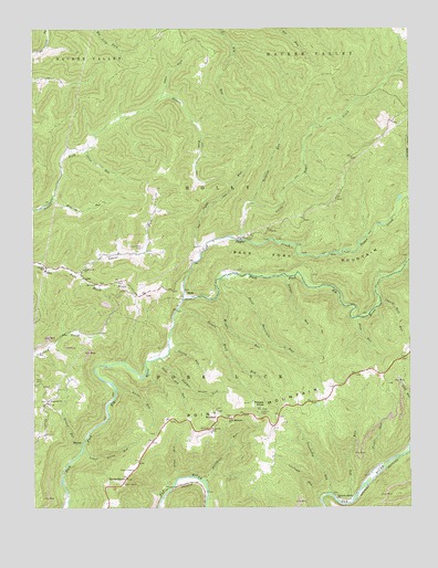
Skelt, WV USGS Topographic Map
Click on map above to begin viewing in our Map Viewer.

This topographic map contains these locations and features:
Feature Name Type Latitude Longitude GNIS ID View Map
Aaron RunStreamN38.5309°W80.3476°1534780View Map
Abb RunStreamN38.5012°W80.2704°1534785View Map
Allen Cogar Cemetery CemeteryN38.5680°W80.3390°2728246View Map
Amos ForkStreamN38.6068°W80.3326°1534926View Map
Baltimore RunStreamN38.5076°W80.3204°1535196View Map
BernardstownPopulated PlaceN38.5079°W80.3445°1549590View Map
Carlo RunStreamN38.5937°W80.3576°1537038View Map
Cherry Root RunStreamN38.5537°W80.2595°1537246View Map
Chestnut Bottom ChurchChurchN38.5023°W80.2745°1537262View Map
Chestnut Bottom School (historical)SchoolN38.5023°W80.2748°1727839View Map
Coalbank RunStreamN38.5029°W80.2792°1537475View Map
Dodrell School (historical)SchoolN38.5173°W80.3359°1727851View Map
Easy RunStreamN38.5493°W80.2690°1538528View Map
Fairview CemeteryCemeteryN38.5282°W80.3701°2586178View Map
Fairview ChurchChurchN38.5282°W80.3701°1538806View Map
Fisher RunStreamN38.5065°W80.2648°1538997View Map
Grandaddy RunStreamN38.5034°W80.2767°1539568View Map
Jumbo SchoolSchoolN38.5626°W80.3706°1541041View Map
Laurel ForkStreamN38.5609°W80.3595°1541441View Map
Laurel Fork CemeteryCemeteryN38.5679°W80.3390°1541465View Map
Laurel RunStreamN38.5159°W80.3590°1541495View Map
Little Sugar CreekStreamN38.5698°W80.3067°1551898View Map
Lower Aaron RunStreamN38.5148°W80.3590°1542520View Map
Lower Point Mountain Community Church CemeteryCemeteryN38.5238°W80.3094°2729025View Map
McCoy ChurchChurchN38.5584°W80.3540°1542966View Map
Middle RunStreamN38.5423°W80.3298°1727879View Map
Middle RunStreamN38.5548°W80.3145°1543212View Map
Northern DistrictCivilN38.5506°W80.3531°1928329View Map
Panther LickStreamN38.5393°W80.3329°1544554View Map
Pantherlick School (historical)SchoolN38.5409°W80.3329°1727891View Map
Point MountainRidgeN38.5279°W80.2895°1552522View Map
Point Mountain CemeteryCemeteryN38.5238°W80.3094°2573997View Map
Point Mountain ChurchChurchN38.5234°W80.3098°1545096View Map
Point Mountain Lookout TowerLocaleN38.5257°W80.2992°1727898View Map
Point Mountain RunStreamN38.5601°W80.3126°1545097View Map
Potato KnobSummitN38.5257°W80.2995°1545183View Map
Potato Knob RunStreamN38.5512°W80.3276°1545184View Map
Richard D Pyles SpringSpringN38.5015°W80.3490°1678172View Map
Roaring RunStreamN38.5807°W80.3681°1545836View Map
Sand Lick ChurchChurchN38.5584°W80.3540°1546367View Map
Sawyer RunStreamN38.5607°W80.2926°1546467View Map
SkeltPopulated PlaceN38.5554°W80.3220°1549931View Map
Spring RunStreamN38.5412°W80.3301°1547206View Map
Steps Gap RunStreamN38.5387°W80.3345°1547392View Map
Steps RunStreamN38.5079°W80.3267°1547393View Map
Sugar CreekStreamN38.5546°W80.3254°1553113View Map
Sugar RunStreamN38.5668°W80.3192°1547640View Map
WoodzellPopulated PlaceN38.5229°W80.3145°1556025View Map
Yelping RunStreamN38.5793°W80.3026°1549454View Map

Note: Coordinates in the location and feature list above are referenced to NAD83 datum.


Copyright (C) 2008-2024 Ryan Niemi / Sunset Dynamics ... All Rights Reserved