TopoQuest Logo
Do you find TopoQuest useful?
Help keep TopoQuest running and adding new maps/features by donating!
Bitcoin:  19c7KJd3qBynnjoSw5npx9KScwjBe4ifkT
Litecoin:  LXs6TkuXGGXo1vDsWCkWVdjQX94eUKd6ui
Home View Maps Find Maps Find Places Resources & Links


Slagle, Louisiana Topographic Map

USGS Map Title: Slagle, LA
USGS Map MRC: 31093B2
DRG (GeoTIFF) Download: o31093b2.tif


Neighboring USGS Topographic Map Quads:


  Dowden Creek, LA  
31093C3
 

  Kurthwood, LA  
31093C2
 

  Simpson North, LA  
31093C1
 

  Leesville, LA  
31093B3
 

  Slagle, LA  
31093B2
 

  Simpson South, LA  
31093B1
 

  New Llano, LA  
31093A3
 

  Fort Polk, LA  
31093A2
 

  Birds Creek, LA  
31093A1


Map MRC Location:

N32°
W94°
N32°
W93°
H8 H7 H6 H5 H4 H3 H2 H1
G8 G7 G6 G5 G4 G3 G2 G1
F8 F7 F6 F5 F4 F3 F2 F1
E8 E7 E6 E5 E4 E3 E2 E1
D8 D7 D6 D5 D4 D3 D2 D1
C8 C7 C6 C5 C4 C3 C2 C1
B8 B7 B6 B5 B4 B3 B2 B1
A8 A7 A6 A5 A4 A3 A2 A1
N31°
W94°
N31°
W93°

Slagle, LA USGS 1:24K Topographic Map Preview:
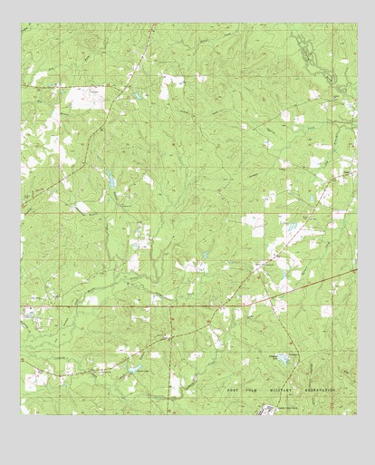
Slagle, LA USGS Topographic Map
Click on map above to begin viewing in our Map Viewer.

This topographic map contains these locations and features:
Feature Name Type Latitude Longitude GNIS ID View Map
Alligator LakeReservoirN31.1431°W93.1527°553292View Map
Alligator Lake DamDamN31.1385°W93.1385°556875View Map
Antioch Baptist ChurchChurchN31.2260°W93.1338°553307View Map
Antioch CemeteryCemeteryN31.2257°W93.1340°549978View Map
Beason CreekStreamN31.1694°W93.2146°532848View Map
Blackland BranchStreamN31.1877°W93.2188°533198View Map
Castor Baptist ChurchChurchN31.1507°W93.1963°553918View Map
Castor LakeReservoirN31.1390°W93.2094°553921View Map
Castor Lake DamDamN31.1402°W93.2102°556914View Map
Cooper CreekStreamN31.1680°W93.2124°554081View Map
Dry Fork Volunteer Fire DepartmentBuildingN31.2287°W93.2147°2672775View Map
East Leesville Baptist ChurchChurchN31.1591°W93.2463°549992View Map
East Leesville ChurchChurchN31.1621°W93.2424°554328View Map
Four Winds Cherokee State Designated Tribal Statistical AreaCensusN31.2348°W93.1580°2418587View Map
Franklin CemeteryCemeteryN31.1560°W93.1660°535086View Map
Mount Bethel Baptist ChurchChurchN31.1735°W93.1602°555388View Map
Mount Bethel ChurchChurchN31.1919°W93.2129°537289View Map
Mount Zion Church (historical)ChurchN31.1780°W93.2074°550044View Map
Parish Governing Authority District 11CivilN31.1328°W93.1948°1929813View Map
Pond BranchStreamN31.1349°W93.2185°538328View Map
Self CemeteryCemeteryN31.2280°W93.2243°539252View Map
SlaglePopulated PlaceN31.2024°W93.1274°543673View Map
Slagle Baptist ChurchChurchN31.2027°W93.1257°550073View Map
Slagle Post OfficePost OfficeN31.2021°W93.1277°1631400View Map
Slagle Volunteer Fire DepartmentBuildingN31.2016°W93.1285°2672791View Map
Smart CemeteryCemeteryN31.1946°W93.2490°539421View Map
Ward OneCivilN31.1407°W93.2260°545247View Map

Note: Coordinates in the location and feature list above are referenced to NAD83 datum.


Copyright (C) 2008-2024 Ryan Niemi / Sunset Dynamics ... All Rights Reserved