TopoQuest Logo
Do you find TopoQuest useful?
Help keep TopoQuest running and adding new maps/features by donating!
Bitcoin:  19c7KJd3qBynnjoSw5npx9KScwjBe4ifkT
Litecoin:  LXs6TkuXGGXo1vDsWCkWVdjQX94eUKd6ui
Home View Maps Find Maps Find Places Resources & Links


Slayden, Mississippi Topographic Map

USGS Map Title: Slayden, MS
USGS Map MRC: 34089H4
DRG (GeoTIFF) Download: o34089h4.tif


Neighboring USGS Topographic Map Quads:


  Rossville, TN  
35089A5
 

  Moscow, TN  
35089A4
 

  Moscow SE, TN  
35089A3
 

  Mount Pleasant, MS  
34089H5
 

  Slayden, MS  
34089H4
 

  Lamar, MS  
34089H3
 

  Red Banks, MS  
34089G5
 

  Holly Springs, MS  
34089G4
 

  Holly Springs SE, MS  
34089G3


Map MRC Location:

N35°
W90°
N35°
W89°
H8 H7 H6 H5 H4 H3 H2 H1
G8 G7 G6 G5 G4 G3 G2 G1
F8 F7 F6 F5 F4 F3 F2 F1
E8 E7 E6 E5 E4 E3 E2 E1
D8 D7 D6 D5 D4 D3 D2 D1
C8 C7 C6 C5 C4 C3 C2 C1
B8 B7 B6 B5 B4 B3 B2 B1
A8 A7 A6 A5 A4 A3 A2 A1
N34°
W90°
N34°
W89°

Slayden, MS USGS 1:24K Topographic Map Preview:
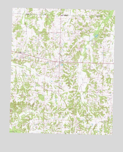
Slayden, MS USGS Topographic Map
Click on map above to begin viewing in our Map Viewer.

This topographic map contains these locations and features:
Feature Name Type Latitude Longitude GNIS ID View Map
Bailey CemeteryCemeteryN34.9923°W89.3756°666455View Map
Bethel CemeteryCemeteryN34.8890°W89.4765°666894View Map
Boswell CemeteryCemeteryN34.9506°W89.4823°667460View Map
Concord CemeteryCemeteryN34.9784°W89.4151°683796View Map
Concord ChurchChurchN34.9793°W89.4151°668745View Map
Concord School (historical)SchoolN34.9795°W89.4145°683797View Map
Dawson CreekStreamN34.8765°W89.4942°693068View Map
Early GrovePopulated PlaceN34.9759°W89.3848°691832View Map
Early Grove CemeteryCemeteryN34.9723°W89.3926°669550View Map
Gaters School (historical)SchoolN34.9009°W89.4292°683803View Map
Gatewood CemeteryCemeteryN34.9004°W89.4278°706307View Map
Gatewood ChurchChurchN34.9006°W89.4292°670335View Map
Hurdle School (historical)SchoolN34.9768°W89.4987°683813View Map
Isom Chapel CemeteryCemeteryN34.9031°W89.4762°1959769View Map
Isom Chapel Christian Methodist Episcopal ChurchChurchN34.9034°W89.4762°671743View Map
Isom School (historical)SchoolN34.9334°W89.4815°683815View Map
Jeter FieldAirportN34.9537°W89.3929°2676377View Map
Kimbrough CemeteryCemeteryN34.8887°W89.3865°683820View Map
Kimbrough ChapelChurchN34.8881°W89.3879°672128View Map
Knocks School (historical)SchoolN34.9843°W89.4717°683821View Map
Marshall County SchoolSchoolN34.9481°W89.4373°683826View Map
Mill PondLakeN34.9739°W89.3968°673634View Map
Pittman CemeteryCemeteryN34.9631°W89.4898°675948View Map
Roberts ChapelChurchN34.9398°W89.4029°676708View Map
Rocks School (historical)SchoolN34.8887°W89.3873°683851View Map
Sand FlatsFlatN34.9437°W89.4159°677338View Map
Sand Flats Junior High SchoolSchoolN34.9554°W89.4898°677339View Map
SlaydenPopulated PlaceN34.9470°W89.4409°677877View Map
Slayden Baptist ChurchChurchN34.9470°W89.4392°683858View Map
Slayden CemeteryCemeteryN34.9534°W89.4406°677878View Map
Slayden School (historical)SchoolN34.9318°W89.4029°683859View Map
Supervisor District 2CivilN34.9085°W89.4643°711983View Map

Note: Coordinates in the location and feature list above are referenced to NAD83 datum.


Copyright (C) 2008-2024 Ryan Niemi / Sunset Dynamics ... All Rights Reserved