TopoQuest Logo
Do you find TopoQuest useful?
Help keep TopoQuest running and adding new maps/features by donating!
Bitcoin:  19c7KJd3qBynnjoSw5npx9KScwjBe4ifkT
Litecoin:  LXs6TkuXGGXo1vDsWCkWVdjQX94eUKd6ui
Home View Maps Find Maps Find Places Resources & Links


Lamar, Mississippi Topographic Map

USGS Map Title: Lamar, MS
USGS Map MRC: 34089H3
DRG (GeoTIFF) Download: o34089h3.tif


Neighboring USGS Topographic Map Quads:


  Moscow, TN  
35089A4
 

  Moscow SE, TN  
35089A3
 

  Grand Junction, TN  
35089A2
 

  Slayden, MS  
34089H4
 

  Lamar, MS  
34089H3
 

  Canaan, MS  
34089H2
 

  Holly Springs, MS  
34089G4
 

  Holly Springs SE, MS  
34089G3
 

  Ashland, MS  
34089G2


Map MRC Location:

N35°
W90°
N35°
W89°
H8 H7 H6 H5 H4 H3 H2 H1
G8 G7 G6 G5 G4 G3 G2 G1
F8 F7 F6 F5 F4 F3 F2 F1
E8 E7 E6 E5 E4 E3 E2 E1
D8 D7 D6 D5 D4 D3 D2 D1
C8 C7 C6 C5 C4 C3 C2 C1
B8 B7 B6 B5 B4 B3 B2 B1
A8 A7 A6 A5 A4 A3 A2 A1
N34°
W90°
N34°
W89°

Lamar, MS USGS 1:24K Topographic Map Preview:
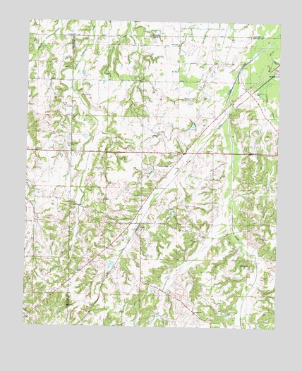
Lamar, MS USGS Topographic Map
Click on map above to begin viewing in our Map Viewer.

This topographic map contains these locations and features:
Feature Name Type Latitude Longitude GNIS ID View Map
Berry ChapelChurchN34.9906°W89.3001°666852View Map
Chubby CreekStreamN34.9779°W89.2537°692903View Map
Clear Creek CemeteryCemeteryN34.9176°W89.3703°706305View Map
Clear Creek ChurchChurchN34.9181°W89.3704°668577View Map
Franklin School (historical)SchoolN34.9976°W89.3003°1319818View Map
Frnklin CemeteryCemeteryN34.9809°W89.3534°670257View Map
Gorman CemeteryCemeteryN34.9356°W89.2823°670540View Map
Grays CreekStreamN34.9923°W89.2540°693346View Map
Greenwood CemeteryCemeteryN34.8806°W89.2890°683263View Map
Greenwood ChurchChurchN34.8809°W89.2909°670724View Map
Greenwood School (historical)SchoolN34.8809°W89.2904°683264View Map
Hardaway CemeteryCemeteryN34.9006°W89.2637°670897View Map
Hebron ChurchChurchN34.9118°W89.2565°671083View Map
Hebron School (historical)SchoolN34.9118°W89.2559°683265View Map
Hickory Hill CemeteryCemeteryN34.9268°W89.3337°671172View Map
Howard CemeteryCemeteryN34.9695°W89.3473°671527View Map
Indian CreekStreamN34.9851°W89.2537°693583View Map
LamarPopulated PlaceN34.9173°W89.3179°672275View Map
Lamar Post OfficePost OfficeN34.9149°W89.3189°2768664View Map
Latter Day Saints ChurchChurchN34.9645°W89.3534°672229View Map
Living Christ ChurchChurchN34.9468°W89.2637°683266View Map
Michigan CityPopulated PlaceN34.9809°W89.2506°693948View Map
Michigan City Post OfficePost OfficeN34.9814°W89.2510°2760200View Map
Michigan City School (historical)SchoolN34.9726°W89.2653°683267View Map
North Benton Volunteer Fire DepartmentBuildingN34.9322°W89.3113°2666041View Map
Old Lamar CemeteryCemeteryN34.9144°W89.3167°705891View Map
Pine CemeteryCemeteryN34.9692°W89.2875°675801View Map
Rice ChapelChurchN34.9495°W89.3531°676623View Map
Rice Chapel CemeteryCemeteryN34.9493°W89.3531°706322View Map
Rynehart CemeteryCemeteryN34.9409°W89.3051°676983View Map
Sand Hill School (historical)SchoolN34.9176°W89.3170°683269View Map
Sandhill Baptist ChurchChurchN34.9176°W89.3173°683268View Map
Sim ChapelChurchN34.9798°W89.3003°677810View Map
Smith CemeteryCemeteryN34.8976°W89.3478°677911View Map
Supervisor District 2CivilN34.9193°W89.2903°711780View Map
Thompson CemeteryCemeteryN34.9025°W89.3602°678699View Map
Valley Grove CemeteryCemeteryN34.9712°W89.2618°679172View Map
Worship CemeteryCemeteryN34.9687°W89.2931°679883View Map

Note: Coordinates in the location and feature list above are referenced to NAD83 datum.


Copyright (C) 2008-2024 Ryan Niemi / Sunset Dynamics ... All Rights Reserved