TopoQuest Logo
Do you find TopoQuest useful?
Help keep TopoQuest running and adding new maps/features by donating!
Bitcoin:  19c7KJd3qBynnjoSw5npx9KScwjBe4ifkT
Litecoin:  LXs6TkuXGGXo1vDsWCkWVdjQX94eUKd6ui
Home View Maps Find Maps Find Places Resources & Links


Slayton, Minnesota Topographic Map

USGS Map Title: Slayton, MN
USGS Map MRC: 43095H7
DRG (GeoTIFF) Download: o43095h7.tif


Neighboring USGS Topographic Map Quads:


  Balaton SW, MN  
44095A8
 

  Hadley, MN  
44095A7
 

  Currie, MN  
44095A6
 

  Chandler, MN  
43095H8
 

  Slayton, MN  
43095H7
 

  Avoca, MN  
43095H6
 

  Slayton SW, MN  
43095G8
 

  Wilmont, MN  
43095G7
 

  Fulda SW, MN  
43095G6


Map MRC Location:

N44°
W96°
N44°
W95°
H8 H7 H6 H5 H4 H3 H2 H1
G8 G7 G6 G5 G4 G3 G2 G1
F8 F7 F6 F5 F4 F3 F2 F1
E8 E7 E6 E5 E4 E3 E2 E1
D8 D7 D6 D5 D4 D3 D2 D1
C8 C7 C6 C5 C4 C3 C2 C1
B8 B7 B6 B5 B4 B3 B2 B1
A8 A7 A6 A5 A4 A3 A2 A1
N43°
W96°
N43°
W95°

Slayton, MN USGS 1:24K Topographic Map Preview:
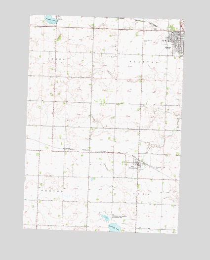
Slayton, MN USGS Topographic Map
Click on map above to begin viewing in our Map Viewer.

This topographic map contains these locations and features:
Feature Name Type Latitude Longitude GNIS ID View Map
Assembly of God ChurchChurchN43.9869°W95.7589°2049955View Map
City of HadleyCivilN43.9986°W95.8575°2394266View Map
City of IonaCivilN43.9149°W95.7857°2395431View Map
City of SlaytonCivilN43.9902°W95.7577°2395897View Map
Corabelle LakeLakeN43.8769°W95.8013°641492View Map
First Presbyterian ChurchChurchN43.9877°W95.7520°2049956View Map
First Reformed ChurchChurchN43.9883°W95.7608°2049957View Map
IonaPopulated PlaceN43.9155°W95.7842°645439View Map
Iona Fire DepartmentBuildingN43.9159°W95.7844°2666414View Map
Iona Lake (historical)LocaleN43.9166°W95.7808°2050015View Map
Iona Post OfficePost OfficeN43.9166°W95.7808°2050016View Map
Murray County Central High SchoolSchoolN43.9847°W95.7570°2049965View Map
Murray County CourthouseBuildingN43.9847°W95.7561°2049947View Map
Murray County Medical CenterHospitalN43.9925°W95.7598°2049964View Map
Murray County MuseumBuildingN43.9847°W95.7561°2049945View Map
Murray County Sheriff's OfficeBuildingN43.9844°W95.7563°2049946View Map
Ruthton FarmsLocaleN43.8928°W95.7794°2702572View Map
Saint Ann's Catholic ChurchChurchN43.9844°W95.7531°2049961View Map
Saint Columba CemeteryCemeteryN43.9134°W95.7709°650561View Map
Schoeberl State Wildlife Management AreaParkN43.8836°W95.8095°651306View Map
School Number 1261SchoolN43.9497°W95.8031°651369View Map
SlaytonPopulated PlaceN43.9877°W95.7558°652147View Map
Slayton (historical)LocaleN43.9902°W95.7572°2049952View Map
Slayton Baptist ChurchChurchN43.9869°W95.7522°2049958View Map
Slayton ClinicHospitalN43.9922°W95.7600°2049963View Map
Slayton Fire DepartmentBuildingN43.9904°W95.7531°2049948View Map
Slayton Municipal AirportAirportN43.9868°W95.7826°660416View Map
Slayton Police DepartmentBuildingN43.9918°W95.7559°2049949View Map
Slayton Post OfficePost OfficeN43.9883°W95.7558°2049951View Map
Slayton Public LibraryBuildingN43.9902°W95.7558°2049950View Map
Summit LakeLakeN43.9973°W95.8584°652794View Map
Township of IonaCivilN43.8911°W95.7630°664551View Map
Township of SlaytonCivilN43.9780°W95.7638°665632View Map
Trinity Lutheran ChurchChurchN43.9922°W95.7575°2049960View Map
United Methodist ChurchChurchN43.9855°W95.7567°2049959View Map
West SchoolSchoolN43.9875°W95.7647°654008View Map
Zion Lutheran Church CemeteryCemeteryN43.9141°W95.7768°2050030View Map

Note: Coordinates in the location and feature list above are referenced to NAD83 datum.


Copyright (C) 2008-2024 Ryan Niemi / Sunset Dynamics ... All Rights Reserved