TopoQuest Logo
Do you find TopoQuest useful?
Help keep TopoQuest running and adding new maps/features by donating!
Bitcoin:  19c7KJd3qBynnjoSw5npx9KScwjBe4ifkT
Litecoin:  LXs6TkuXGGXo1vDsWCkWVdjQX94eUKd6ui
Home View Maps Find Maps Find Places Resources & Links


Currie, Minnesota Topographic Map

USGS Map Title: Currie, MN
USGS Map MRC: 44095A6
DRG (GeoTIFF) Download: o44095a6.tif


Neighboring USGS Topographic Map Quads:


  Balaton, MN  
44095B7
 

  Tracy West, MN  
44095B6
 

  Tracy East, MN  
44095B5
 

  Hadley, MN  
44095A7
 

  Currie, MN  
44095A6
 

  Dovray, MN  
44095A5
 

  Slayton, MN  
43095H7
 

  Avoca, MN  
43095H6
 

  Lime Creek, MN  
43095H5


Map MRC Location:

N45°
W96°
N45°
W95°
H8 H7 H6 H5 H4 H3 H2 H1
G8 G7 G6 G5 G4 G3 G2 G1
F8 F7 F6 F5 F4 F3 F2 F1
E8 E7 E6 E5 E4 E3 E2 E1
D8 D7 D6 D5 D4 D3 D2 D1
C8 C7 C6 C5 C4 C3 C2 C1
B8 B7 B6 B5 B4 B3 B2 B1
A8 A7 A6 A5 A4 A3 A2 A1
N44°
W96°
N44°
W95°

Currie, MN USGS 1:24K Topographic Map Preview:
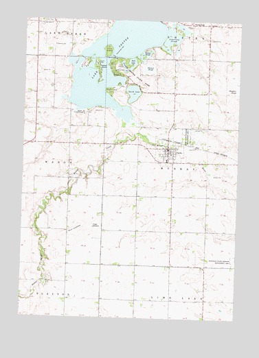
Currie, MN USGS Topographic Map
Click on map above to begin viewing in our Map Viewer.

This topographic map contains these locations and features:
Feature Name Type Latitude Longitude GNIS ID View Map
Armstrong SloughLakeN44.1186°W95.6653°639446View Map
Beaver CreekStreamN44.0805°W95.6836°639820View Map
Bethany CemeteryCemeteryN44.1145°W95.7327°639995View Map
Blocks PointCapeN44.0966°W95.7225°2049937View Map
Bowmans PointCapeN44.0986°W95.7220°2049938View Map
Breezy PointLakeN44.1233°W95.6536°640455View Map
City of CurrieCivilN44.0705°W95.6669°2393698View Map
Clear LakebedFlatN44.0386°W95.7070°641308View Map
CurriePopulated PlaceN44.0714°W95.6664°642557View Map
Currie (historical)LocaleN44.0750°W95.6670°2049943View Map
Currie ClinicHospitalN44.0714°W95.6664°2049929View Map
Currie Pioneer CemeteryCemeteryN44.0672°W95.6675°2050031View Map
Currie Post OfficePost OfficeN44.0711°W95.6656°2049942View Map
Currie Volunteer Fire DepartmentBuildingN44.0690°W95.6641°2666421View Map
End-O-Line Railroad ParkParkN44.0677°W95.6667°2049930View Map
Hanover SloughLakeN44.1051°W95.6784°644633View Map
Immaculate Heart of Mary ChurchChurchN44.0669°W95.6667°2049941View Map
Indian BayBayN44.1000°W95.6925°2049933View Map
Keeley IslandIslandN44.1047°W95.7081°646056View Map
Lake Sarah CemeteryCemeteryN44.1231°W95.7402°2050026View Map
Lake Sarah ChurchChurchN44.1230°W95.7408°646391View Map
Lake ShetekReservoirN44.1186°W95.6990°1776100View Map
Lake Shetek State MonumentParkN44.1041°W95.6975°2050032View Map
Lake Shetek State ParkParkN44.1022°W95.6900°646392View Map
Loon IslandIslandN44.1125°W95.7028°647162View Map
Mud LakebedFlatN44.0364°W95.7192°648364View Map
Park LakeLakeN44.1069°W95.6877°649147View Map
Rauenhorst PointCapeN44.0980°W95.7081°2049935View Map
Rupp State Wildlife Management AreaParkN44.0764°W95.6556°650388View Map
Schreiers on Shetek CampgroundLocaleN44.1136°W95.6781°2049931View Map
Shetek Church CampLocaleN44.0861°W95.7161°651972View Map
Shetek Lake DamDamN44.0800°W95.6820°1776099View Map
Smith LakeLakeN44.0945°W95.6870°652169View Map
Stoney PointCapeN44.0950°W95.7033°2049936View Map
Sweetman State Wildlife Management AreaParkN44.0241°W95.6264°652942View Map
The Lakes Census Designated PlaceCensusN44.0982°W95.7187°2393255View Map
Township of MurrayCivilN44.0655°W95.6426°665067View Map
Valhalla IslandIslandN44.1069°W95.7156°2049939View Map
Valhalla Island CampgroundLocaleN44.1064°W95.7181°2049940View Map
Webster SloughLakeN44.1102°W95.6805°653888View Map
Wolf PointCapeN44.1014°W95.6983°2049934View Map
Wolf Point CampgroundLocaleN44.1027°W95.6989°2049932View Map

Note: Coordinates in the location and feature list above are referenced to NAD83 datum.


Copyright (C) 2008-2025 Ryan Niemi / Sunset Dynamics ... All Rights Reserved