TopoQuest Logo
Do you find TopoQuest useful?
Help keep TopoQuest running and adding new maps/features by donating!
Bitcoin:  19c7KJd3qBynnjoSw5npx9KScwjBe4ifkT
Litecoin:  LXs6TkuXGGXo1vDsWCkWVdjQX94eUKd6ui
Home View Maps Find Maps Find Places Resources & Links


Sleeping Beauty, Washington Topographic Map

USGS Map Title: Sleeping Beauty, WA
USGS Map MRC: 46121A6
DRG (GeoTIFF) Download: o46121a6.tif


Neighboring USGS Topographic Map Quads:


  Quartz Creek Butte, WA  
46121B7
 

  Steamboat Mountain, WA  
46121B6
 

  Mount Adams West, WA  
46121B5
 

  Lone Butte, WA  
46121A7
 

  Sleeping Beauty, WA  
46121A6
 

  Trout Lake, WA  
46121A5
 

  Gifford Peak, WA  
45121H7
 

  Little Huckleberry Mountain, WA  
45121H6
 

  Guler Mountain, WA  
45121H5


Map MRC Location:

N47°
W122°
N47°
W121°
H8 H7 H6 H5 H4 H3 H2 H1
G8 G7 G6 G5 G4 G3 G2 G1
F8 F7 F6 F5 F4 F3 F2 F1
E8 E7 E6 E5 E4 E3 E2 E1
D8 D7 D6 D5 D4 D3 D2 D1
C8 C7 C6 C5 C4 C3 C2 C1
B8 B7 B6 B5 B4 B3 B2 B1
A8 A7 A6 A5 A4 A3 A2 A1
N46°
W122°
N46°
W121°

Sleeping Beauty, WA USGS 1:24K Topographic Map Preview:
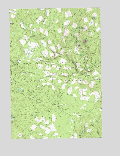
Sleeping Beauty, WA USGS Topographic Map
Click on map above to begin viewing in our Map Viewer.

This topographic map contains these locations and features:
Feature Name Type Latitude Longitude GNIS ID View Map
Cultus CreekStreamN46.0790°W121.6823°1518400View Map
Deadhorse MeadowFlatN46.0210°W121.6590°1518543View Map
Hidden LakeLakeN46.0471°W121.7359°1520752View Map
Lake ComcomlyLakeN46.0220°W121.7200°1517991View Map
Lake WapikiLakeN46.0198°W121.7499°1527794View Map
Langfield FallsFallsN46.0965°W121.7151°1521890View Map
Little Goose CampgroundLocaleN46.0348°W121.7151°1531475View Map
Little Goose CreekStreamN46.0637°W121.6579°1522221View Map
Little Goose LakeLakeN46.0395°W121.7181°1522222View Map
Meadow CreekStreamN46.0757°W121.6951°1522961View Map
Mosquito CreekStreamN46.0976°W121.6965°1523396View Map
North Fork Meadow CreekStreamN46.0696°W121.7495°1523804View Map
Peterson RidgeRidgeN46.0115°W121.6406°1534442View Map
Skull CreekStreamN46.0671°W121.6365°1525886View Map
Sleeping BeautySummitN46.0932°W121.6495°1525921View Map
Sleeping Beauty LookoutLocaleN46.0932°W121.6492°1530252View Map
Smoky CreekStreamN46.0582°W121.6715°1525991View Map
Smoky Creek CampgroundLocaleN46.0321°W121.6901°1525992View Map
Tire JunctionPopulated PlaceN46.0979°W121.7217°1527258View Map

Note: Coordinates in the location and feature list above are referenced to NAD83 datum.


Copyright (C) 2008-2024 Ryan Niemi / Sunset Dynamics ... All Rights Reserved