TopoQuest Logo
Do you find TopoQuest useful?
Help keep TopoQuest running and adding new maps/features by donating!
Bitcoin:  19c7KJd3qBynnjoSw5npx9KScwjBe4ifkT
Litecoin:  LXs6TkuXGGXo1vDsWCkWVdjQX94eUKd6ui
Home View Maps Find Maps Find Places Resources & Links


Steamboat Mountain, Washington Topographic Map

USGS Map Title: Steamboat Mountain, WA
USGS Map MRC: 46121B6
DRG (GeoTIFF) Download: o46121b6.tif


Neighboring USGS Topographic Map Quads:


  McCoy Peak, WA  
46121C7
 

  East Canyon Ridge, WA  
46121C6
 

  Green Mountain, WA  
46121C5
 

  Quartz Creek Butte, WA  
46121B7
 

  Steamboat Mountain, WA  
46121B6
 

  Mount Adams West, WA  
46121B5
 

  Lone Butte, WA  
46121A7
 

  Sleeping Beauty, WA  
46121A6
 

  Trout Lake, WA  
46121A5


Map MRC Location:

N47°
W122°
N47°
W121°
H8 H7 H6 H5 H4 H3 H2 H1
G8 G7 G6 G5 G4 G3 G2 G1
F8 F7 F6 F5 F4 F3 F2 F1
E8 E7 E6 E5 E4 E3 E2 E1
D8 D7 D6 D5 D4 D3 D2 D1
C8 C7 C6 C5 C4 C3 C2 C1
B8 B7 B6 B5 B4 B3 B2 B1
A8 A7 A6 A5 A4 A3 A2 A1
N46°
W122°
N46°
W121°

Steamboat Mountain, WA USGS 1:24K Topographic Map Preview:
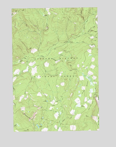
Steamboat Mountain, WA USGS Topographic Map
Click on map above to begin viewing in our Map Viewer.

This topographic map contains these locations and features:
Feature Name Type Latitude Longitude GNIS ID View Map
Big Spring CreekStreamN46.2235°W121.6476°1516544View Map
Boulder CreekStreamN46.2354°W121.6423°1516833View Map
Cold SpringSpringN46.1268°W121.7321°1517931View Map
Deer CreekStreamN46.2234°W121.7095°1518601View Map
Dry MeadowsFlatN46.1396°W121.6459°1518974View Map
Grand MeadowsFlatN46.1501°W121.6548°1520191View Map
Grand Meadows CreekStreamN46.1279°W121.6859°1520192View Map
Ichter HillSummitN46.2093°W121.7268°1521122View Map
Island ShelterLocaleN46.1962°W121.7406°1521272View Map
Little Fish LakeLakeN46.1557°W121.7018°1522211View Map
Mulligan MeadowFlatN46.2426°W121.7031°1523512View Map
Noname CreekStreamN46.2240°W121.6412°1523710View Map
North Fork Pass CreekStreamN46.1860°W121.7015°1523818View Map
North Fork Swampy CreekStreamN46.1987°W121.6901°1523854View Map
North Fork Trout Lake CreekStreamN46.1407°W121.6826°1523874View Map
Pass CreekStreamN46.1971°W121.7020°1524231View Map
Pin CreekStreamN46.2004°W121.7112°1524431View Map
Poison CreekStreamN46.1962°W121.7284°1524540View Map
Riley CreekStreamN46.2251°W121.6387°1525052View Map
South Fork Pass CreekStreamN46.1598°W121.6920°1526228View Map
Steamboat CreekStreamN46.1948°W121.7290°1526515View Map
Steamboat LakeLakeN46.1301°W121.7156°1526517View Map
Steamboat Lake CampgroundLocaleN46.1323°W121.7154°1529163View Map
Steamboat MountainSummitN46.1423°W121.7354°1526518View Map
Steamboat Mountain Research Natural AreaAreaN46.1387°W121.7365°1529164View Map
Swampy CreekStreamN46.2012°W121.7079°1526831View Map
Swampy MeadowsFlatN46.1682°W121.6448°1526832View Map
Table Mountain TrailTrailN46.2418°W121.6731°1526887View Map
Twin FallsFallsN46.2148°W121.6679°1527527View Map
Twin Falls CampgroundLocaleN46.2148°W121.6706°1529586View Map
Twin Falls CreekStreamN46.2148°W121.6670°1527529View Map
Williams MineMineN46.1593°W121.6290°1528179View Map

Note: Coordinates in the location and feature list above are referenced to NAD83 datum.


Copyright (C) 2008-2025 Ryan Niemi / Sunset Dynamics ... All Rights Reserved