TopoQuest Logo
Do you find TopoQuest useful?
Help keep TopoQuest running and adding new maps/features by donating!
Bitcoin:  19c7KJd3qBynnjoSw5npx9KScwjBe4ifkT
Litecoin:  LXs6TkuXGGXo1vDsWCkWVdjQX94eUKd6ui
Home View Maps Find Maps Find Places Resources & Links


Mount Adams West, Washington Topographic Map

USGS Map Title: Mount Adams West, WA
USGS Map MRC: 46121B5
DRG (GeoTIFF) Download: o46121b5.tif


Neighboring USGS Topographic Map Quads:


  East Canyon Ridge, WA  
46121C6
 

  Green Mountain, WA  
46121C5
 

  Glaciate Butte, WA  
46121C4
 

  Steamboat Mountain, WA  
46121B6
 

  Mount Adams West, WA  
46121B5
 

  Mount Adams East, WA  
46121B4
 

  Sleeping Beauty, WA  
46121A6
 

  Trout Lake, WA  
46121A5
 

  King Mountain, WA  
46121A4


Map MRC Location:

N47°
W122°
N47°
W121°
H8 H7 H6 H5 H4 H3 H2 H1
G8 G7 G6 G5 G4 G3 G2 G1
F8 F7 F6 F5 F4 F3 F2 F1
E8 E7 E6 E5 E4 E3 E2 E1
D8 D7 D6 D5 D4 D3 D2 D1
C8 C7 C6 C5 C4 C3 C2 C1
B8 B7 B6 B5 B4 B3 B2 B1
A8 A7 A6 A5 A4 A3 A2 A1
N46°
W122°
N46°
W121°

Mount Adams West, WA USGS 1:24K Topographic Map Preview:
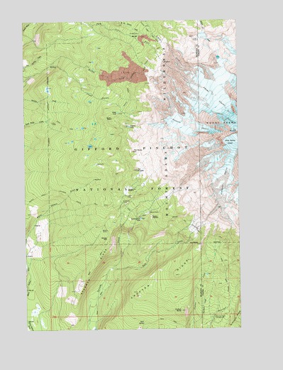
Mount Adams West, WA USGS Topographic Map
Click on map above to begin viewing in our Map Viewer.

This topographic map contains these locations and features:
Feature Name Type Latitude Longitude GNIS ID View Map
Adams GlacierGlacierN46.2173°W121.5118°1515724View Map
Avalanche GlacierGlacierN46.1846°W121.5101°1515991View Map
Bottle CampLocaleN46.1648°W121.5779°1516813View Map
Burnt RockPillarN46.2104°W121.5740°1517132View Map
Crofton ButteSummitN46.1323°W121.5351°1518332View Map
Crofton RidgeRidgeN46.1468°W121.5365°1518334View Map
Crystal LakeLakeN46.2071°W121.5640°1518376View Map
Divide CampLocaleN46.2448°W121.5570°1518808View Map
Dry Lake CampLocaleN46.1790°W121.5634°1518972View Map
Grassy HillSummitN46.1618°W121.5770°1520254View Map
Graveyard CampLocaleN46.1762°W121.5687°1520268View Map
High CampLocaleN46.2421°W121.5234°1520774View Map
Horseshoe MeadowFlatN46.1812°W121.5662°1520962View Map
Lake CampLocaleN46.1918°W121.5834°1521828View Map
Lookingglass LakeLakeN46.1697°W121.5585°1522420View Map
Madcat MeadowFlatN46.1701°W121.5520°1522628View Map
Meadow CampLocaleN46.1721°W121.5537°1522947View Map
Morrison Creek CampgroundLocaleN46.1293°W121.5159°1523376View Map
Mount Adams WildernessReserveN46.2137°W121.5384°1533350View Map
Mutton CreekStreamN46.2323°W121.6095°1523536View Map
Pinnacle GlacierGlacierN46.2071°W121.5287°1524461View Map
Riley CampLocaleN46.2187°W121.5798°1525051View Map
Rock SpringSpringN46.1274°W121.5577°1525151View Map
Round the Mountain TrailTrailN46.1668°W121.5309°1525244View Map
Salt CreekStreamN46.1498°W121.5756°1525395View Map
Sheep LakeLakeN46.2126°W121.5704°1525637View Map
Shorthorn CreekStreamN46.1271°W121.5287°1525708View Map
Sled CampLocaleN46.2087°W121.6095°1525919View Map
Stagman RidgeRidgeN46.1446°W121.5923°1526478View Map
The BumperSummitN46.1893°W121.5598°1527027View Map
The HumpSummitN46.1971°W121.5615°1527040View Map
The PinnaclePillarN46.2048°W121.5015°1527060View Map
White Salmon GlacierGlacierN46.1998°W121.5029°1528088View Map

Note: Coordinates in the location and feature list above are referenced to NAD83 datum.


Copyright (C) 2008-2024 Ryan Niemi / Sunset Dynamics ... All Rights Reserved