TopoQuest Logo
Do you find TopoQuest useful?
Help keep TopoQuest running and adding new maps/features by donating!
Bitcoin:  19c7KJd3qBynnjoSw5npx9KScwjBe4ifkT
Litecoin:  LXs6TkuXGGXo1vDsWCkWVdjQX94eUKd6ui
Home View Maps Find Maps Find Places Resources & Links


Masontown, Pennsylvania Topographic Map

USGS Map Title: Masontown, PA
USGS Map MRC: 39079G8
DRG (GeoTIFF) Download: o39079g8.tif


Neighboring USGS Topographic Map Quads:


  Mather, PA  
39080H1
 

  Carmichaels, PA  
39079H8
 

  New Salem, PA  
39079H7
 

  Garards Fort, PA  
39080G1
 

  Masontown, PA  
39079G8
 

  Smithfield, PA  
39079G7
 

  Osage, WV  
39080F1
 

  Morgantown North, WV  
39079F8
 

  Lake Lynn, PA  
39079F7


Map MRC Location:

N40°
W80°
N40°
W79°
H8 H7 H6 H5 H4 H3 H2 H1
G8 G7 G6 G5 G4 G3 G2 G1
F8 F7 F6 F5 F4 F3 F2 F1
E8 E7 E6 E5 E4 E3 E2 E1
D8 D7 D6 D5 D4 D3 D2 D1
C8 C7 C6 C5 C4 C3 C2 C1
B8 B7 B6 B5 B4 B3 B2 B1
A8 A7 A6 A5 A4 A3 A2 A1
N39°
W80°
N39°
W79°

Masontown, PA USGS 1:24K Topographic Map Preview:
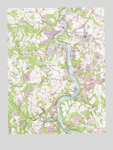
Masontown, PA USGS Topographic Map
Click on map above to begin viewing in our Map Viewer.

This topographic map contains these locations and features:
Feature Name Type Latitude Longitude GNIS ID View Map
Ache CemeteryCemeteryN39.8220°W79.8981°1168038View Map
Active Uellow Boy PondReservoirN39.8351°W79.9431°1194373View Map
Albert Gallatin Senior High SchoolSchoolN39.7787°W79.9184°1210602View Map
Alexander CemeteryCemeteryN39.7825°W79.9557°1168141View Map
AtlanticPopulated PlaceN39.7781°W79.9156°1202997View Map
Big TreeLocaleN39.8676°W79.9123°1212456View Map
Blomster Field Farm AirportAirportN39.8731°W79.9552°2442857View Map
Blosser Cagey CemeteryCemeteryN39.7501°W79.9023°1170867View Map
BobtownPopulated PlaceN39.7612°W79.9814°1169928View Map
Bobtown - Dunkard Township Volunteer Fire Department Company 17BuildingN39.7620°W79.9819°2645139View Map
Bobtown Census Designated PlaceCensusN39.7603°W79.9844°2629997View Map
Bobtown Elementary SchoolSchoolN39.7601°W79.9848°1211496View Map
Bobtown Post OfficePost OfficeN39.7594°W79.9800°2779851View Map
Borough of GreensboroCivilN39.7921°W79.9126°1215254View Map
Borough of MasontownCivilN39.8488°W79.9081°1215232View Map
Browns RunStreamN39.8747°W79.9185°1170401View Map
Cabbage FlatsPopulated PlaceN39.8083°W79.9417°2574566View Map
Cagey SchoolSchoolN39.7562°W79.9023°1205186View Map
Cats RunStreamN39.8312°W79.9209°1171349View Map
Cats Run JunctionPopulated PlaceN39.8351°W79.9201°1203235View Map
Cats Run Junction Station (historical)BuildingN39.8367°W79.9214°1212458View Map
Cedar Grove CemeteryCemeteryN39.7815°W79.9095°1171368View Map
CeylonPopulated PlaceN39.8620°W79.9806°1171522View Map
DavistownLocaleN39.7731°W79.9703°1202275View Map
DillinerPopulated PlaceN39.7517°W79.9251°1205037View Map
Dilliner Post OfficePost OfficeN39.7512°W79.9234°2779756View Map
Donham CemeteryCemeteryN39.7856°W79.9534°1173375View Map
DoraLocaleN39.7917°W79.9298°1213056View Map
Dunkard CreekStreamN39.7648°W79.9360°1538438View Map
Emergency Medical Services Southwest CarmichaelsBuildingN39.8639°W79.9569°2719666View Map
Everly CemeteryCemeteryN39.7565°W79.9937°1174378View Map
Fairview ChurchChurchN39.8301°W79.8912°1174510View Map
Fallen Timbers ChurchChurchN39.7554°W79.8848°1174588View Map
FayettePopulated PlaceN39.8223°W79.9189°1174647View Map
Fayette Emergency Medical Services GermanBuildingN39.8486°W79.9126°2719595View Map
Fieldsons CrossroadsPopulated PlaceN39.7901°W79.9403°1174739View Map
Friendship HeightsPopulated PlaceN39.7829°W79.9170°1175266View Map
Friendship HillSummitN39.7765°W79.9320°1175267View Map
Friendship Hill Elementary SchoolSchoolN39.7798°W79.9181°1210599View Map
Friendship Hill National Historic SiteParkN39.7755°W79.9253°1888922View Map
Furman CemeteryCemeteryN39.7519°W79.9929°1175343View Map
GallatinPopulated PlaceN39.8240°W79.9178°1175389View Map
Gallatin Fuel HeliportAirportN39.8665°W79.9506°1213709View Map
Garrison CemeteryCemeteryN39.7799°W79.9684°1175470View Map
Geneva SidingLocaleN39.8104°W79.9156°1175521View Map
Georges CreekStreamN39.7862°W79.9162°1192509View Map
GlassworksPopulated PlaceN39.8020°W79.9142°1175683View Map
Goose RunStreamN39.8615°W79.9817°1175829View Map
Grays LandingPopulated PlaceN39.8323°W79.9187°1176032View Map
Greater Point MarionPopulated PlaceN39.7501°W79.8992°1176047View Map
Green Dale CemeteryCemeteryN39.8434°W79.8814°1176060View Map
Greene CemeteryCemeteryN39.7792°W79.9614°1176147View Map
GreensboroPopulated PlaceN39.7912°W79.9128°1176170View Map
Greensboro - Monongahela Township Volunteer Fire Department Company 63BuildingN39.7935°W79.9108°2645262View Map
Greensboro Post OfficePost OfficeN39.7923°W79.9119°2779819View Map
Greensburg FerryLocaleN39.7904°W79.9164°1207571View Map
GriffinPopulated PlaceN39.8401°W79.8914°1203723View Map
Hanna CemeteryCemeteryN39.8288°W79.9808°1176462View Map
Headlee HeightsPopulated PlaceN39.8151°W79.9723°1176722View Map
HuronPopulated PlaceN39.8737°W79.9192°1203863View Map
Jacobs CreekStreamN39.8080°W79.9153°1177959View Map
Keener CemeteryCemeteryN39.7930°W79.9865°1178290View Map
Lambert CemeteryCemeteryN39.7679°W79.9890°1178822View Map
LardinPopulated PlaceN39.8617°W79.8964°1212457View Map
Lee Norse Number Five HeliportAirportN39.8417°W79.9581°1213707View Map
Linton CemeteryCemeteryN39.7652°W79.9869°1179436View Map
Little ChicagoPopulated PlaceN39.8601°W79.9606°1179503View Map
Little Whiteley CreekStreamN39.8623°W79.9285°1179711View Map
Live EasyPopulated PlaceN39.8631°W79.9370°1179725View Map
Locks HillSummitN39.8631°W79.8828°1179764View Map
Mable HillPopulated PlaceN39.7748°W79.9384°1180146View Map
MapletownPopulated PlaceN39.8045°W79.9437°1180376View Map
Mapletown Census Designated PlaceCensusN39.8050°W79.9407°2630022View Map
MartinPopulated PlaceN39.8065°W79.9098°1180487View Map
Martin Post OfficePost OfficeN39.8081°W79.9122°2772821View Map
MasontownPopulated PlaceN39.8467°W79.8998°1180533View Map
Masontown Borough Police DepartmentBuildingN39.8472°W79.8993°2777188View Map
Masontown Post OfficePost OfficeN39.8471°W79.8988°2779802View Map
Masontown Volunteer Fire Department Station 25BuildingN39.8497°W79.9020°2644792View Map
McClure CemeteryCemeteryN39.7723°W79.9962°1180637View Map
Mennonite ChurchChurchN39.8434°W79.8798°1205187View Map
Moffitt SterlingPopulated PlaceN39.7579°W79.9362°1181392View Map
Monongahela CemeteryCemeteryN39.8028°W79.9309°1181427View Map
Monongahela River Lock and Dam Seven (historical)DamN39.7851°W79.9181°1194357View Map
Monongahela River Pool Seven (historical)ReservoirN39.7851°W79.9181°1194356View Map
Mount Moriah Presbyterian CemeteryCemeteryN39.7612°W79.9006°1181747View Map
Mount Olive ChurchChurchN39.7795°W79.9681°1181765View Map
Mount SterlingPopulated PlaceN39.8462°W79.9351°1181851View Map
Mundell CemeteryCemeteryN39.8606°W79.9760°1182087View Map
Mundell HollowValleyN39.8587°W79.9645°1182088View Map
Mundell HollowValleyN39.7652°W79.9761°1182089View Map
New GenevaPopulated PlaceN39.7884°W79.9092°1182323View Map
New Providence ChurchChurchN39.8723°W79.9626°1182359View Map
NewtownPopulated PlaceN39.7570°W79.9698°1182420View Map
PaisleyPopulated PlaceN39.8626°W79.9548°1183215View Map
Penn PittPopulated PlaceN39.7892°W79.9248°1183481View Map
Penn Pitt Elementary SchoolSchoolN39.7912°W79.9209°1211690View Map
Poland MinesMineN39.7656°W79.9453°1213091View Map
Pond FourReservoirN39.8310°W79.9460°1194371View Map
Robena Slope Mine DamDamN39.8351°W79.9431°1194374View Map
Robena Slope Mine Refuse Bank DamDamN39.8317°W79.9448°1194372View Map
Robena Slurry Pond Number Six DamDamN39.8301°W79.9531°1194370View Map
Rocks WorksPopulated PlaceN39.8373°W79.8959°1185321View Map
Rocky HollowValleyN39.7709°W79.9532°1185353View Map
RoncoPopulated PlaceN39.8698°W79.9203°1185419View Map
Ronco Census Designated PlaceCensusN39.8686°W79.9211°2634272View Map
Ronco Post OfficePost OfficeN39.8696°W79.9234°2768362View Map
Ronco Volunteer Fire Department Station 49BuildingN39.8696°W79.9180°2644879View Map
Ross FerryLocaleN39.8417°W79.9364°1207570View Map
Saint Agnes CemeteryCemeteryN39.8564°W79.8776°1185729View Map
Saint Georges ChurchChurchN39.8551°W79.9317°1185976View Map
Saint Marys CemeteryCemeteryN39.8681°W79.8853°1186362View Map
Saint Marys Nativity Orthodox CemeteryCemeteryN39.8415°W79.9217°1186361View Map
Saint Nicholas ChurchChurchN39.7598°W79.9670°1186521View Map
Shordon ChapelChurchN39.7648°W79.9903°1187589View Map
SigsbeePopulated PlaceN39.8279°W79.9562°1187660View Map
South CemeteryCemeteryN39.7914°W79.9819°1188047View Map
SprucetownPopulated PlaceN39.7529°W79.9106°1188360View Map
Sugar Grove ChurchChurchN39.8320°W79.9642°1188933View Map
Sugar Grove SchoolSchoolN39.8320°W79.9642°1188938View Map
SunshinePopulated PlaceN39.8165°W79.9164°1189097View Map
Sunshine HillSummitN39.8225°W79.9108°1189098View Map
Thomas CemeteryCemeteryN39.7721°W79.9887°1189474View Map
Tomcat HollowValleyN39.7717°W79.8936°1189636View Map
Township of DunkardCivilN39.7561°W79.9935°1216486View Map
Township of MonongahelaCivilN39.8165°W79.9501°1216494View Map
Turkey KnobSummitN39.8365°W79.9878°1189941View Map
Union ChurchChurchN39.7601°W79.9295°1190129View Map
War BranchStreamN39.7779°W79.8753°1190582View Map
Whiteley CreekStreamN39.8412°W79.9378°1191330View Map
WileyPopulated PlaceN39.7792°W79.9728°1201508View Map
Williamson CemeteryCemeteryN39.7813°W79.9734°1191485View Map
Willow Grove SchoolSchoolN39.8204°W79.8801°1191502View Map
Willow TreePopulated PlaceN39.8095°W79.9889°1191512View Map
WinsteadPopulated PlaceN39.7590°W79.9281°1191608View Map
Wolfs CemeteryCemeteryN39.7517°W79.9273°1191704View Map

Note: Coordinates in the location and feature list above are referenced to NAD83 datum.


Copyright (C) 2008-2025 Ryan Niemi / Sunset Dynamics ... All Rights Reserved