TopoQuest Logo
Do you find TopoQuest useful?
Help keep TopoQuest running and adding new maps/features by donating!
Bitcoin:  19c7KJd3qBynnjoSw5npx9KScwjBe4ifkT
Litecoin:  LXs6TkuXGGXo1vDsWCkWVdjQX94eUKd6ui
Home View Maps Find Maps Find Places Resources & Links


Soldier Creek SE, Kansas Topographic Map

USGS Map Title: Soldier Creek SE, KS
USGS Map MRC: 39095C7
DRG (GeoTIFF) Download: o39095c7.tif


Neighboring USGS Topographic Map Quads:


  Soldier Creek NW, KS  
39095D8
 

  Soldier Creek NE, KS  
39095D7
 

  Holton, KS  
39095D6
 

  Soldier Creek SW, KS  
39095C8
 

  Soldier Creek SE, KS  
39095C7
 

  Mayetta, KS  
39095C6
 

  Rossville, KS  
39095B8
 

  Grove, KS  
39095B7
 

  Elmont, KS  
39095B6


Map MRC Location:

N40°
W96°
N40°
W95°
H8 H7 H6 H5 H4 H3 H2 H1
G8 G7 G6 G5 G4 G3 G2 G1
F8 F7 F6 F5 F4 F3 F2 F1
E8 E7 E6 E5 E4 E3 E2 E1
D8 D7 D6 D5 D4 D3 D2 D1
C8 C7 C6 C5 C4 C3 C2 C1
B8 B7 B6 B5 B4 B3 B2 B1
A8 A7 A6 A5 A4 A3 A2 A1
N39°
W96°
N39°
W95°

Soldier Creek SE, KS USGS 1:24K Topographic Map Preview:
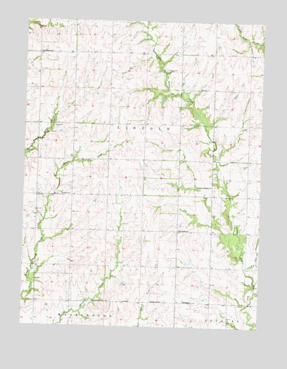
Soldier Creek SE, KS USGS Topographic Map
Click on map above to begin viewing in our Map Viewer.

This topographic map contains these locations and features:
Feature Name Type Latitude Longitude GNIS ID View Map
Big Elm CreekStreamN39.2744°W95.7583°478300View Map
Firekeepers Elder CenterBuildingN39.3261°W95.8484°2692250View Map
Grand Prairie SchoolSchoolN39.3622°W95.8678°478296View Map
Harrahs Prairie Band Casino Recreational Vehicle ParkLocaleN39.3119°W95.7519°2694455View Map
Jackson County LandfillLocaleN39.3490°W95.7836°2692260View Map
Little Elm CreekStreamN39.2814°W95.7511°478312View Map
Mitchell CemeteryCemeteryN39.3549°W95.8002°2739651View Map
Mitchell CemeteryCemeteryN39.3549°W95.8002°478295View Map
Potawatomi Tribal Fire DepartmentBuildingN39.3271°W95.8490°2111733View Map
Pottawatomi United Methodist ChurchChurchN39.3075°W95.7761°478297View Map
Pottawatomie Indian Reservation (historical)CivilN39.3333°W95.8336°479834View Map
Prairie Band of Potawatomi Nation ReservationCivilN39.3407°W95.8402°1934332View Map
Prairie Band Potawatomi CasinoLocaleN39.3153°W95.7510°2692249View Map
Shipsee CemeteryCemeteryN39.3039°W95.8503°478298View Map
Spring CreekStreamN39.2503°W95.7530°478319View Map
Sunnybrook SchoolSchoolN39.2897°W95.7933°478299View Map
Thunderhill SpeedwayLocaleN39.3022°W95.7601°2692850View Map
Township of LincolnCivilN39.3253°W95.8402°478183View Map

Note: Coordinates in the location and feature list above are referenced to NAD83 datum.


Copyright (C) 2008-2025 Ryan Niemi / Sunset Dynamics ... All Rights Reserved