TopoQuest Logo
Do you find TopoQuest useful?
Help keep TopoQuest running and adding new maps/features by donating!
Bitcoin:  19c7KJd3qBynnjoSw5npx9KScwjBe4ifkT
Litecoin:  LXs6TkuXGGXo1vDsWCkWVdjQX94eUKd6ui
Home View Maps Find Maps Find Places Resources & Links


Sonyea, New York Topographic Map

USGS Map Title: Sonyea, NY
USGS Map MRC: 42077F7
DRG (GeoTIFF) Download: o42077f7.tif


Neighboring USGS Topographic Map Quads:


  Leicester, NY  
42077G8
 

  Geneseo, NY  
42077G7
 

  Livonia, NY  
42077G6
 

  Mount Morris, NY  
42077F8
 

  Sonyea, NY  
42077F7
 

  Conesus, NY  
42077F6
 

  Nunda, NY  
42077E8
 

  Ossian, NY  
42077E7
 

  Dansville, NY  
42077E6


Map MRC Location:

N43°
W78°
N43°
W77°
H8 H7 H6 H5 H4 H3 H2 H1
G8 G7 G6 G5 G4 G3 G2 G1
F8 F7 F6 F5 F4 F3 F2 F1
E8 E7 E6 E5 E4 E3 E2 E1
D8 D7 D6 D5 D4 D3 D2 D1
C8 C7 C6 C5 C4 C3 C2 C1
B8 B7 B6 B5 B4 B3 B2 B1
A8 A7 A6 A5 A4 A3 A2 A1
N42°
W78°
N42°
W77°

Sonyea, NY USGS 1:24K Topographic Map Preview:
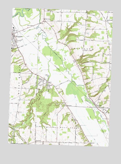
Sonyea, NY USGS Topographic Map
Click on map above to begin viewing in our Map Viewer.

This topographic map contains these locations and features:
Feature Name Type Latitude Longitude GNIS ID View Map
Allens CreekStreamN42.7273°W77.8414°942369View Map
Bellamy ParkParkN42.7292°W77.8725°943601View Map
Berean Bible ChurchChurchN42.6824°W77.7814°2597790View Map
Bradner CreekStreamN42.6840°W77.7983°944587View Map
Buck Run CreekStreamN42.7242°W77.8428°945065View Map
Calvary Chapel of Genesee ValleyChurchN42.7387°W77.7589°2597792View Map
Canaseraga CanalCanalN42.7073°W77.8172°969954View Map
Craig State SchoolSchoolN42.6851°W77.8375°947642View Map
Craig State School CemeteryCemeteryN42.6733°W77.8401°947643View Map
Dutch Street CemeteryCemeteryN42.6543°W77.8646°948869View Map
East GrovelandPopulated PlaceN42.7406°W77.7589°949090View Map
Elim Gospel Church of Mount MorrisChurchN42.7247°W77.8732°2597798View Map
Glenwood CemeteryCemeteryN42.6865°W77.7554°951242View Map
GrovelandPopulated PlaceN42.6648°W77.7697°951869View Map
Groveland CornersPopulated PlaceN42.7017°W77.7517°951870View Map
Groveland Correctional FacilityBuildingN42.6763°W77.8262°2781131View Map
Groveland Correctional FacilityBuildingN42.6829°W77.8354°2756190View Map
Groveland Federated Parish ChurchChurchN42.7018°W77.7528°2597801View Map
Groveland Fire Department Station 1BuildingN42.6640°W77.7695°2701062View Map
Groveland Post OfficePost OfficeN42.6641°W77.7695°2599644View Map
Groveland Station Census Designated PlaceCensusN42.6634°W77.7667°2584263View Map
Hampton CornersLocaleN42.7406°W77.8356°952139View Map
Hawkins SchoolSchoolN42.6815°W77.8264°952406View Map
Keshequa CreekStreamN42.7128°W77.8258°954558View Map
KysorvillePopulated PlaceN42.6487°W77.7928°954840View Map
Kysorville CemeteryCemeteryN42.6431°W77.7919°954841View Map
Kysorville Census Designated PlaceCensusN42.6528°W77.7949°2584270View Map
Letchworth Estates Mobile Home CommunityPopulated PlaceN42.7191°W77.8688°2598836View Map
Livingston Correctional FacilityBuildingN42.6862°W77.8240°2756193View Map
Livingston CountyCivilN42.7281°W77.7755°974124View Map
Lombardo Mobile Home CommunityPopulated PlaceN42.7246°W77.8681°2598837View Map
Merrimac Farms AirportAirportN42.7480°W77.7857°978164View Map
Mount MorrisPopulated PlaceN42.7256°W77.8742°957862View Map
Mount Morris Ambulance ServiceBuildingN42.7242°W77.8737°2701137View Map
Mount Morris Eastbound Rest AreaLocaleN42.7270°W77.8318°2598855View Map
Mount Morris Fire DepartmentBuildingN42.7239°W77.8728°2700940View Map
Mount Morris LibraryBuildingN42.7236°W77.8725°2598871View Map
Mount Morris Post OfficePost OfficeN42.7247°W77.8748°2598821View Map
Mount Morris Senior High SchoolSchoolN42.7130°W77.8742°946320View Map
Mount Morris Town HallBuildingN42.7246°W77.8731°2598876View Map
Mount Morris Village Wastewater Treatment PlantLocaleN42.7267°W77.8659°2597249View Map
Mount Morris Westbound Rest AreaLocaleN42.7277°W77.8293°2598856View Map
New Family TheaterBuildingN42.7244°W77.8736°2708560View Map
Pioneer CemeteryCemeteryN42.7028°W77.7952°960614View Map
Ross CornersLocaleN42.6612°W77.8036°962938View Map
Seven Gullies AirportAirportN42.6947°W77.7919°978051View Map
Shaker CrossingPopulated PlaceN42.7342°W77.8486°973055View Map
SonyeaPopulated PlaceN42.6790°W77.8272°965641View Map
Sonyea Golf CourseLocaleN42.6772°W77.8370°2598866View Map
Sparta First Presbyterian ChurchChurchN42.6630°W77.7666°2597821View Map
Tail RaceCanalN42.7292°W77.8558°967000View Map
Tony's Mobile Home ParkPopulated PlaceN42.7266°W77.8692°2598844View Map
Town of GrovelandCivilN42.7067°W77.7793°979029View Map
TuscaroraPopulated PlaceN42.6306°W77.8697°967991View Map
Tuscarora Census Designated PlaceCensusN42.6345°W77.8694°2584297View Map
Tuscarora CreekStreamN42.7212°W77.8431°967995View Map
Twomile CreekStreamN42.6851°W77.7981°968090View Map
Union CornersPopulated PlaceN42.6276°W77.8411°968186View Map
West DitchCanalN42.6531°W77.7894°969206View Map
West SpartaPopulated PlaceN42.6270°W77.7731°973251View Map
Wildcat GullyValleyN42.6376°W77.8669°971248View Map
Williamsburg CemeteryCemeteryN42.7484°W77.8322°971316View Map

Note: Coordinates in the location and feature list above are referenced to NAD83 datum.


Copyright (C) 2008-2024 Ryan Niemi / Sunset Dynamics ... All Rights Reserved