TopoQuest Logo
Do you find TopoQuest useful?
Help keep TopoQuest running and adding new maps/features by donating!
Bitcoin:  19c7KJd3qBynnjoSw5npx9KScwjBe4ifkT
Litecoin:  LXs6TkuXGGXo1vDsWCkWVdjQX94eUKd6ui
Home View Maps Find Maps Find Places Resources & Links


Conesus, New York Topographic Map

USGS Map Title: Conesus, NY
USGS Map MRC: 42077F6
DRG (GeoTIFF) Download: o42077f6.tif


Neighboring USGS Topographic Map Quads:


  Geneseo, NY  
42077G7
 

  Livonia, NY  
42077G6
 

  Honeoye, NY  
42077G5
 

  Sonyea, NY  
42077F7
 

  Conesus, NY  
42077F6
 

  Springwater, NY  
42077F5
 

  Ossian, NY  
42077E7
 

  Dansville, NY  
42077E6
 

  Wayland, NY  
42077E5


Map MRC Location:

N43°
W78°
N43°
W77°
H8 H7 H6 H5 H4 H3 H2 H1
G8 G7 G6 G5 G4 G3 G2 G1
F8 F7 F6 F5 F4 F3 F2 F1
E8 E7 E6 E5 E4 E3 E2 E1
D8 D7 D6 D5 D4 D3 D2 D1
C8 C7 C6 C5 C4 C3 C2 C1
B8 B7 B6 B5 B4 B3 B2 B1
A8 A7 A6 A5 A4 A3 A2 A1
N42°
W78°
N42°
W77°

Conesus, NY USGS 1:24K Topographic Map Preview:
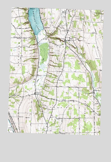
Conesus, NY USGS Topographic Map
Click on map above to begin viewing in our Map Viewer.

This topographic map contains these locations and features:
Feature Name Type Latitude Longitude GNIS ID View Map
All Western Evergreen NurseryLocaleN42.6506°W77.6378°2548117View Map
Arnold CemeteryCemeteryN42.7214°W77.6669°942578View Map
Clark CemeteryCemeteryN42.6594°W77.6782°946747View Map
ConesusPopulated PlaceN42.7190°W77.6764°947262View Map
Conesus Golf ClubLocaleN42.7226°W77.6800°2598862View Map
Conesus Hamlet Census Designated PlaceCensusN42.7263°W77.6697°2584247View Map
Conesus InletStreamN42.7231°W77.7144°947264View Map
Conesus LakeLakeN42.7345°W77.7114°947265View Map
Conesus Lake CampgroundLocaleN42.7486°W77.7093°2598857View Map
Conesus Post OfficePost OfficeN42.7219°W77.6759°2598811View Map
Conesus Volunteer Fire DepartmentBuildingN42.7255°W77.6730°2734778View Map
Erwin CemeteryCemeteryN42.6565°W77.6337°949697View Map
Foots CornersPopulated PlaceN42.7465°W77.6775°950370View Map
Gray CornersLocaleN42.7198°W77.7350°951604View Map
Groveland Fire Department Station 2BuildingN42.7020°W77.7488°2734779View Map
Lakeview CemeteryCemeteryN42.7195°W77.7331°954980View Map
LibertypolePopulated PlaceN42.6490°W77.6339°972721View Map
Livonia ReservoirReservoirN42.7403°W77.6541°955756View Map
Logan HillSummitN42.6406°W77.7203°955814View Map
Maple BeachPopulated PlaceN42.7351°W77.7239°956388View Map
McMillan CreekStreamN42.7148°W77.7122°956831View Map
North McMillan CreekStreamN42.7276°W77.7097°958850View Map
Rau CemeteryCemeteryN42.6353°W77.7031°2547866View Map
Saint Michaels MissionChurchN42.7470°W77.6289°964022View Map
School Number 1 (historical)SchoolN42.6587°W77.6783°974892View Map
School Number 2 (historical)SchoolN42.7203°W77.7400°975186View Map
School Number 3 (historical)SchoolN42.6956°W77.6514°975259View Map
School Number 4 (historical)SchoolN42.6409°W77.7353°975336View Map
School Number 5 (historical)SchoolN42.6828°W77.7131°975408View Map
School Number 7 (historical)SchoolN42.6256°W77.6783°975531View Map
School Number 7 (historical)SchoolN42.7017°W77.6275°975536View Map
School Number 9 (historical)SchoolN42.6795°W77.6833°975638View Map
ScottsburgPopulated PlaceN42.6642°W77.7142°964694View Map
Scottsburg Census Designated PlaceCensusN42.6638°W77.7123°2584291View Map
Southern Shores CampgroundLocaleN42.7436°W77.7108°2598859View Map
Town of ConesusCivilN42.7169°W77.6611°978858View Map
Town of SpartaCivilN42.6278°W77.6976°979512View Map
Turkey HillSummitN42.7403°W77.6947°967965View Map
Union CemeteryCemeteryN42.6799°W77.7151°968157View Map
Union CornersPopulated PlaceN42.7284°W77.6728°968187View Map
Walkleys LandingPopulated PlaceN42.7309°W77.7061°968692View Map
Webster Crossing United Methodist ChurchChurchN42.6696°W77.6355°2597824View Map
Websters CrossingPopulated PlaceN42.6698°W77.6350°968998View Map
Websters Crossing Census Designated PlaceCensusN42.6661°W77.6368°2584301View Map

Note: Coordinates in the location and feature list above are referenced to NAD83 datum.


Copyright (C) 2008-2024 Ryan Niemi / Sunset Dynamics ... All Rights Reserved