TopoQuest Logo
Do you find TopoQuest useful?
Help keep TopoQuest running and adding new maps/features by donating!
Bitcoin:  19c7KJd3qBynnjoSw5npx9KScwjBe4ifkT
Litecoin:  LXs6TkuXGGXo1vDsWCkWVdjQX94eUKd6ui
Home View Maps Find Maps Find Places Resources & Links


Ossian, New York Topographic Map

USGS Map Title: Ossian, NY
USGS Map MRC: 42077E7
DRG (GeoTIFF) Download: o42077e7.tif


Neighboring USGS Topographic Map Quads:


  Mount Morris, NY  
42077F8
 

  Sonyea, NY  
42077F7
 

  Conesus, NY  
42077F6
 

  Nunda, NY  
42077E8
 

  Ossian, NY  
42077E7
 

  Dansville, NY  
42077E6
 

  Birdsall, NY  
42077D8
 

  Canaseraga, NY  
42077D7
 

  Arkport, NY  
42077D6


Map MRC Location:

N43°
W78°
N43°
W77°
H8 H7 H6 H5 H4 H3 H2 H1
G8 G7 G6 G5 G4 G3 G2 G1
F8 F7 F6 F5 F4 F3 F2 F1
E8 E7 E6 E5 E4 E3 E2 E1
D8 D7 D6 D5 D4 D3 D2 D1
C8 C7 C6 C5 C4 C3 C2 C1
B8 B7 B6 B5 B4 B3 B2 B1
A8 A7 A6 A5 A4 A3 A2 A1
N42°
W78°
N42°
W77°

Ossian, NY USGS 1:24K Topographic Map Preview:
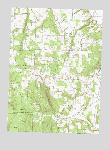
Ossian, NY USGS Topographic Map
Click on map above to begin viewing in our Map Viewer.

This topographic map contains these locations and features:
Feature Name Type Latitude Longitude GNIS ID View Map
ByersvillePopulated PlaceN42.5834°W77.7908°945400View Map
Byersville CemeteryCemeteryN42.5830°W77.7883°2547864View Map
Byersville Census Designated PlaceCensusN42.5839°W77.7915°2584245View Map
East HillSummitN42.5037°W77.8639°949110View Map
Frog HillSummitN42.5381°W77.8325°950747View Map
Oaklawn CemeteryCemeteryN42.5984°W77.7995°959176View Map
OssianPopulated PlaceN42.5212°W77.7794°959518View Map
Ossian Center CemeteryCemeteryN42.5256°W77.7732°959519View Map
Ossian Hill Presbyterian ChurchChurchN42.5252°W77.7741°2485666View Map
Ossian Volunteer Fire DepartmentBuildingN42.5225°W77.7770°2734782View Map
Town of OssianCivilN42.5201°W77.7810°979322View Map
Town of West SpartaCivilN42.6105°W77.7892°979627View Map
West Sparta United Methodist ChurchChurchN42.5986°W77.7973°2485667View Map
West Sparta Volunteer Fire DepartmentBuildingN42.6185°W77.7899°2701007View Map
WestviewPopulated PlaceN42.5567°W77.8253°973256View Map
Westview CemeteryCemeteryN42.5542°W77.7990°970947View Map
Wood CemeteryCemeteryN42.5344°W77.7501°971595View Map

Note: Coordinates in the location and feature list above are referenced to NAD83 datum.


Copyright (C) 2008-2025 Ryan Niemi / Sunset Dynamics ... All Rights Reserved