TopoQuest Logo
Do you find TopoQuest useful?
Help keep TopoQuest running and adding new maps/features by donating!
Bitcoin:  19c7KJd3qBynnjoSw5npx9KScwjBe4ifkT
Litecoin:  LXs6TkuXGGXo1vDsWCkWVdjQX94eUKd6ui
Home View Maps Find Maps Find Places Resources & Links


Sorento North, Illinois Topographic Map

USGS Map Title: Sorento North, IL
USGS Map MRC: 39089A5
DRG (GeoTIFF) Download: o39089a5.tif


Neighboring USGS Topographic Map Quads:


  Litchfield, IL  
39089B6
 

  Butler, IL  
39089B5
 

  Hillsboro, IL  
39089B4
 

  Mount Olive, IL  
39089A6
 

  Sorento North, IL  
39089A5
 

  Coffeen, IL  
39089A4
 

  New Douglas, IL  
38089H6
 

  Sorento South, IL  
38089H5
 

  Greenville, IL  
38089H4


Map MRC Location:

N40°
W90°
N40°
W89°
H8 H7 H6 H5 H4 H3 H2 H1
G8 G7 G6 G5 G4 G3 G2 G1
F8 F7 F6 F5 F4 F3 F2 F1
E8 E7 E6 E5 E4 E3 E2 E1
D8 D7 D6 D5 D4 D3 D2 D1
C8 C7 C6 C5 C4 C3 C2 C1
B8 B7 B6 B5 B4 B3 B2 B1
A8 A7 A6 A5 A4 A3 A2 A1
N39°
W90°
N39°
W89°

Sorento North, IL USGS 1:24K Topographic Map Preview:
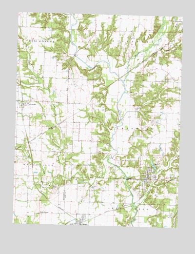
Sorento North, IL USGS Topographic Map
Click on map above to begin viewing in our Map Viewer.

This topographic map contains these locations and features:
Feature Name Type Latitude Longitude GNIS ID View Map
Auburn School (historical)SchoolN39.1042°W89.5484°1772058View Map
Baptist CemeteryCemeteryN39.0653°W89.5967°1772059View Map
Bearcat CreekStreamN39.0123°W89.5315°404033View Map
Cherry Grove School (historical)SchoolN39.0462°W89.5243°1772072View Map
Clear Springs CemeteryCemeteryN39.1120°W89.5384°1953388View Map
Clear Springs ChurchChurchN39.1120°W89.5398°406230View Map
East Branch Lake ForkStreamN39.0828°W89.6079°407611View Map
Grove BranchStreamN39.0287°W89.5873°409534View Map
Hampton School (historical)SchoolN39.0209°W89.5556°1725164View Map
Harry Sampsons LakeReservoirN39.0890°W89.5637°1692129View Map
Harry Sampsons Lake DamDamN39.0900°W89.5634°1692128View Map
Hart's Church CemeteryCemeteryN39.1237°W89.6159°1772089View Map
Kessinger School (historical)SchoolN39.0789°W89.5287°1772096View Map
Kirkland CemeteryCemeteryN39.0223°W89.5917°411548View Map
Kirkland School (historical)SchoolN39.0203°W89.6137°1772097View Map
Lake ForkStreamN39.0398°W89.5537°411716View Map
Lake Glenn ShoalsReservoirN39.1034°W89.5618°1692199View Map
Lake Glenn Shoals DamDamN39.1034°W89.5618°1692198View Map
Long BranchStreamN39.1248°W89.5840°412554View Map
Middle ForkStreamN39.1031°W89.6181°1821762View Map
Middle Fork Shoal CreekStreamN39.0848°W89.5440°413500View Map
Miller CreekStreamN39.1084°W89.5204°413586View Map
Missimore School (historical)SchoolN39.0717°W89.5720°1772112View Map
PanamaPopulated PlaceN39.0295°W89.5243°415339View Map
Panama LakeReservoirN39.0367°W89.5198°415340View Map
Panama Lake DamDamN39.0350°W89.5173°1691834View Map
Panama Post OfficePost OfficeN39.0297°W89.5238°2788732View Map
Pleasant View School (historical)SchoolN39.0428°W89.6043°1772135View Map
Prospect School (historical)SchoolN39.0742°W89.5006°1772140View Map
Rankin Presbyterian CemeteryCemeteryN39.0348°W89.5584°416196View Map
Robbs MoundSummitN39.0067°W89.6056°416749View Map
Root School (historical)SchoolN39.0425°W89.5670°1772143View Map
Shoal Creek Fire Protection District Station 1BuildingN39.0005°W89.5736°2640891View Map
Shoal Creek Fire Protection District Station 2BuildingN39.0290°W89.5251°2640880View Map
Simpson School (historical)SchoolN39.0975°W89.5870°1772149View Map
Sorento Post OfficePost OfficeN39.0003°W89.5730°2788684View Map
Township of GrishamCivilN39.0572°W89.5296°429086View Map
Union CemeteryCemeteryN39.0228°W89.5265°420016View Map
Village of PanamaCivilN39.0295°W89.5246°2399617View Map
Village of SorentoCivilN39.0001°W89.5728°2399839View Map
Village of WalshvilleCivilN39.0690°W89.6189°2400089View Map
WalshvillePopulated PlaceN39.0709°W89.6190°420489View Map
Waveland CemeteryCemeteryN39.0825°W89.5034°1953396View Map
Waveland ChurchChurchN39.0831°W89.5029°420654View Map
Waveland CreekStreamN39.0684°W89.5445°420655View Map
West Fork Shoal CreekStreamN39.0848°W89.5443°420837View Map

Note: Coordinates in the location and feature list above are referenced to NAD83 datum.


Copyright (C) 2008-2025 Ryan Niemi / Sunset Dynamics ... All Rights Reserved