TopoQuest Logo
Do you find TopoQuest useful?
Help keep TopoQuest running and adding new maps/features by donating!
Bitcoin:  19c7KJd3qBynnjoSw5npx9KScwjBe4ifkT
Litecoin:  LXs6TkuXGGXo1vDsWCkWVdjQX94eUKd6ui
Home View Maps Find Maps Find Places Resources & Links


Mount Olive, Illinois Topographic Map

USGS Map Title: Mount Olive, IL
USGS Map MRC: 39089A6
DRG (GeoTIFF) Download: o39089a6.tif


Neighboring USGS Topographic Map Quads:


  Gillespie North, IL  
39089B7
 

  Litchfield, IL  
39089B6
 

  Butler, IL  
39089B5
 

  Gillespie South, IL  
39089A7
 

  Mount Olive, IL  
39089A6
 

  Sorento North, IL  
39089A5
 

  Worden, IL  
38089H7
 

  New Douglas, IL  
38089H6
 

  Sorento South, IL  
38089H5


Map MRC Location:

N40°
W90°
N40°
W89°
H8 H7 H6 H5 H4 H3 H2 H1
G8 G7 G6 G5 G4 G3 G2 G1
F8 F7 F6 F5 F4 F3 F2 F1
E8 E7 E6 E5 E4 E3 E2 E1
D8 D7 D6 D5 D4 D3 D2 D1
C8 C7 C6 C5 C4 C3 C2 C1
B8 B7 B6 B5 B4 B3 B2 B1
A8 A7 A6 A5 A4 A3 A2 A1
N39°
W90°
N39°
W89°

Mount Olive, IL USGS 1:24K Topographic Map Preview:
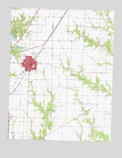
Mount Olive, IL USGS Topographic Map
Click on map above to begin viewing in our Map Viewer.

This topographic map contains these locations and features:
Feature Name Type Latitude Longitude GNIS ID View Map
Brokaw School (historical)SchoolN39.1089°W89.6706°1772067View Map
CarlsburgPopulated PlaceN39.0834°W89.7223°405599View Map
Cavalry CemeteryCemeteryN39.0800°W89.7309°1993772View Map
City of Mount OliveCivilN39.0727°W89.7278°2395123View Map
Davis School (historical)SchoolN39.0209°W89.6795°1772075View Map
East SchoolSchoolN39.0675°W89.7206°407693View Map
Eichmeyer School (historical)SchoolN39.0214°W89.7273°1764614View Map
Griswold CemeteryCemeteryN39.0623°W89.6762°409522View Map
Heeren PondReservoirN39.0273°W89.6951°1692361View Map
Heeren Pond DamDamN39.0284°W89.6968°1692360View Map
Hill School (historical)SchoolN39.0134°W89.6515°1772091View Map
Immanuel Lutheran CemeteryCemeteryN39.0800°W89.7323°1993759View Map
Interchange 41CrossingN39.0209°W89.7498°1821497View Map
Karnes SidingLocaleN39.0459°W89.7443°411316View Map
Lake Ka-HoReservoirN39.0980°W89.7468°411288View Map
Lake Ka-HoPopulated PlaceN39.0998°W89.7470°1922763View Map
Lake Ka-Ho Dam Number 1DamN39.1017°W89.7484°1692332View Map
Lake Ka-Ho Dam Number 2DamN39.1000°W89.7484°1691952View Map
Mount OlivePopulated PlaceN39.0723°W89.7273°414005View Map
Mount Olive Area Ambulance ServiceBuildingN39.0727°W89.7380°2673849View Map
Mount Olive CemeteryCemeteryN39.0789°W89.7337°1764599View Map
Mount Olive City HallBuildingN39.0717°W89.7259°1764663View Map
Mount Olive Fire Protection DistrictBuildingN39.0727°W89.7380°2640499View Map
Mount Olive High SchoolSchoolN39.0717°W89.7373°1764664View Map
Mount Olive Police DepartmentBuildingN39.0719°W89.7259°2758848View Map
Mount Olive Post OfficePost OfficeN39.0713°W89.7269°1764665View Map
Nieman School (historical)SchoolN39.0659°W89.6743°1772120View Map
North SchoolSchoolN39.0689°W89.7320°414659View Map
Old Mount Olive City Lake DamDamN39.0850°W89.7465°1691918View Map
Old Mount Olive ReservoirReservoirN39.0864°W89.7422°415032View Map
Saint John's Lutheran CemeteryCemeteryN39.0953°W89.6759°417374View Map
Silver Creek School (historical)SchoolN39.1156°W89.7184°1764699View Map
Smith School (historical)SchoolN39.0478°W89.6429°1772150View Map
Township of WalshvilleCivilN39.0432°W89.6426°429890View Map
Trinity CemeteryCemeteryN39.0642°W89.7187°419853View Map
Union Miners CemeteryCemeteryN39.0806°W89.7326°1993775View Map
Village of Lake Ka-HoCivilN39.0998°W89.7463°2398380View Map

Note: Coordinates in the location and feature list above are referenced to NAD83 datum.


Copyright (C) 2008-2025 Ryan Niemi / Sunset Dynamics ... All Rights Reserved