TopoQuest Logo
Do you find TopoQuest useful?
Help keep TopoQuest running and adding new maps/features by donating!
Bitcoin:  19c7KJd3qBynnjoSw5npx9KScwjBe4ifkT
Litecoin:  LXs6TkuXGGXo1vDsWCkWVdjQX94eUKd6ui
Home View Maps Find Maps Find Places Resources & Links


South China Mountain, California Topographic Map

USGS Map Title: South China Mountain, CA
USGS Map MRC: 41122C5
DRG (GeoTIFF) Download: o41122c5.tif


Neighboring USGS Topographic Map Quads:


  Gazelle Mountain, CA  
41122D6
 

  China Mountain, CA  
41122D5
 

  Weed, CA  
41122D4
 

  Scott Mountain, CA  
41122C6
 

  South China Mountain, CA  
41122C5
 

  Mount Eddy, CA  
41122C4
 

  Tangle Blue Lake, CA  
41122B6
 

  Mumbo Basin, CA  
41122B5
 

  Seven Lakes Basin, CA  
41122B4


Map MRC Location:

N42°
W123°
N42°
W122°
H8 H7 H6 H5 H4 H3 H2 H1
G8 G7 G6 G5 G4 G3 G2 G1
F8 F7 F6 F5 F4 F3 F2 F1
E8 E7 E6 E5 E4 E3 E2 E1
D8 D7 D6 D5 D4 D3 D2 D1
C8 C7 C6 C5 C4 C3 C2 C1
B8 B7 B6 B5 B4 B3 B2 B1
A8 A7 A6 A5 A4 A3 A2 A1
N41°
W123°
N41°
W122°

South China Mountain, CA USGS 1:24K Topographic Map Preview:
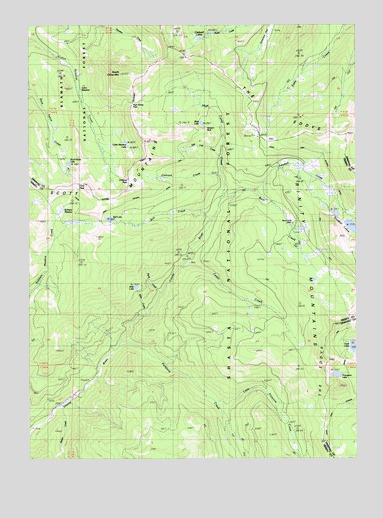
South China Mountain, CA USGS Topographic Map
Click on map above to begin viewing in our Map Viewer.

This topographic map contains these locations and features:
Feature Name Type Latitude Longitude GNIS ID View Map
Bear CreekStreamN41.3246°W122.5520°218818View Map
Bear Creek CabinLocaleN41.3174°W122.5247°218830View Map
Bluff LakeLakeN41.3465°W122.5600°219544View Map
Bull CreekStreamN41.3185°W122.5559°220100View Map
Bull LakeLakeN41.3189°W122.5952°220113View Map
Cabin MeadowFlatN41.3565°W122.6064°1657851View Map
Cabin Meadow LakeLakeN41.3411°W122.5890°233593View Map
Caldwell LakesLakeN41.3726°W122.5556°220386View Map
Cedar CreekStreamN41.3057°W122.5675°220764View Map
Cement BluffCliffN41.3457°W122.5522°220809View Map
Chilcoot CreekStreamN41.3313°W122.5525°220985View Map
Chilcoot PassGapN41.3304°W122.5878°252407View Map
Cory PeakSummitN41.3285°W122.6028°221608View Map
Deadfall CreekStreamN41.3276°W122.5403°222106View Map
Deadfall LakesLakeN41.3167°W122.5029°222107View Map
HarmonLocaleN41.3051°W122.5656°276893View Map
High Camp CreekStreamN41.3315°W122.5517°225263View Map
High Camp PassGapN41.3526°W122.5859°252410View Map
Little Picayune CreekStreamN41.2663°W122.5536°227326View Map
Nyott CreekStreamN41.2971°W122.5756°276892View Map
Picayune CreekStreamN41.2826°W122.5903°230614View Map
Porcupine LakeLakeN41.2740°W122.5087°230943View Map
Robbers MeadowFlatN41.3224°W122.6134°231669View Map
Rock Fence LakeLakeN41.3349°W122.6108°231733View Map
Salt Lick CreekStreamN41.3374°W122.5522°232325View Map
Sherer CreekStreamN41.2646°W122.6142°232963View Map
Slide LakeLakeN41.2993°W122.5851°233284View Map
South China MountainSummitN41.3610°W122.5900°234952View Map
Tamarack FlatFlatN41.3715°W122.5320°235993View Map
Toad LakeLakeN41.2821°W122.5015°236404View Map

Note: Coordinates in the location and feature list above are referenced to NAD83 datum.


Copyright (C) 2008-2025 Ryan Niemi / Sunset Dynamics ... All Rights Reserved