TopoQuest Logo
Do you find TopoQuest useful?
Help keep TopoQuest running and adding new maps/features by donating!
Bitcoin:  19c7KJd3qBynnjoSw5npx9KScwjBe4ifkT
Litecoin:  LXs6TkuXGGXo1vDsWCkWVdjQX94eUKd6ui
Home View Maps Find Maps Find Places Resources & Links


Seven Lakes Basin, California Topographic Map

USGS Map Title: Seven Lakes Basin, CA
USGS Map MRC: 41122B4
DRG (GeoTIFF) Download: o41122b4.tif


Neighboring USGS Topographic Map Quads:


  South China Mountain, CA  
41122C5
 

  Mount Eddy, CA  
41122C4
 

  City of Mount Shasta, CA  
41122C3
 

  Mumbo Basin, CA  
41122B5
 

  Seven Lakes Basin, CA  
41122B4
 

  Dunsmuir, CA  
41122B3
 

  Whisky Bill Peak, CA  
41122A5
 

  Chicken Hawk Hill, CA  
41122A4
 

  Tombstone Mountain, CA  
41122A3


Map MRC Location:

N42°
W123°
N42°
W122°
H8 H7 H6 H5 H4 H3 H2 H1
G8 G7 G6 G5 G4 G3 G2 G1
F8 F7 F6 F5 F4 F3 F2 F1
E8 E7 E6 E5 E4 E3 E2 E1
D8 D7 D6 D5 D4 D3 D2 D1
C8 C7 C6 C5 C4 C3 C2 C1
B8 B7 B6 B5 B4 B3 B2 B1
A8 A7 A6 A5 A4 A3 A2 A1
N41°
W123°
N41°
W122°

Seven Lakes Basin, CA USGS 1:24K Topographic Map Preview:
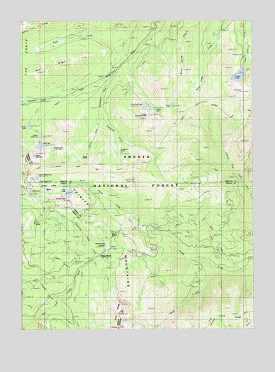
Seven Lakes Basin, CA USGS Topographic Map
Click on map above to begin viewing in our Map Viewer.

This topographic map contains these locations and features:
Feature Name Type Latitude Longitude GNIS ID View Map
Asbestos GulchValleyN41.1354°W122.4842°218422View Map
Bear RidgeRidgeN41.2288°W122.4925°233469View Map
Boulder PeakSummitN41.1776°W122.4781°219698View Map
Castle Crags WildernessReserveN41.1966°W122.3756°276750View Map
Castle LakeLakeN41.2273°W122.3833°220688View Map
Castle Lake CampgroundLocaleN41.2352°W122.3800°277052View Map
Castle Lake Nordic CenterLocaleN41.2402°W122.3778°277050View Map
Cedar LakeLakeN41.2073°W122.4968°220786View Map
Cliff LakeLakeN41.1992°W122.4906°221221View Map
Devils GulchValleyN41.2096°W122.4589°222310View Map
Devils PocketBasinN41.1929°W122.4656°222323View Map
Echo LakeLakeN41.1806°W122.4748°222958View Map
Echo Lake TrailTrailN41.1851°W122.4661°222959View Map
Fawn CreekStreamN41.2346°W122.4436°223413View Map
Grader GulchValleyN41.1485°W122.4720°224378View Map
Gray Rock LakeLakeN41.2156°W122.4338°224521View Map
Grey RocksSummitN41.1310°W122.4486°224608View Map
Heart LakeLakeN41.2210°W122.3837°225100View Map
Horse Heaven MeadowsFlatN41.1571°W122.4561°225608View Map
Lake HelenLakeN41.1808°W122.4960°225123View Map
Lower Cliff LakeLakeN41.2034°W122.4902°227763View Map
Lower Seven LakeLakeN41.1845°W122.4914°227789View Map
Methodist Church CampLocaleN41.2438°W122.3967°277049View Map
Panther RockPillarN41.1682°W122.4903°230314View Map
Root CreekStreamN41.1493°W122.3806°231870View Map
Ruby Pearl MineMineN41.1790°W122.4539°277048View Map
Scott Camp RidgeRidgeN41.2460°W122.4086°232720View Map
Scott LakeLakeN41.2152°W122.4196°232726View Map
Seven Lakes BasinBasinN41.1828°W122.4861°232820View Map
Soapstone CreekStreamN41.2271°W122.4506°234807View Map
Soapstone GulchValleyN41.2110°W122.4558°234808View Map
Soapstone Lake (historical)LakeN41.1985°W122.4356°1682325View Map
Soapstone PondLakeN41.1970°W122.4474°234810View Map
South Fork Castle CreekStreamN41.1479°W122.3931°234984View Map
Tamarack CreekStreamN41.1540°W122.4614°235991View Map
Terrace LakeLakeN41.1979°W122.4838°236127View Map
Timber LakeLakeN41.2141°W122.4289°236358View Map
Upper Cliff LakeLakeN41.1958°W122.4937°236878View Map
Upper Gray Rock LakeLakeN41.2117°W122.4321°236890View Map
Upper Seven LakeLakeN41.1867°W122.4921°236922View Map
Whalan StationLocaleN41.1543°W122.4592°237584View Map
Whalan SummitGapN41.1626°W122.4517°1661878View Map

Note: Coordinates in the location and feature list above are referenced to NAD83 datum.


Copyright (C) 2008-2024 Ryan Niemi / Sunset Dynamics ... All Rights Reserved