TopoQuest Logo
Do you find TopoQuest useful?
Help keep TopoQuest running and adding new maps/features by donating!
Bitcoin:  19c7KJd3qBynnjoSw5npx9KScwjBe4ifkT
Litecoin:  LXs6TkuXGGXo1vDsWCkWVdjQX94eUKd6ui
Home View Maps Find Maps Find Places Resources & Links


Weed, California Topographic Map

USGS Map Title: Weed, CA
USGS Map MRC: 41122D4
DRG (GeoTIFF) Download: o41122d4.tif


Neighboring USGS Topographic Map Quads:


  Gazelle, CA  
41122E5
 

  Lake Shastina, CA  
41122E4
 

  Juniper Flat, CA  
41122E3
 

  China Mountain, CA  
41122D5
 

  Weed, CA  
41122D4
 

  Hotlum, CA  
41122D3
 

  South China Mountain, CA  
41122C5
 

  Mount Eddy, CA  
41122C4
 

  City of Mount Shasta, CA  
41122C3


Map MRC Location:

N42°
W123°
N42°
W122°
H8 H7 H6 H5 H4 H3 H2 H1
G8 G7 G6 G5 G4 G3 G2 G1
F8 F7 F6 F5 F4 F3 F2 F1
E8 E7 E6 E5 E4 E3 E2 E1
D8 D7 D6 D5 D4 D3 D2 D1
C8 C7 C6 C5 C4 C3 C2 C1
B8 B7 B6 B5 B4 B3 B2 B1
A8 A7 A6 A5 A4 A3 A2 A1
N41°
W123°
N41°
W122°

Weed, CA USGS 1:24K Topographic Map Preview:
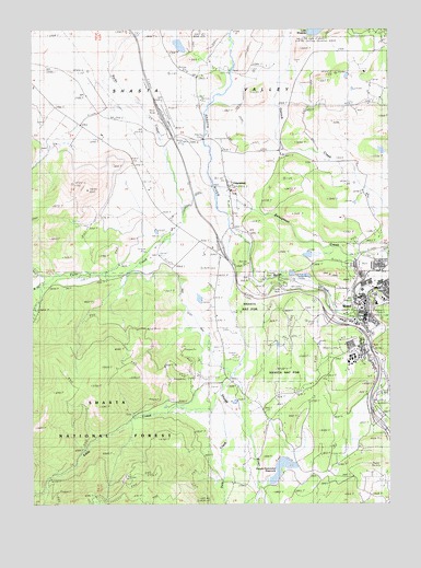
Weed, CA USGS Topographic Map
Click on map above to begin viewing in our Map Viewer.

This topographic map contains these locations and features:
Feature Name Type Latitude Longitude GNIS ID View Map
Beaughton CreekStreamN41.4601°W122.4378°218936View Map
Bel Air ParkParkN41.4151°W122.3889°1701835View Map
Boles CreekStreamN41.4468°W122.4306°219599View Map
Butteville Elementary SchoolSchoolN41.4572°W122.4313°1701840View Map
Cal-ore Trail Mobile EstatesPopulated PlaceN41.4039°W122.3797°2515985View Map
California Department of Forestry and Fire Protection WeedBuildingN41.4253°W122.3907°2622026View Map
Calvary ChapelChurchN41.4279°W122.3845°1701841View Map
Cedar Park School (historical)SchoolN41.4876°W122.4411°1682291View Map
City of WeedCivilN41.4128°W122.3815°2412201View Map
College of the SiskiyousSchoolN41.4136°W122.3895°276909View Map
Dale CreekStreamN41.4018°W122.4336°221982View Map
Dwight Hammond 1182 DamDamN41.3799°W122.4178°1664255View Map
Dwight Hammond ReservoirReservoirN41.3817°W122.4166°1657857View Map
Eddy CreekStreamN41.4035°W122.4347°222964View Map
EdgewoodPopulated PlaceN41.4582°W122.4317°1658474View Map
Edgewood Census Designated PlaceCensusN41.4622°W122.4261°2408045View Map
Edgewood Post OfficePost OfficeN41.4601°W122.4328°1657858View Map
Hammond RanchPopulated PlaceN41.3830°W122.3973°2573569View Map
Hammond Ranch Fire CompanyBuildingN41.3942°W122.4132°2622031View Map
IgernaPopulated PlaceN41.4015°W122.3795°225830View Map
KWHO-FM (Weed)TowerN41.4160°W122.3931°1663140View Map
Lees Lodge (historical)LocaleN41.3990°W122.4650°227001View Map
Lincoln ParkParkN41.4379°W122.3867°1701876View Map
Metcalf (historical)Populated PlaceN41.4826°W122.4820°1682313View Map
Mills Ranch QuarryMineN41.4853°W122.4083°2680700View Map
Soda SpringSpringN41.4682°W122.4542°234842View Map
WeedPopulated PlaceN41.4226°W122.3861°1652650View Map
Weed AirportAirportN41.4764°W122.4532°1654112View Map
Weed City HallBuildingN41.4288°W122.3778°1701908View Map
Weed City Police DepartmentBuildingN41.4274°W122.3846°2751061View Map
Weed City Volunteer Fire DepartmentBuildingN41.4320°W122.3819°2621901View Map
Weed ClinicHospitalN41.4268°W122.3847°1701909View Map
Weed DivisionCivilN41.4824°W122.4355°1935366View Map
Weed Elementary SchoolSchoolN41.4277°W122.3806°1701910View Map
Weed Golf ClubLocaleN41.4285°W122.3956°1701911View Map
Weed MuseumBuildingN41.4254°W122.3831°1701913View Map
Weed Post OfficePost OfficeN41.4277°W122.3850°1657883View Map
West Fork Parks CreekStreamN41.4326°W122.4978°237478View Map
Winema CemeteryCemeteryN41.4401°W122.3831°1701915View Map

Note: Coordinates in the location and feature list above are referenced to NAD83 datum.


Copyright (C) 2008-2025 Ryan Niemi / Sunset Dynamics ... All Rights Reserved