TopoQuest Logo
Do you find TopoQuest useful?
Help keep TopoQuest running and adding new maps/features by donating!
Bitcoin:  19c7KJd3qBynnjoSw5npx9KScwjBe4ifkT
Litecoin:  LXs6TkuXGGXo1vDsWCkWVdjQX94eUKd6ui
Home View Maps Find Maps Find Places Resources & Links


Blackfoot, Texas Topographic Map

USGS Map Title: Blackfoot, TX
USGS Map MRC: 31095H7
DRG (GeoTIFF) Download: o31095h7.tif


Neighboring USGS Topographic Map Quads:


  Cross Roads, TX  
32095A8
 

  Coon Creek Lake, TX  
32095A7
 

  LaRue, TX  
32095A6
 

  Cayuga, TX  
31095H8
 

  Blackfoot, TX  
31095H7
 

  Wilkerson Mountain, TX  
31095H6
 

  Yard, TX  
31095G8
 

  Tennessee Colony, TX  
31095G7
 

  Northwest Palestine, TX  
31095G6


Map MRC Location:

N32°
W96°
N32°
W95°
H8 H7 H6 H5 H4 H3 H2 H1
G8 G7 G6 G5 G4 G3 G2 G1
F8 F7 F6 F5 F4 F3 F2 F1
E8 E7 E6 E5 E4 E3 E2 E1
D8 D7 D6 D5 D4 D3 D2 D1
C8 C7 C6 C5 C4 C3 C2 C1
B8 B7 B6 B5 B4 B3 B2 B1
A8 A7 A6 A5 A4 A3 A2 A1
N31°
W96°
N31°
W95°

Blackfoot, TX USGS 1:24K Topographic Map Preview:
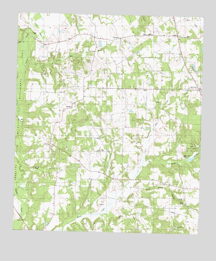
Blackfoot, TX USGS Topographic Map
Click on map above to begin viewing in our Map Viewer.

This topographic map contains these locations and features:
Feature Name Type Latitude Longitude GNIS ID View Map
BlackfootPopulated PlaceN31.9463°W95.8352°1379426View Map
Blackfoot Oil FieldOilfieldN31.9424°W95.7761°1352365View Map
Bois D ArcLocaleN31.9582°W95.7513°1352611View Map
Bois d'ArcPopulated PlaceN31.9585°W95.7530°2034745View Map
Bomer LakeReservoirN31.9802°W95.7519°1865523View Map
Bomer Lake DamDamN31.9802°W95.7519°1865522View Map
Bosman SchoolSchoolN31.9652°W95.8539°1352709View Map
BradfordPopulated PlaceN31.9888°W95.7666°1379452View Map
Bradford Volunteer Fire DepartmentBuildingN31.9877°W95.7669°2655357View Map
Camp Bette PerotLocaleN31.9229°W95.7575°1889527View Map
Coon CreekStreamN31.9916°W95.8583°1373197View Map
Freewill ChurchChurchN31.8802°W95.8652°1357722View Map
Friendship ChurchChurchN31.9252°W95.8497°1357750View Map
Gibson BranchStreamN31.9841°W95.8700°1889526View Map
Gray ChapelChurchN31.9577°W95.7864°1358346View Map
Holly SpringSpringN31.8934°W95.7613°1359445View Map
Holly Spring BranchStreamN31.8971°W95.8022°1359446View Map
Holly Spring ChurchChurchN31.8949°W95.7600°1359447View Map
Liberty CemeteryCemeteryN31.9882°W95.7616°1361145View Map
Montalba-Tennessee Colony DivisionCivilN31.8937°W95.7997°1939004View Map
Otter CreekStreamN31.9138°W95.7888°1364601View Map
Pickle ChapelChurchN31.9585°W95.7766°1365164View Map
Providence CemeteryCemeteryN31.8793°W95.7644°1365814View Map
SpringfieldPopulated PlaceN31.9868°W95.8052°1380593View Map
WardPopulated PlaceN31.9071°W95.8047°1380741View Map
WBS SchoolSchoolN31.9641°W95.8291°1370700View Map

Note: Coordinates in the location and feature list above are referenced to NAD83 datum.


Copyright (C) 2008-2025 Ryan Niemi / Sunset Dynamics ... All Rights Reserved