TopoQuest Logo
Do you find TopoQuest useful?
Help keep TopoQuest running and adding new maps/features by donating!
Bitcoin:  19c7KJd3qBynnjoSw5npx9KScwjBe4ifkT
Litecoin:  LXs6TkuXGGXo1vDsWCkWVdjQX94eUKd6ui
Home View Maps Find Maps Find Places Resources & Links


Cayuga, Texas Topographic Map

USGS Map Title: Cayuga, TX
USGS Map MRC: 31095H8
DRG (GeoTIFF) Download: o31095h8.tif


Neighboring USGS Topographic Map Quads:


  Creslenn Ranch, TX  
32096A1
 

  Cross Roads, TX  
32095A8
 

  Coon Creek Lake, TX  
32095A7
 

  Roustabout Camp, TX  
31096H1
 

  Cayuga, TX  
31095H8
 

  Blackfoot, TX  
31095H7
 

  Young, TX  
31096G1
 

  Yard, TX  
31095G8
 

  Tennessee Colony, TX  
31095G7


Map MRC Location:

N32°
W96°
N32°
W95°
H8 H7 H6 H5 H4 H3 H2 H1
G8 G7 G6 G5 G4 G3 G2 G1
F8 F7 F6 F5 F4 F3 F2 F1
E8 E7 E6 E5 E4 E3 E2 E1
D8 D7 D6 D5 D4 D3 D2 D1
C8 C7 C6 C5 C4 C3 C2 C1
B8 B7 B6 B5 B4 B3 B2 B1
A8 A7 A6 A5 A4 A3 A2 A1
N31°
W96°
N31°
W95°

Cayuga, TX USGS 1:24K Topographic Map Preview:
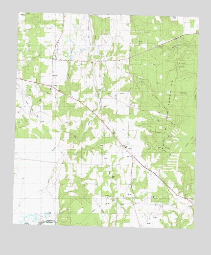
Cayuga, TX USGS Topographic Map
Click on map above to begin viewing in our Map Viewer.

This topographic map contains these locations and features:
Feature Name Type Latitude Longitude GNIS ID View Map
Bee BranchStreamN31.9535°W95.9380°1351752View Map
BethelPopulated PlaceN31.9202°W95.9202°1379413View Map
Bethel Cayuga Volunteer Fire DepartmentBuildingN31.9490°W95.9568°2655353View Map
Bethel ChurchChurchN31.8929°W95.9169°1889522View Map
Bethel School Number 2SchoolN31.8927°W95.9161°1351963View Map
CayugaPopulated PlaceN31.9571°W95.9747°1379518View Map
Cayuga DivisionCivilN31.9371°W95.9494°1938605View Map
Cayuga High SchoolSchoolN31.9563°W95.9747°2003031View Map
Cayuga Post OfficePost OfficeN31.9567°W95.9765°2732260View Map
Cayuga SchoolLocaleN31.9738°W95.9730°1354028View Map
Cox LakeReservoirN31.9763°W95.9628°1864205View Map
Cox Lake DamDamN31.9735°W95.9636°1864204View Map
Crawford BranchStreamN31.9257°W95.8861°1889523View Map
DD SpringSpringN31.9704°W95.8883°1889520View Map
Duck LakeLakeN31.8814°W95.9769°1356396View Map
Gus Engeling Wildlife Management AreaParkN31.9438°W95.8891°2028291View Map
Hall BranchStreamN31.9204°W95.9714°1358662View Map
Jackson CemeteryCemeteryN31.9038°W95.9297°1360103View Map
Judson CemeteryCemeteryN31.9543°W95.9400°1360456View Map
Judson ChurchChurchN31.9749°W95.9733°1889518View Map
Kidd SpringSpringN31.9549°W95.8866°1889521View Map
Lochridge Ranch AirportAirportN31.9957°W95.9519°1386179View Map
Lone Pine ChurchChurchN31.9846°W95.9166°1889519View Map
Long BranchStreamN31.9293°W95.8777°1361699View Map
Mitchell BranchStreamN31.9204°W95.9711°1374973View Map
New Bethel ChurchChurchN31.8932°W95.9322°1364390View Map
New Bethel Church (historical)ChurchN31.8935°W95.9144°1363687View Map
Saline BranchStreamN31.8774°W95.9683°1367363View Map
Shaw CemeteryCemeteryN31.8882°W95.8764°1368070View Map
Short BranchStreamN31.9293°W95.8825°1368225View Map
Skeet BranchStreamN31.9221°W95.8844°1889525View Map

Note: Coordinates in the location and feature list above are referenced to NAD83 datum.


Copyright (C) 2008-2025 Ryan Niemi / Sunset Dynamics ... All Rights Reserved