TopoQuest Logo
Do you find TopoQuest useful?
Help keep TopoQuest running and adding new maps/features by donating!
Bitcoin:  19c7KJd3qBynnjoSw5npx9KScwjBe4ifkT
Litecoin:  LXs6TkuXGGXo1vDsWCkWVdjQX94eUKd6ui
Home View Maps Find Maps Find Places Resources & Links


Wilkerson Mountain, Texas Topographic Map

USGS Map Title: Wilkerson Mountain, TX
USGS Map MRC: 31095H6
DRG (GeoTIFF) Download: o31095h6.tif


Neighboring USGS Topographic Map Quads:


  Coon Creek Lake, TX  
32095A7
 

  LaRue, TX  
32095A6
 

  Poynor, TX  
32095A5
 

  Blackfoot, TX  
31095H7
 

  Wilkerson Mountain, TX  
31095H6
 

  Pert, TX  
31095H5
 

  Tennessee Colony, TX  
31095G7
 

  Northwest Palestine, TX  
31095G6
 

  Northeast Palestine, TX  
31095G5


Map MRC Location:

N32°
W96°
N32°
W95°
H8 H7 H6 H5 H4 H3 H2 H1
G8 G7 G6 G5 G4 G3 G2 G1
F8 F7 F6 F5 F4 F3 F2 F1
E8 E7 E6 E5 E4 E3 E2 E1
D8 D7 D6 D5 D4 D3 D2 D1
C8 C7 C6 C5 C4 C3 C2 C1
B8 B7 B6 B5 B4 B3 B2 B1
A8 A7 A6 A5 A4 A3 A2 A1
N31°
W96°
N31°
W95°

Wilkerson Mountain, TX USGS 1:24K Topographic Map Preview:
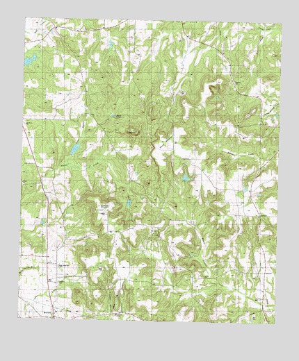
Wilkerson Mountain, TX USGS Topographic Map
Click on map above to begin viewing in our Map Viewer.

This topographic map contains these locations and features:
Feature Name Type Latitude Longitude GNIS ID View Map
Beaver MarshLakeN31.9459°W95.7242°1351733View Map
Bois D' Arc ChurchChurchN31.9560°W95.7486°1352612View Map
Briar Lakes Ranch AirportAirportN31.9535°W95.7123°2717056View Map
Concord ChurchChurchN31.9107°W95.6808°1354860View Map
ElmtownPopulated PlaceN31.8960°W95.6286°1379719View Map
ElmwoodPopulated PlaceN31.9196°W95.6311°1379720View Map
Elmwood Volunteer Fire DepartmentBuildingN31.9302°W95.6371°2655685View Map
Evergreen MarshSwampN31.9379°W95.7205°1357131View Map
Hopewell CemeteryCemeteryN31.9749°W95.6447°1359544View Map
John B Jones LakeReservoirN31.9418°W95.7336°1854529View Map
John B Jones Lake DamDamN31.9418°W95.7336°1854528View Map
MontalbaPopulated PlaceN31.8766°W95.7327°1363057View Map
Montalba Post OfficePost OfficeN31.8757°W95.7336°2731625View Map
Montalba Volunteer Fire DepartmentBuildingN31.8787°W95.7327°2655355View Map
Pine MountainSummitN31.9541°W95.6947°1365299View Map

Note: Coordinates in the location and feature list above are referenced to NAD83 datum.


Copyright (C) 2008-2025 Ryan Niemi / Sunset Dynamics ... All Rights Reserved