TopoQuest Logo
Do you find TopoQuest useful?
Help keep TopoQuest running and adding new maps/features by donating!
Bitcoin:  19c7KJd3qBynnjoSw5npx9KScwjBe4ifkT
Litecoin:  LXs6TkuXGGXo1vDsWCkWVdjQX94eUKd6ui
Home View Maps Find Maps Find Places Resources & Links


South Sebec, Maine Topographic Map

USGS Map Title: South Sebec, ME
USGS Map MRC: 45069B1
DRG (GeoTIFF) Download: o45069b1.tif


Neighboring USGS Topographic Map Quads:


  Sebec Lake East, ME  
45069C2
 

  Brownville Junction, ME  
45069C1
 

  Milo North, ME  
45068C8
 

  Dover-Foxcroft, ME  
45069B2
 

  South Sebec, ME  
45069B1
 

  Milo South, ME  
45068B8
 

  Garland, ME  
45069A2
 

  Charleston, ME  
45069A1
 

  Bradford, ME  
45068A8


Map MRC Location:

N46°
W70°
N46°
W69°
H8 H7 H6 H5 H4 H3 H2 H1
G8 G7 G6 G5 G4 G3 G2 G1
F8 F7 F6 F5 F4 F3 F2 F1
E8 E7 E6 E5 E4 E3 E2 E1
D8 D7 D6 D5 D4 D3 D2 D1
C8 C7 C6 C5 C4 C3 C2 C1
B8 B7 B6 B5 B4 B3 B2 B1
A8 A7 A6 A5 A4 A3 A2 A1
N45°
W70°
N45°
W69°

South Sebec, ME USGS 1:24K Topographic Map Preview:
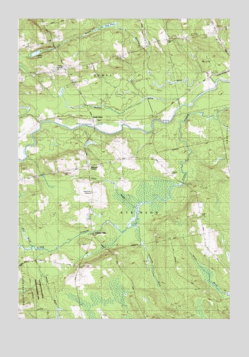
South Sebec, ME USGS Topographic Map
Click on map above to begin viewing in our Map Viewer.

This topographic map contains these locations and features:
Feature Name Type Latitude Longitude GNIS ID View Map
Atkinson ChurchChurchN45.1776°W69.0817°1910007View Map
Atkinson CornersLocaleN45.1887°W69.0864°561338View Map
Atkinson MillsPopulated PlaceN45.1598°W69.0823°579108View Map
Atkinson SchoolSchoolN45.1689°W69.0859°563771View Map
Chase CemeteryCemeteryN45.2073°W69.0785°2736947View Map
Clark CemeteryCemeteryN45.1518°W69.0683°2736949View Map
Dow PondLakeN45.2472°W69.0714°565254View Map
Farnham CemeteryCemeteryN45.1851°W69.0343°566059View Map
Gould CemeteryCemeteryN45.1685°W69.0170°566990View Map
Gulf StreamStreamN45.2464°W69.0784°567380View Map
Hall BrookStreamN45.1545°W69.1198°567498View Map
Hart CemeteryCemeteryN45.1469°W69.0852°567702View Map
Kingdom HallChurchN45.2414°W69.0031°1910095View Map
Ladd SchoolSchoolN45.2406°W69.1075°1910099View Map
Maple SchoolSchoolN45.1603°W69.0161°570743View Map
Meadow BrookStreamN45.2142°W69.0303°571082View Map
Morrison BrookStreamN45.2237°W69.0095°571678View Map
Morrison SchoolSchoolN45.2367°W69.0589°571691View Map
North Atkinson CemeteryCemeteryN45.1866°W69.0961°1910133View Map
Parker PondLakeN45.2355°W69.1145°572990View Map
Sebec Corner CemeteryCemeteryN45.2264°W69.1157°1910168View Map
Sebec CornersPopulated PlaceN45.2298°W69.1017°575166View Map
Sebec StationLocaleN45.2078°W69.0839°575170View Map
Sebec Volunteer North Road Fire StationBuildingN45.2405°W69.1074°2552687View Map
South SebecPopulated PlaceN45.2081°W69.0837°579723View Map
Town CemeteryCemeteryN45.1683°W69.0829°2736962View Map
Town of AtkinsonCivilN45.1603°W69.0582°582332View Map
Town of SebecCivilN45.2429°W69.1042°582718View Map

Note: Coordinates in the location and feature list above are referenced to NAD83 datum.


Copyright (C) 2008-2025 Ryan Niemi / Sunset Dynamics ... All Rights Reserved