TopoQuest Logo
Do you find TopoQuest useful?
Help keep TopoQuest running and adding new maps/features by donating!
Bitcoin:  19c7KJd3qBynnjoSw5npx9KScwjBe4ifkT
Litecoin:  LXs6TkuXGGXo1vDsWCkWVdjQX94eUKd6ui
Home View Maps Find Maps Find Places Resources & Links


Speedsville, New York Topographic Map

USGS Map Title: Speedsville, NY
USGS Map MRC: 42076C3
DRG (GeoTIFF) Download: o42076c3.tif


Neighboring USGS Topographic Map Quads:


  Ithaca East, NY  
42076D4
 

  Dryden, NY  
42076D3
 

  Harford, NY  
42076D2
 

  Willseyville, NY  
42076C4
 

  Speedsville, NY  
42076C3
 

  Richford, NY  
42076C2
 

  Spencer, NY  
42076B4
 

  Candor, NY  
42076B3
 

  Newark Valley, NY  
42076B2


Map MRC Location:

N43°
W77°
N43°
W76°
H8 H7 H6 H5 H4 H3 H2 H1
G8 G7 G6 G5 G4 G3 G2 G1
F8 F7 F6 F5 F4 F3 F2 F1
E8 E7 E6 E5 E4 E3 E2 E1
D8 D7 D6 D5 D4 D3 D2 D1
C8 C7 C6 C5 C4 C3 C2 C1
B8 B7 B6 B5 B4 B3 B2 B1
A8 A7 A6 A5 A4 A3 A2 A1
N42°
W77°
N42°
W76°

Speedsville, NY USGS 1:24K Topographic Map Preview:
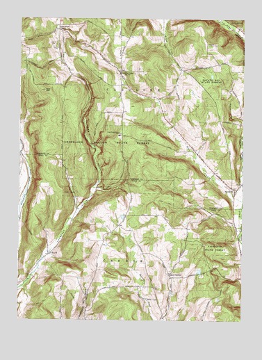
Speedsville, NY USGS Topographic Map
Click on map above to begin viewing in our Map Viewer.

This topographic map contains these locations and features:
Feature Name Type Latitude Longitude GNIS ID View Map
Bald MountainSummitN42.3451°W76.3608°942865View Map
Blair Family PlotCemeteryN42.3201°W76.2817°2514953View Map
Caroline CenterPopulated PlaceN42.3520°W76.3185°945877View Map
Caroline Center CemeteryCemeteryN42.3532°W76.3178°2514948View Map
Caroline Centre ChurchChurchN42.3531°W76.3181°2514949View Map
Central Chapel CemeteryCemeteryN42.3535°W76.3471°2514952View Map
Danby CreekStreamN42.2915°W76.3741°948011View Map
Fairfield CemeteryCemeteryN42.2696°W76.2909°2507618View Map
Fairfield State ForestForestN42.2804°W76.2658°949813View Map
Goodrich Hill CemeteryCemeteryN42.3310°W76.2505°2514950View Map
Guide Board CornersLocaleN42.3704°W76.3533°951898View Map
MacCormick Secure CenterBuildingN42.3270°W76.3187°2598050View Map
Padlock Lookout TowerTowerN42.3645°W76.2697°974813View Map
Potato Hill State ForestForestN42.3492°W76.2683°961026View Map
Prospect ValleyValleyN42.2634°W76.3730°961196View Map
Saint Marys ChurchChurchN42.2773°W76.3574°963939View Map
Shindagin HollowValleyN42.3051°W76.3324°965109View Map
Shindagin Hollow State ForestForestN42.3234°W76.3241°965110View Map
SpeedsvillePopulated PlaceN42.3037°W76.2544°965975View Map
Speedsville CemeteryCemeteryN42.3032°W76.2533°2514951View Map
Speedsville Volunteer Fire CompanyBuildingN42.3061°W76.2514°2735438View Map
Town of CarolineCivilN42.3586°W76.3299°978795View Map
Upper FairfieldPopulated PlaceN42.2692°W76.2905°973181View Map

Note: Coordinates in the location and feature list above are referenced to NAD83 datum.


Copyright (C) 2008-2025 Ryan Niemi / Sunset Dynamics ... All Rights Reserved