TopoQuest Logo
Do you find TopoQuest useful?
Help keep TopoQuest running and adding new maps/features by donating!
Bitcoin:  19c7KJd3qBynnjoSw5npx9KScwjBe4ifkT
Litecoin:  LXs6TkuXGGXo1vDsWCkWVdjQX94eUKd6ui
Home View Maps Find Maps Find Places Resources & Links


Spottsville, Kentucky Topographic Map

USGS Map Title: Spottsville, KY
USGS Map MRC: 37087G4
DRG (GeoTIFF) Download: o37087g4.tif


Neighboring USGS Topographic Map Quads:


  Evansville South, IN  
37087H5
 

  Newburgh, IN  
37087H4
 

  Yankeetown, IN  
37087H3
 

  Henderson, KY  
37087G5
 

  Spottsville, KY  
37087G4
 

  Reed, KY  
37087G3
 

  Robards, KY  
37087F5
 

  Delaware, KY  
37087F4
 

  Curdsville, KY  
37087F3


Map MRC Location:

N38°
W88°
N38°
W87°
H8 H7 H6 H5 H4 H3 H2 H1
G8 G7 G6 G5 G4 G3 G2 G1
F8 F7 F6 F5 F4 F3 F2 F1
E8 E7 E6 E5 E4 E3 E2 E1
D8 D7 D6 D5 D4 D3 D2 D1
C8 C7 C6 C5 C4 C3 C2 C1
B8 B7 B6 B5 B4 B3 B2 B1
A8 A7 A6 A5 A4 A3 A2 A1
N37°
W88°
N37°
W87°

Spottsville, KY USGS 1:24K Topographic Map Preview:
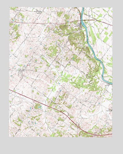
Spottsville, KY USGS Topographic Map
Click on map above to begin viewing in our Map Viewer.

This topographic map contains these locations and features:
Feature Name Type Latitude Longitude GNIS ID View Map
BaskettPopulated PlaceN37.8709°W87.4625°486457View Map
Baskett Volunteer Fire DepartmentBuildingN37.8712°W87.4643°2637322View Map
BealsPopulated PlaceN37.8667°W87.4028°486506View Map
Bluff CityPopulated PlaceN37.8017°W87.3794°487567View Map
Christodelphian ChurchChurchN37.7748°W87.4742°489502View Map
HebbardsvillePopulated PlaceN37.7762°W87.3753°493984View Map
Hebbardsville SchoolSchoolN37.7845°W87.4064°493985View Map
Lick CreekStreamN37.8223°W87.3897°496482View Map
Lock and Dam Number 1DamN37.8584°W87.4100°517211View Map
Race Creek ChurchChurchN37.8575°W87.4567°501512View Map
Ridgewood Presbyterian ChurchChurchN37.8566°W87.4304°501846View Map
SpottsvillePopulated PlaceN37.8575°W87.4136°504091View Map
Spottsville Census Designated PlaceCensusN37.8563°W87.4166°2629683View Map
Spottsville DivisionCivilN37.8608°W87.4598°1937271View Map
Spottsville Fire DepartmentBuildingN37.8531°W87.4172°2636748View Map
ZionPopulated PlaceN37.8148°W87.4836°507274View Map
Zion Census Designated PlaceCensusN37.8149°W87.4872°2629706View Map
Zion Fire DepartmentBuildingN37.8146°W87.4851°2637074View Map

Note: Coordinates in the location and feature list above are referenced to NAD83 datum.


Copyright (C) 2008-2025 Ryan Niemi / Sunset Dynamics ... All Rights Reserved