TopoQuest Logo
Do you find TopoQuest useful?
Help keep TopoQuest running and adding new maps/features by donating!
Bitcoin:  19c7KJd3qBynnjoSw5npx9KScwjBe4ifkT
Litecoin:  LXs6TkuXGGXo1vDsWCkWVdjQX94eUKd6ui
Home View Maps Find Maps Find Places Resources & Links


Robards, Kentucky Topographic Map

USGS Map Title: Robards, KY
USGS Map MRC: 37087F5
DRG (GeoTIFF) Download: o37087f5.tif


Neighboring USGS Topographic Map Quads:


  Wilson, KY  
37087G6
 

  Henderson, KY  
37087G5
 

  Spottsville, KY  
37087G4
 

  Poole, KY  
37087F6
 

  Robards, KY  
37087F5
 

  Delaware, KY  
37087F4
 

  Dixon, KY  
37087E6
 

  Sebree, KY  
37087E5
 

  Beech Grove, KY  
37087E4


Map MRC Location:

N38°
W88°
N38°
W87°
H8 H7 H6 H5 H4 H3 H2 H1
G8 G7 G6 G5 G4 G3 G2 G1
F8 F7 F6 F5 F4 F3 F2 F1
E8 E7 E6 E5 E4 E3 E2 E1
D8 D7 D6 D5 D4 D3 D2 D1
C8 C7 C6 C5 C4 C3 C2 C1
B8 B7 B6 B5 B4 B3 B2 B1
A8 A7 A6 A5 A4 A3 A2 A1
N37°
W88°
N37°
W87°

Robards, KY USGS 1:24K Topographic Map Preview:
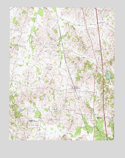
Robards, KY USGS Topographic Map
Click on map above to begin viewing in our Map Viewer.

This topographic map contains these locations and features:
Feature Name Type Latitude Longitude GNIS ID View Map
Agnew CemeteryCemeteryN37.7289°W87.6223°485794View Map
Alcan Ambulance ServiceBuildingN37.6572°W87.5117°2636771View Map
Barrett DitchCanalN37.7484°W87.6222°486438View Map
Cherry Hill ChurchChurchN37.7128°W87.5825°489408View Map
City of RobardsCivilN37.6766°W87.5333°2404629View Map
Denton CemeteryCemeteryN37.7328°W87.6172°490821View Map
Eakins CemeteryCemeteryN37.6625°W87.5140°491414View Map
Eakins CemeteryCemeteryN37.6664°W87.5424°491415View Map
Grane CreekStreamN37.6375°W87.5203°493104View Map
Groves CreekStreamN37.6264°W87.5000°493444View Map
Hunter CemeteryCemeteryN37.6439°W87.5516°494784View Map
Majors Family CemeteryCemeteryN37.6442°W87.5035°2780858View Map
McMullin CemeteryCemeteryN37.6795°W87.5760°497929View Map
Meahl CemeteryCemeteryN37.7140°W87.6144°498006View Map
Mock Roy CreekStreamN37.6256°W87.5100°498465View Map
New Sights CemeteryCemeteryN37.7134°W87.6148°499401View Map
Niagara SchoolSchoolN37.7345°W87.5095°499461View Map
Normen CemeteryCemeteryN37.7400°W87.5353°499526View Map
RobardsPopulated PlaceN37.6739°W87.5467°502050View Map
Robards DistrictCivilN37.6834°W87.5500°507330View Map
Robards Fire DepartmentBuildingN37.6739°W87.5476°2636817View Map
Spencer CemeteryCemeteryN37.6917°W87.5781°504056View Map
Sportsman LakeReservoirN37.6842°W87.5071°504089View Map

Note: Coordinates in the location and feature list above are referenced to NAD83 datum.


Copyright (C) 2008-2025 Ryan Niemi / Sunset Dynamics ... All Rights Reserved