TopoQuest Logo
Do you find TopoQuest useful?
Help keep TopoQuest running and adding new maps/features by donating!
Bitcoin:  19c7KJd3qBynnjoSw5npx9KScwjBe4ifkT
Litecoin:  LXs6TkuXGGXo1vDsWCkWVdjQX94eUKd6ui
Home View Maps Find Maps Find Places Resources & Links


Delaware, Kentucky Topographic Map

USGS Map Title: Delaware, KY
USGS Map MRC: 37087F4
DRG (GeoTIFF) Download: o37087f4.tif


Neighboring USGS Topographic Map Quads:


  Henderson, KY  
37087G5
 

  Spottsville, KY  
37087G4
 

  Reed, KY  
37087G3
 

  Robards, KY  
37087F5
 

  Delaware, KY  
37087F4
 

  Curdsville, KY  
37087F3
 

  Sebree, KY  
37087E5
 

  Beech Grove, KY  
37087E4
 

  Calhoun, KY  
37087E3


Map MRC Location:

N38°
W88°
N38°
W87°
H8 H7 H6 H5 H4 H3 H2 H1
G8 G7 G6 G5 G4 G3 G2 G1
F8 F7 F6 F5 F4 F3 F2 F1
E8 E7 E6 E5 E4 E3 E2 E1
D8 D7 D6 D5 D4 D3 D2 D1
C8 C7 C6 C5 C4 C3 C2 C1
B8 B7 B6 B5 B4 B3 B2 B1
A8 A7 A6 A5 A4 A3 A2 A1
N37°
W88°
N37°
W87°

Delaware, KY USGS 1:24K Topographic Map Preview:
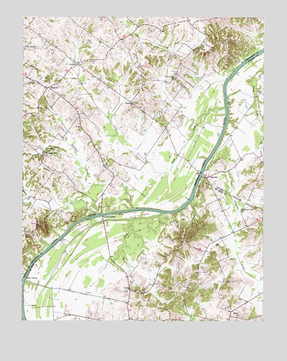
Delaware, KY USGS Topographic Map
Click on map above to begin viewing in our Map Viewer.

This topographic map contains these locations and features:
Feature Name Type Latitude Longitude GNIS ID View Map
Abe CreekStreamN37.6695°W87.4261°485723View Map
Bethel ChurchChurchN37.6268°W87.3880°486979View Map
Boston CemeteryCemeteryN37.6405°W87.4434°487713View Map
Cash CreekStreamN37.7131°W87.3944°489056View Map
Cash Creek ChurchChurchN37.7248°W87.4203°489057View Map
Cobb CemeteryCemeteryN37.6489°W87.4372°489750View Map
ComerPopulated PlaceN37.6378°W87.4439°507737View Map
CoravillePopulated PlaceN37.7306°W87.4714°507757View Map
Corey CemeteryCemeteryN37.6384°W87.4217°490096View Map
DelawarePopulated PlaceN37.6839°W87.4042°490792View Map
Delaware CreekStreamN37.6870°W87.4053°490793View Map
Delaware Creek ChurchChurchN37.6709°W87.3864°490794View Map
EuterpePopulated PlaceN37.7150°W87.4433°507956View Map
Hebbardsville-Robards DivisionCivilN37.7296°W87.4613°1937054View Map
James Bethel Gresham Historical MarkerParkN37.6257°W87.4443°2744595View Map
Mackey CemeteryCemeteryN37.6305°W87.3943°497428View Map
NiagaraPopulated PlaceN37.7209°W87.4864°508702View Map
Niagara Fire DepartmentBuildingN37.7216°W87.4872°2637044View Map
Nunn CemeteryCemeteryN37.6889°W87.4571°499638View Map
Pleasant Valley ChurchChurchN37.6931°W87.4895°500935View Map
Quinn LandingPopulated PlaceN37.6417°W87.4967°508891View Map
Rangers LandingPopulated PlaceN37.6675°W87.4581°508901View Map
Sputzman CreekStreamN37.6684°W87.4614°504196View Map
Sputzman CreekStreamN37.6672°W87.4418°2743129View Map

Note: Coordinates in the location and feature list above are referenced to NAD83 datum.


Copyright (C) 2008-2025 Ryan Niemi / Sunset Dynamics ... All Rights Reserved