TopoQuest Logo
Do you find TopoQuest useful?
Help keep TopoQuest running and adding new maps/features by donating!
Bitcoin:  19c7KJd3qBynnjoSw5npx9KScwjBe4ifkT
Litecoin:  LXs6TkuXGGXo1vDsWCkWVdjQX94eUKd6ui
Home View Maps Find Maps Find Places Resources & Links


Spray, Oregon Topographic Map

USGS Map Title: Spray, OR
USGS Map MRC: 44119G7
DRG (GeoTIFF) Download: o44119g7.tif


Neighboring USGS Topographic Map Quads:


  Wheeler Point, OR  
44119H8
 

  Collins Butte, OR  
44119H7
 

  Whitetail Butte, OR  
44119H6
 

  Masiker Mountain, OR  
44119G8
 

  Spray, OR  
44119G7
 

  Kimberly, OR  
44119G6
 

  Richmond, OR  
44119F8
 

  Johnson Heights, OR  
44119F7
 

  Mount Misery, OR  
44119F6


Map MRC Location:

N45°
W120°
N45°
W119°
H8 H7 H6 H5 H4 H3 H2 H1
G8 G7 G6 G5 G4 G3 G2 G1
F8 F7 F6 F5 F4 F3 F2 F1
E8 E7 E6 E5 E4 E3 E2 E1
D8 D7 D6 D5 D4 D3 D2 D1
C8 C7 C6 C5 C4 C3 C2 C1
B8 B7 B6 B5 B4 B3 B2 B1
A8 A7 A6 A5 A4 A3 A2 A1
N44°
W120°
N44°
W119°

Spray, OR USGS 1:24K Topographic Map Preview:
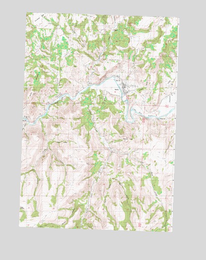
Spray, OR USGS Topographic Map
Click on map above to begin viewing in our Map Viewer.

This topographic map contains these locations and features:
Feature Name Type Latitude Longitude GNIS ID View Map
Balm HollowValleyN44.7840°W119.8097°1117216View Map
Branson CanyonValleyN44.8282°W119.7792°1133779View Map
Burton CanyonValleyN44.8207°W119.8553°1129499View Map
Button HollowValleyN44.7640°W119.8194°1118411View Map
Canyon CreekStreamN44.8140°W119.8608°1118575View Map
Corncob CreekStreamN44.8682°W119.8031°1140124View Map
Cry CreekStreamN44.8346°W119.7983°1161778View Map
Evans CreekStreamN44.7976°W119.8542°1120536View Map
Harper MountainSummitN44.8429°W119.8658°1121611View Map
Haystack CreekStreamN44.8176°W119.7611°1143414View Map
Haystack ValleyValleyN44.8165°W119.7650°1153779View Map
Holmes CreekStreamN44.8476°W119.8164°1143678View Map
Kahler CreekStreamN44.8332°W119.8219°1144478View Map
Laurel HollowValleyN44.7813°W119.8019°1122982View Map
Left Hand CreekStreamN44.7974°W119.8022°1123035View Map
Long HollowValleyN44.8082°W119.8747°1123424View Map
Parrish CreekStreamN44.8326°W119.8161°1125197View Map
Poplar Post Office (historical)Post OfficeN44.8304°W119.7553°1165807View Map
Sentinel PeakSummitN44.8034°W119.7900°1126742View Map
Slick HollowValleyN44.8015°W119.8542°1127071View Map
Snabel CreekStreamN44.8262°W119.8470°1129939View Map
SprayPopulated PlaceN44.8343°W119.7944°1127403View Map
Spray Airstrip (historical)AirportN44.8332°W119.7803°1131719View Map
Spray Boat Access SiteLocaleN44.8266°W119.7942°2700118View Map
Spray CemeteryCemeteryN44.8301°W119.8113°1158631View Map
Spray City HallBuildingN44.8335°W119.7929°2698935View Map
Spray Pioneer MuseumBuildingN44.8312°W119.7940°2699839View Map
Spray Post OfficePost OfficeN44.8321°W119.7940°1165974View Map
Spray Public Works Road DepartmentBuildingN44.8370°W119.7948°2698937View Map
Spray Riverfront ParkParkN44.8251°W119.7950°2058335View Map
Spray Rodeo GroundsLocaleN44.8340°W119.7916°2699840View Map
Spray SchoolSchoolN44.8344°W119.7927°2495557View Map
Spray School Public LibraryBuildingN44.8342°W119.7928°2698936View Map
Spray Sewage Treatment PlantLocaleN44.8285°W119.7776°2697126View Map
Spray Volunteer Ambulance AssociationBuildingN44.8298°W119.7907°2553806View Map
Spray Volunteer Fire DepartmentBuildingN44.8297°W119.7907°2577162View Map
Town GulchValleyN44.8304°W119.7942°1129502View Map
Town of SprayCivilN44.8331°W119.7941°2413318View Map

Note: Coordinates in the location and feature list above are referenced to NAD83 datum.


Copyright (C) 2008-2025 Ryan Niemi / Sunset Dynamics ... All Rights Reserved