TopoQuest Logo
Do you find TopoQuest useful?
Help keep TopoQuest running and adding new maps/features by donating!
Bitcoin:  19c7KJd3qBynnjoSw5npx9KScwjBe4ifkT
Litecoin:  LXs6TkuXGGXo1vDsWCkWVdjQX94eUKd6ui
Home View Maps Find Maps Find Places Resources & Links


Masiker Mountain, Oregon Topographic Map

USGS Map Title: Masiker Mountain, OR
USGS Map MRC: 44119G8
DRG (GeoTIFF) Download: o44119g8.tif


Neighboring USGS Topographic Map Quads:


  Kinzua, OR  
44120H1
 

  Wheeler Point, OR  
44119H8
 

  Collins Butte, OR  
44119H7
 

  Service Creek, OR  
44120G1
 

  Masiker Mountain, OR  
44119G8
 

  Spray, OR  
44119G7
 

  Toney Butte, OR  
44120F1
 

  Richmond, OR  
44119F8
 

  Johnson Heights, OR  
44119F7


Map MRC Location:

N45°
W120°
N45°
W119°
H8 H7 H6 H5 H4 H3 H2 H1
G8 G7 G6 G5 G4 G3 G2 G1
F8 F7 F6 F5 F4 F3 F2 F1
E8 E7 E6 E5 E4 E3 E2 E1
D8 D7 D6 D5 D4 D3 D2 D1
C8 C7 C6 C5 C4 C3 C2 C1
B8 B7 B6 B5 B4 B3 B2 B1
A8 A7 A6 A5 A4 A3 A2 A1
N44°
W120°
N44°
W119°

Masiker Mountain, OR USGS 1:24K Topographic Map Preview:
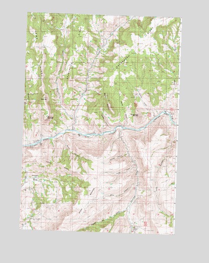
Masiker Mountain, OR USGS Topographic Map
Click on map above to begin viewing in our Map Viewer.

This topographic map contains these locations and features:
Feature Name Type Latitude Longitude GNIS ID View Map
Alder CreekStreamN44.8079°W119.9600°1137078View Map
Alder MountainSummitN44.8254°W119.9836°1116837View Map
Ben Glenn CanyonValleyN44.8229°W119.9997°1117507View Map
Dippen Rig CreekStreamN44.7657°W119.9122°1119949View Map
Donnelly BasinBasinN44.7790°W119.9886°1120026View Map
Donnely CreekStreamN44.7804°W119.9970°1129498View Map
Forked CanyonValleyN44.7901°W119.9089°1120886View Map
Grassy Dell CreekStreamN44.8193°W119.8914°1129501View Map
Harper CreekStreamN44.8196°W119.8845°1121610View Map
Hawk RidgeRidgeN44.8540°W119.9906°1133778View Map
Hoogie Doogie MountainSummitN44.8174°W119.9075°1121967View Map
Horseshoe CreekStreamN44.8096°W119.9211°1122038View Map
Juniper CanyonValleyN44.8099°W119.9267°1122570View Map
Juniper RidgeRidgeN44.7840°W119.9572°1122607View Map
Lake CreekStreamN44.8151°W119.9586°1144769View Map
Masiker CanyonValleyN44.8104°W119.9183°1135810View Map
Masiker MountainSummitN44.8282°W119.9339°1135811View Map
Mathas CreekStreamN44.8174°W119.8939°1123834View Map
Mule Shoe Boat LaunchLocaleN44.8069°W119.9663°2699637View Map
Muleshoe CreekStreamN44.7987°W119.9945°1124525View Map
Muleshoe MountainSummitN44.8137°W119.9817°1132101View Map
Rimrock SpringSpringN44.7563°W119.9778°1116497View Map
Rock CreekStreamN44.8207°W119.8872°1129500View Map
Rollin CanyonValleyN44.8057°W119.9681°1126267View Map
Solitude CanyonValleyN44.7965°W119.9153°1127206View Map
Sourdough RidgeRidgeN44.8546°W119.9122°1149889View Map
Starvation RidgeRidgeN44.8568°W119.9595°1133777View Map
William CreekStreamN44.7524°W119.9089°1129105View Map
Wills CanyonValleyN44.7787°W119.9061°1129180View Map
Wooden Bridge Boat LaunchLocaleN44.8104°W119.9189°2699971View Map

Note: Coordinates in the location and feature list above are referenced to NAD83 datum.


Copyright (C) 2008-2024 Ryan Niemi / Sunset Dynamics ... All Rights Reserved