TopoQuest Logo
Do you find TopoQuest useful?
Help keep TopoQuest running and adding new maps/features by donating!
Bitcoin:  19c7KJd3qBynnjoSw5npx9KScwjBe4ifkT
Litecoin:  LXs6TkuXGGXo1vDsWCkWVdjQX94eUKd6ui
Home View Maps Find Maps Find Places Resources & Links


Mount Misery, Oregon Topographic Map

USGS Map Title: Mount Misery, OR
USGS Map MRC: 44119F6
DRG (GeoTIFF) Download: o44119f6.tif


Neighboring USGS Topographic Map Quads:


  Spray, OR  
44119G7
 

  Kimberly, OR  
44119G6
 

  Bologna Basin, OR  
44119G5
 

  Johnson Heights, OR  
44119F7
 

  Mount Misery, OR  
44119F6
 

  Miller Flat, OR  
44119F5
 

  Tubb Spring, OR  
44119E7
 

  Picture Gorge West, OR  
44119E6
 

  Picture Gorge East, OR  
44119E5


Map MRC Location:

N45°
W120°
N45°
W119°
H8 H7 H6 H5 H4 H3 H2 H1
G8 G7 G6 G5 G4 G3 G2 G1
F8 F7 F6 F5 F4 F3 F2 F1
E8 E7 E6 E5 E4 E3 E2 E1
D8 D7 D6 D5 D4 D3 D2 D1
C8 C7 C6 C5 C4 C3 C2 C1
B8 B7 B6 B5 B4 B3 B2 B1
A8 A7 A6 A5 A4 A3 A2 A1
N44°
W120°
N44°
W119°

Mount Misery, OR USGS 1:24K Topographic Map Preview:
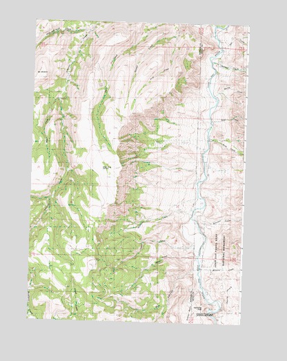
Mount Misery, OR USGS Topographic Map
Click on map above to begin viewing in our Map Viewer.

This topographic map contains these locations and features:
Feature Name Type Latitude Longitude GNIS ID View Map
Basin Post Office (historical)Post OfficeN44.6776°W119.6492°1164204View Map
Bear CreekStreamN44.7165°W119.7347°1117347View Map
Black Snag SpringsSpringN44.6882°W119.7083°1117782View Map
Bone CreekStreamN44.7021°W119.6467°1133799View Map
Branson CreekStreamN44.6710°W119.6561°1118041View Map
Bull CanyonValleyN44.6479°W119.6519°1118269View Map
Cathedral RockPillarN44.6310°W119.6455°1118687View Map
Deep CreekStreamN44.6563°W119.6517°1119787View Map
Devils GulchValleyN44.6332°W119.6372°1129506View Map
First CreekStreamN44.7443°W119.6700°1120745View Map
Fossil CreekStreamN44.7082°W119.6447°1161780View Map
Gus CreekStreamN44.7388°W119.6414°1129508View Map
Harry CreekStreamN44.6524°W119.6533°1121630View Map
Hide and Seek CreekStreamN44.7454°W119.7178°1121800View Map
Holmes CreekStreamN44.7332°W119.6486°1121929View Map
Johnson CreekStreamN44.7490°W119.6475°1144344View Map
Longview Ranch AirportAirportN44.6672°W119.6550°2650872View Map
McCarty CreekStreamN44.6471°W119.6455°1129507View Map
McGinnis CreekStreamN44.6696°W119.6572°1123964View Map
Mount MiserySummitN44.7263°W119.7458°1124253View Map
Rose CreekStreamN44.7096°W119.6455°1133798View Map
Spring CreekStreamN44.7207°W119.6455°1161779View Map

Note: Coordinates in the location and feature list above are referenced to NAD83 datum.


Copyright (C) 2008-2024 Ryan Niemi / Sunset Dynamics ... All Rights Reserved