TopoQuest Logo
Do you find TopoQuest useful?
Help keep TopoQuest running and adding new maps/features by donating!
Bitcoin:  19c7KJd3qBynnjoSw5npx9KScwjBe4ifkT
Litecoin:  LXs6TkuXGGXo1vDsWCkWVdjQX94eUKd6ui
Home View Maps Find Maps Find Places Resources & Links


Spring Ridge, Louisiana Topographic Map

USGS Map Title: Spring Ridge, LA
USGS Map MRC: 32093C8
DRG (GeoTIFF) Download: o32093c8.tif


Neighboring USGS Topographic Map Quads:


  Waskom, TX  
32094D1
 

  Greenwood, LA  
32093D8
 

  Shreveport West, LA  
32093D7
 

  Panola, LA  
32094C1
 

  Spring Ridge, LA  
32093C8
 

  Stonewall, LA  
32093C7
 

  Old Panola, TX  
32094B1
 

  Keatchie, LA  
32093B8
 

  Gloster, LA  
32093B7


Map MRC Location:

N33°
W94°
N33°
W93°
H8 H7 H6 H5 H4 H3 H2 H1
G8 G7 G6 G5 G4 G3 G2 G1
F8 F7 F6 F5 F4 F3 F2 F1
E8 E7 E6 E5 E4 E3 E2 E1
D8 D7 D6 D5 D4 D3 D2 D1
C8 C7 C6 C5 C4 C3 C2 C1
B8 B7 B6 B5 B4 B3 B2 B1
A8 A7 A6 A5 A4 A3 A2 A1
N32°
W94°
N32°
W93°

Spring Ridge, LA USGS 1:24K Topographic Map Preview:
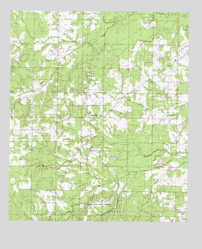
Spring Ridge, LA USGS Topographic Map
Click on map above to begin viewing in our Map Viewer.

This topographic map contains these locations and features:
Feature Name Type Latitude Longitude GNIS ID View Map
Caddo Parish Fire District 4BuildingN32.3122°W93.9431°2672853View Map
Daisy Grove SchoolSchoolN32.3377°W93.9002°534386View Map
Davidson CemeteryCemeteryN32.3004°W93.9621°534402View Map
Forcht - Wade Correctional CenterBuildingN32.2631°W93.9349°541019View Map
Forcht Wade Correctional Center Special Services District FacilitySchoolN32.2627°W93.9350°2462807View Map
Galilee ChurchChurchN32.3177°W93.9271°535154View Map
Hughes CemeteryCemeteryN32.2754°W93.9782°535854View Map
Johnson CemeteryCemeteryN32.2985°W93.9471°536087View Map
Johnson Gas FieldOilfieldN32.3154°W93.9660°552328View Map
Maiden CemeteryCemeteryN32.2653°W93.9403°2776779View Map
Metcalf Oil and Gas FieldOilfieldN32.3682°W93.8988°552352View Map
Mount Olive Missionary Baptist ChurchChurchN32.3746°W93.9674°552491View Map
Mount Olive SchoolSchoolN32.3738°W93.9663°537370View Map
Mount Washington ChurchChurchN32.3079°W93.8799°537420View Map
New Hill CemeteryCemeteryN32.3046°W93.9643°537571View Map
Northwest Louisiana Veterans CemeteryCemeteryN32.2665°W93.9332°2774681View Map
Parish Governing Authority District 11CivilN32.3008°W93.9242°1929800View Map
Pollard CemeteryCemeteryN32.2893°W93.9543°538323View Map
PrestonPopulated PlaceN32.2557°W93.8774°541170View Map
Providence ChurchChurchN32.3202°W93.9852°538424View Map
Saint Johns ChurchChurchN32.3115°W93.9849°538895View Map
Spring BranchStreamN32.2732°W93.9238°539578View Map
Spring RidgePopulated PlaceN32.3121°W93.9446°556124View Map
Ward SixCivilN32.3179°W93.9171°544945View Map
White Hall SchoolSchoolN32.2679°W93.9330°540363View Map

Note: Coordinates in the location and feature list above are referenced to NAD83 datum.


Copyright (C) 2008-2025 Ryan Niemi / Sunset Dynamics ... All Rights Reserved