TopoQuest Logo
Do you find TopoQuest useful?
Help keep TopoQuest running and adding new maps/features by donating!
Bitcoin:  19c7KJd3qBynnjoSw5npx9KScwjBe4ifkT
Litecoin:  LXs6TkuXGGXo1vDsWCkWVdjQX94eUKd6ui
Home View Maps Find Maps Find Places Resources & Links


Stonewall, Louisiana Topographic Map

USGS Map Title: Stonewall, LA
USGS Map MRC: 32093C7
DRG (GeoTIFF) Download: o32093c7.tif


Neighboring USGS Topographic Map Quads:


  Greenwood, LA  
32093D8
 

  Shreveport West, LA  
32093D7
 

  Shreveport East, LA  
32093D6
 

  Spring Ridge, LA  
32093C8
 

  Stonewall, LA  
32093C7
 

  Wallace Lake, LA  
32093C6
 

  Keatchie, LA  
32093B8
 

  Gloster, LA  
32093B7
 

  Holly, LA  
32093B6


Map MRC Location:

N33°
W94°
N33°
W93°
H8 H7 H6 H5 H4 H3 H2 H1
G8 G7 G6 G5 G4 G3 G2 G1
F8 F7 F6 F5 F4 F3 F2 F1
E8 E7 E6 E5 E4 E3 E2 E1
D8 D7 D6 D5 D4 D3 D2 D1
C8 C7 C6 C5 C4 C3 C2 C1
B8 B7 B6 B5 B4 B3 B2 B1
A8 A7 A6 A5 A4 A3 A2 A1
N32°
W94°
N32°
W93°

Stonewall, LA USGS 1:24K Topographic Map Preview:
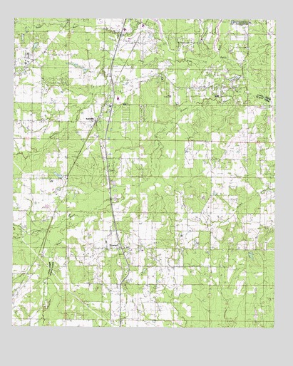
Stonewall, LA USGS Topographic Map
Click on map above to begin viewing in our Map Viewer.

This topographic map contains these locations and features:
Feature Name Type Latitude Longitude GNIS ID View Map
Bluebird Hill AirportAirportN32.3483°W93.8003°1632788View Map
Boggy BayouStreamN32.3424°W93.7527°533283View Map
Brush BayouStreamN32.3627°W93.7813°533449View Map
Buchanan BayouStreamN32.3582°W93.7980°533490View Map
Bungalo (historical)Populated PlaceN32.3693°W93.8149°552236View Map
Caddo Parish Fire District 6BuildingN32.3281°W93.8350°2672795View Map
Caddo Parish Sheriff's OfficeBuildingN32.3668°W93.8238°2755285View Map
Caspiana Gas FieldOilfieldN32.2585°W93.7932°545594View Map
Cypress BayouStreamN32.3429°W93.7521°534338View Map
Cypress BayouStreamN32.2890°W93.8524°534344View Map
Davis Pond DamDamN32.2768°W93.7618°556984View Map
De Soto Fire District 3BuildingN32.2826°W93.8196°2672800View Map
East Mission ChurchChurchN32.2699°W93.8668°534733View Map
Fairview SchoolSchoolN32.3690°W93.8468°534889View Map
Foster CreekStreamN32.2871°W93.8727°535055View Map
Hall Grove SchoolSchoolN32.3096°W93.8624°535494View Map
Johnson BranchStreamN32.2877°W93.8680°536082View Map
Keatchie BayouStreamN32.3018°W93.8232°536148View Map
KeithvillePopulated PlaceN32.3332°W93.8363°536151View Map
Keithville Elementary and Middle SchoolSchoolN32.3426°W93.8257°536152View Map
Keithville Post OfficePost OfficeN32.3337°W93.8287°1631873View Map
Louisiana State University School of Medicine LaboratoryLocaleN32.2940°W93.7877°545637View Map
Marshall ChapelChurchN32.3171°W93.7635°536910View Map
Mount Bethel ChurchChurchN32.3035°W93.8538°537290View Map
Old Hickory Ranch AirportAirportN32.3465°W93.8191°1632789View Map
Parish Governing Authority District 2CivilN32.2959°W93.7991°1929888View Map
Powell CemeteryCemeteryN32.2999°W93.7802°538374View Map
Providence ChurchChurchN32.2821°W93.8135°538423View Map
Saint Matthews ChurchChurchN32.2815°W93.7741°539005View Map
StaplesPopulated PlaceN32.3643°W93.8166°543700View Map
StonewallPopulated PlaceN32.2818°W93.8241°543704View Map
Stonewall HospitalHospitalN32.2773°W93.8215°2674196View Map
Town of StonewallCivilN32.2715°W93.8099°2406670View Map
Ward TwoCivilN32.2552°W93.7718°544996View Map

Note: Coordinates in the location and feature list above are referenced to NAD83 datum.


Copyright (C) 2008-2025 Ryan Niemi / Sunset Dynamics ... All Rights Reserved