TopoQuest Logo
Do you find TopoQuest useful?
Help keep TopoQuest running and adding new maps/features by donating!
Bitcoin:  19c7KJd3qBynnjoSw5npx9KScwjBe4ifkT
Litecoin:  LXs6TkuXGGXo1vDsWCkWVdjQX94eUKd6ui
Home View Maps Find Maps Find Places Resources & Links


Spring Water Canyon, Arizona Topographic Map

USGS Map Title: Spring Water Canyon, AZ
USGS Map MRC: 31110G5
DRG (GeoTIFF) Download: o31110g5.tif


Neighboring USGS Topographic Map Quads:


  Mount Fagan, AZ  
31110H6
 

  The Narrows, AZ  
31110H5
 

  Mescal, AZ  
31110H4
 

  Empire Ranch, AZ  
31110G6
 

  Spring Water Canyon, AZ  
31110G5
 

  Apache Peak, AZ  
31110G4
 

  Sonoita, AZ  
31110F6
 

  Elgin, AZ  
31110F5
 

  Mustang Mountains, AZ  
31110F4


Map MRC Location:

N32°
W111°
N32°
W110°
H8 H7 H6 H5 H4 H3 H2 H1
G8 G7 G6 G5 G4 G3 G2 G1
F8 F7 F6 F5 F4 F3 F2 F1
E8 E7 E6 E5 E4 E3 E2 E1
D8 D7 D6 D5 D4 D3 D2 D1
C8 C7 C6 C5 C4 C3 C2 C1
B8 B7 B6 B5 B4 B3 B2 B1
A8 A7 A6 A5 A4 A3 A2 A1
N31°
W111°
N31°
W110°

Spring Water Canyon, AZ USGS 1:24K Topographic Map Preview:
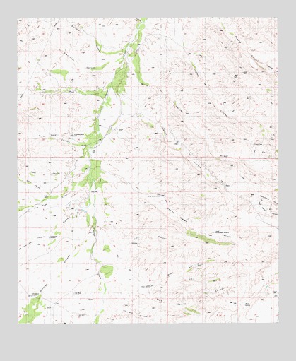
Spring Water Canyon, AZ USGS Topographic Map
Click on map above to begin viewing in our Map Viewer.

This topographic map contains these locations and features:
Feature Name Type Latitude Longitude GNIS ID View Map
Bear Spring CanyonValleyN31.8020°W110.5112°26116View Map
Boulder TankReservoirN31.7742°W110.5404°37181View Map
Cedar CanyonValleyN31.8131°W110.5948°27408View Map
Cienega RanchLocaleN31.8301°W110.5812°27638View Map
Cieneguita WindmillWellN31.7856°W110.6106°37235View Map
Cinco CanyonValleyN31.7887°W110.5837°27652View Map
Cinco WindmillWellN31.7826°W110.5731°37237View Map
Clyne RanchLocaleN31.7601°W110.5009°27749View Map
Cottonwood WindmillLocaleN31.7609°W110.6184°28059View Map
Diamond A WindmillWellN31.8270°W110.6070°37272View Map
Empire GulchValleyN31.7979°W110.5929°28899View Map
Enzenberg North WellWellN31.8268°W110.5987°37290View Map
Fortynine WashStreamN31.8426°W110.5854°29131View Map
Gardner CanyonValleyN31.7904°W110.5895°29259View Map
Greaterville GulchValleyN31.7654°W110.6123°37326View Map
Hilton WashStreamN31.7665°W110.5637°29993View Map
Hummel RanchLocaleN31.7565°W110.6123°30286View Map
Los Posos GulchValleyN31.7845°W110.6167°37376View Map
Los Posos GulchValleyN31.7843°W110.6159°31289View Map
Lower Hilton WindmillWellN31.7654°W110.5620°37380View Map
Lower Spring Water WindmillWellN31.8023°W110.5570°37385View Map
Mattie CanyonValleyN31.8390°W110.5709°31568View Map
Middle CanyonValleyN31.8026°W110.6098°31800View Map
Montosa CanyonValleyN31.8543°W110.5067°31974View Map
Mud SpringSpringN31.7584°W110.5184°32098View Map
Mud Spring CanyonValleyN31.7720°W110.5781°32124View Map
North CanyonValleyN31.8243°W110.5945°32353View Map
Oak Tree CanyonValleyN31.8079°W110.5942°32471View Map
Oil Well CanyonValleyN31.7576°W110.5823°32482View Map
Oil Well TankReservoirN31.7621°W110.5989°37442View Map
Sanford CanyonValleyN31.8604°W110.5751°34060View Map
Shellenberger CanyonValleyN31.8020°W110.5112°34365View Map
Spring Water CanyonValleyN31.8106°W110.5834°34745View Map
Stevenson CanyonValleyN31.8565°W110.5767°34842View Map
Upper Spring Water WindmillWellN31.7870°W110.5312°37575View Map
Wind TankReservoirN31.7683°W110.5415°37596View Map
Wood CanyonValleyN31.8543°W110.5679°36365View Map

Note: Coordinates in the location and feature list above are referenced to NAD83 datum.


Copyright (C) 2008-2025 Ryan Niemi / Sunset Dynamics ... All Rights Reserved