TopoQuest Logo
Do you find TopoQuest useful?
Help keep TopoQuest running and adding new maps/features by donating!
Bitcoin:  19c7KJd3qBynnjoSw5npx9KScwjBe4ifkT
Litecoin:  LXs6TkuXGGXo1vDsWCkWVdjQX94eUKd6ui
Home View Maps Find Maps Find Places Resources & Links


Springfield, West Virginia Topographic Map

USGS Map Title: Springfield, WV
USGS Map MRC: 39078D6
DRG (GeoTIFF) Download: o39078d6.tif


Neighboring USGS Topographic Map Quads:


  Cresaptown, MD  
39078E7
 

  Patterson Creek, WV  
39078E6
 

  Oldtown, MD  
39078E5
 

  Headsville, WV  
39078D7
 

  Springfield, WV  
39078D6
 

  Levels, WV  
39078D5
 

  Romney, WV  
39078C7
 

  Augusta, WV  
39078C6
 

  Hanging Rock, WV  
39078C5


Map MRC Location:

N40°
W79°
N40°
W78°
H8 H7 H6 H5 H4 H3 H2 H1
G8 G7 G6 G5 G4 G3 G2 G1
F8 F7 F6 F5 F4 F3 F2 F1
E8 E7 E6 E5 E4 E3 E2 E1
D8 D7 D6 D5 D4 D3 D2 D1
C8 C7 C6 C5 C4 C3 C2 C1
B8 B7 B6 B5 B4 B3 B2 B1
A8 A7 A6 A5 A4 A3 A2 A1
N39°
W79°
N39°
W78°

Springfield, WV USGS 1:24K Topographic Map Preview:
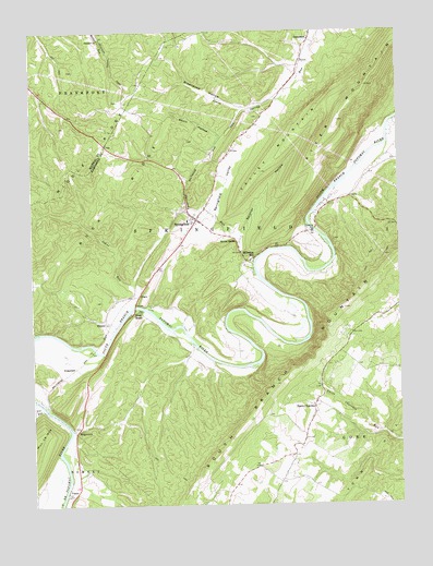
Springfield, WV USGS Topographic Map
Click on map above to begin viewing in our Map Viewer.

This topographic map contains these locations and features:
Feature Name Type Latitude Longitude GNIS ID View Map
Abernathy RunStreamN39.4387°W78.6745°1534792View Map
Bethel Methodist Church CemeteryCemeteryN39.4012°W78.6549°2726523View Map
Blues BeachPopulated PlaceN39.4259°W78.7153°1553940View Map
Branch Mountain Methodist ChurchChurchN39.4187°W78.6536°1718605View Map
Branch Mountain United Methodist Church CemeteryCemeteryN39.3975°W78.6554°2726554View Map
Buck RidgeRidgeN39.4590°W78.7175°1536561View Map
Buffalo CreekStreamN39.3757°W78.7403°1536637View Map
Cornwell School (historical)SchoolN39.3820°W78.6686°1556754View Map
Dennison ChurchChurchN39.4970°W78.7256°1538130View Map
Dewey School (historical)SchoolN39.3937°W78.6378°1556759View Map
DonaldsonPopulated PlaceN39.4976°W78.6545°1554318View Map
Donaldson School (historical)SchoolN39.4906°W78.6608°1556761View Map
Eastview AirportAirportN39.3944°W78.6802°2443478View Map
Fort Valley Volunteer Fire and Rescue - Substation, Company 5BuildingN39.4117°W78.7000°2085987View Map
Fox RunStreamN39.4015°W78.7470°1539209View Map
GracePopulated PlaceN39.4307°W78.7133°1554589View Map
Greenwood HollowValleyN39.4823°W78.6664°1539727View Map
Huffman SpringSpringN39.4887°W78.6575°1677930View Map
Jersey School (historical)SchoolN39.3770°W78.6472°1556777View Map
John Blue BridgeBridgeN39.4274°W78.7149°2646957View Map
Johns RunStreamN39.4276°W78.7153°1540968View Map
Kerns School (historical)SchoolN39.4315°W78.7431°1556779View Map
Kincade School (historical)SchoolN39.4779°W78.7108°1556780View Map
Middle RidgeRidgeN39.4634°W78.7297°1543210View Map
MillesonPopulated PlaceN39.4623°W78.6864°1718673View Map
Millesons MillPopulated PlaceN39.4404°W78.6742°1555126View Map
Millesons Mill BridgeBridgeN39.4478°W78.6543°2646955View Map
Mount Bethel CemeteryCemeteryN39.4848°W78.6550°1718674View Map
Mount Bethel Presbyterian ChurchChurchN39.4012°W78.6545°1718675View Map
Mount Bethel Primitive Baptist Church CemeteryCemeteryN39.4011°W78.6547°2726656View Map
Mount Zion Baptist ChurchChurchN39.3982°W78.6553°1718676View Map
Poland School (historical)SchoolN39.4045°W78.7145°1556792View Map
Raven Rock SpringSpringN39.4415°W78.6781°1677931View Map
Raven RocksPopulated PlaceN39.4445°W78.6797°1555443View Map
RidgedalePopulated PlaceN39.4115°W78.7347°1555478View Map
RittersPopulated PlaceN39.4237°W78.7247°1549899View Map
River MountainSummitN39.4813°W78.6404°1545771View Map
Short HollowValleyN39.4726°W78.6853°1546728View Map
SpringfieldPopulated PlaceN39.4506°W78.6936°1547219View Map
Springfield - Green Spring Elementary SchoolSchoolN39.4502°W78.6965°1718723View Map
Springfield Area Rescue SquadBuildingN39.4523°W78.6916°2581070View Map
Springfield Census Designated PlaceCensusN39.4449°W78.6978°2586885View Map
Springfield DistrictCivilN39.4605°W78.6570°1928369View Map
Springfield Hill CemeteryCemeteryN39.4530°W78.6978°2726696View Map
Springfield Post OfficePost OfficeN39.4525°W78.6968°1718724View Map
Springfield SpringSpringN39.4406°W78.6775°1677932View Map
Springfield ValleyValleyN39.4506°W78.6864°1547221View Map
Springfield Valley Volunteer Fire DepartmentBuildingN39.4488°W78.6901°2577643View Map
Springfield Wildlife Management AreaParkN39.4654°W78.6553°1718725View Map
Swisher HollowValleyN39.4468°W78.6781°1547810View Map
Taylor School (historical)SchoolN39.4626°W78.6281°1556806View Map
Three ChurchesPopulated PlaceN39.4009°W78.6542°1555808View Map
Three Churches Post OfficePost OfficeN39.4023°W78.6539°1718727View Map
Valley MountainSummitN39.4815°W78.6471°1555872View Map
VancePopulated PlaceN39.3782°W78.7386°1549969View Map
WapocomoPopulated PlaceN39.3951°W78.7347°1549977View Map

Note: Coordinates in the location and feature list above are referenced to NAD83 datum.


Copyright (C) 2008-2024 Ryan Niemi / Sunset Dynamics ... All Rights Reserved