TopoQuest Logo
Do you find TopoQuest useful?
Help keep TopoQuest running and adding new maps/features by donating!
Bitcoin:  19c7KJd3qBynnjoSw5npx9KScwjBe4ifkT
Litecoin:  LXs6TkuXGGXo1vDsWCkWVdjQX94eUKd6ui
Home View Maps Find Maps Find Places Resources & Links


Augusta, West Virginia Topographic Map

USGS Map Title: Augusta, WV
USGS Map MRC: 39078C6
DRG (GeoTIFF) Download: o39078c6.tif


Neighboring USGS Topographic Map Quads:


  Headsville, WV  
39078D7
 

  Springfield, WV  
39078D6
 

  Levels, WV  
39078D5
 

  Romney, WV  
39078C7
 

  Augusta, WV  
39078C6
 

  Hanging Rock, WV  
39078C5
 

  Sector, WV  
39078B7
 

  Rio, WV  
39078B6
 

  Yellow Spring, WV  
39078B5


Map MRC Location:

N40°
W79°
N40°
W78°
H8 H7 H6 H5 H4 H3 H2 H1
G8 G7 G6 G5 G4 G3 G2 G1
F8 F7 F6 F5 F4 F3 F2 F1
E8 E7 E6 E5 E4 E3 E2 E1
D8 D7 D6 D5 D4 D3 D2 D1
C8 C7 C6 C5 C4 C3 C2 C1
B8 B7 B6 B5 B4 B3 B2 B1
A8 A7 A6 A5 A4 A3 A2 A1
N39°
W79°
N39°
W78°

Augusta, WV USGS 1:24K Topographic Map Preview:
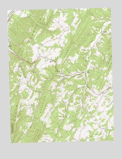
Augusta, WV USGS Topographic Map
Click on map above to begin viewing in our Map Viewer.

This topographic map contains these locations and features:
Feature Name Type Latitude Longitude GNIS ID View Map
AugustaPopulated PlaceN39.2954°W78.6378°1535081View Map
Augusta Elementary SchoolSchoolN39.2932°W78.6403°1718595View Map
Augusta Post OfficePost OfficeN39.2952°W78.6390°1718596View Map
Augusta Volunteer Rescue Squad Company 13BuildingN39.2966°W78.6351°2581114View Map
Barnes MillPopulated PlaceN39.3512°W78.6364°1549579View Map
Bell HollowValleyN39.3018°W78.6586°1535604View Map
Bethel CemeteryCemeteryN39.2854°W78.7247°1718601View Map
Bethel ChurchChurchN39.2851°W78.7242°1535710View Map
Boone Farms Lake DamDamN39.3034°W78.6497°1558870View Map
Bryn School (historical)SchoolN39.2640°W78.6600°1556747View Map
Camp RunStreamN39.3112°W78.6839°1536946View Map
Chestnut Grove School (historical)SchoolN39.3390°W78.7189°1556750View Map
Cleveland School (historical)SchoolN39.3157°W78.7122°1556752View Map
Davey School (historical)SchoolN39.2607°W78.7300°1556756View Map
Ebenezer CemeteryCemeteryN39.3302°W78.7062°2726582View Map
Ebenezer ChurchChurchN39.3301°W78.7064°1538533View Map
Everett Fruit Farm SpringSpringN39.2751°W78.7372°1677896View Map
Fairview ChurchChurchN39.3109°W78.7300°1538823View Map
FrenchburgPopulated PlaceN39.3154°W78.6606°1539262View Map
Hampshire County Career Training CenterSchoolN39.3260°W78.7007°1718645View Map
Hampshire High SchoolSchoolN39.3257°W78.6990°1718648View Map
Hampshire Memorial HospitalHospitalN39.3334°W78.6985°1718647View Map
Highview School (historical)SchoolN39.2923°W78.7289°1556771View Map
Holiness ChurchChurchN39.3112°W78.6831°1540385View Map
J M Chick Buckbee Juvenile Detention CenterBuildingN39.3030°W78.6444°2780329View Map
JM Chick Buckbee Juvenile CenterSchoolN39.3030°W78.6445°2631504View Map
Little Cacapon ChurchChurchN39.3251°W78.6525°1542051View Map
Little Capon School (historical)SchoolN39.3120°W78.6789°1556781View Map
Lost Mountain AirportAirportN39.2873°W78.7378°1558844View Map
Methodist Church CemeteryCemeteryN39.2938°W78.6406°2726653View Map
North Fork Little Cacapon RiverStreamN39.3154°W78.6575°1544214View Map
Potomac Highlands Regional JailBuildingN39.3023°W78.6470°2634792View Map
Ridgedale School (historical)SchoolN39.2795°W78.7000°1556794View Map
Romney Middle SchoolSchoolN39.3241°W78.7007°1718707View Map
Shady Grove School (historical)SchoolN39.3276°W78.7322°1556800View Map
ShanksPopulated PlaceN39.3143°W78.6878°1555598View Map
Shanks Post OfficePost OfficeN39.3137°W78.6866°1718713View Map
Shanks Roadside ParkParkN39.3165°W78.6914°1718714View Map
Shawan RunStreamN39.3509°W78.6383°1546643View Map
South Fork Little Cacapon RiverStreamN39.3154°W78.6575°1547076View Map
Stonewall School (historical)SchoolN39.3176°W78.6308°1556804View Map
Stony MountainSummitN39.2504°W78.7214°1555721View Map
Town HillRidgeN39.3267°W78.6832°1548181View Map
Victory School (historical)SchoolN39.2604°W78.6292°1556811View Map
Walnut Grove School (historical)SchoolN39.3001°W78.6678°1556814View Map
Willow Tree School (historical)SchoolN39.3479°W78.6878°1556817View Map
WJJB-FM (Romney)TowerN39.3107°W78.7170°1559835View Map

Note: Coordinates in the location and feature list above are referenced to NAD83 datum.


Copyright (C) 2008-2025 Ryan Niemi / Sunset Dynamics ... All Rights Reserved