TopoQuest Logo
Do you find TopoQuest useful?
Help keep TopoQuest running and adding new maps/features by donating!
Bitcoin:  19c7KJd3qBynnjoSw5npx9KScwjBe4ifkT
Litecoin:  LXs6TkuXGGXo1vDsWCkWVdjQX94eUKd6ui
Home View Maps Find Maps Find Places Resources & Links


Sprott, Alabama Topographic Map

USGS Map Title: Sprott, AL
USGS Map MRC: 32087F2
DRG (GeoTIFF) Download: o32087f2.tif


Neighboring USGS Topographic Map Quads:


  Heiberger, AL  
32087G3
 

  Harrisburg, AL  
32087G2
 

  Oakmulgee, AL  
32087G1
 

  Marion North, AL  
32087F3
 

  Sprott, AL  
32087F2
 

  Buck Creek, AL  
32087F1
 

  Marion South, AL  
32087E3
 

  Suttle, AL  
32087E2
 

  Summerfield, AL  
32087E1


Map MRC Location:

N33°
W88°
N33°
W87°
H8 H7 H6 H5 H4 H3 H2 H1
G8 G7 G6 G5 G4 G3 G2 G1
F8 F7 F6 F5 F4 F3 F2 F1
E8 E7 E6 E5 E4 E3 E2 E1
D8 D7 D6 D5 D4 D3 D2 D1
C8 C7 C6 C5 C4 C3 C2 C1
B8 B7 B6 B5 B4 B3 B2 B1
A8 A7 A6 A5 A4 A3 A2 A1
N32°
W88°
N32°
W87°

Sprott, AL USGS 1:24K Topographic Map Preview:
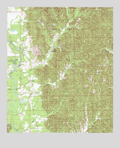
Sprott, AL USGS Topographic Map
Click on map above to begin viewing in our Map Viewer.

This topographic map contains these locations and features:
Feature Name Type Latitude Longitude GNIS ID View Map
Athahatchee (historical)LocaleN32.6765°W87.2472°162645View Map
Barnett BranchStreamN32.7360°W87.1750°159231View Map
Barron-Wells CemeteryCemeteryN32.6454°W87.2025°162988View Map
Camp BranchStreamN32.7237°W87.1858°159297View Map
Cleveland MillsPopulated PlaceN32.7043°W87.1989°159416View Map
Cleveland Mills ChurchChurchN32.7060°W87.1983°162657View Map
Concord Baptist ChurchChurchN32.6257°W87.1606°159437View Map
Daniel CemeteryCemeteryN32.7004°W87.2230°162980View Map
Dobyne-Haggard CemeteryCemeteryN32.7321°W87.1817°162978View Map
Ephesus Baptist ChurchChurchN32.7310°W87.1981°159576View Map
Farrer CemeteryCemeteryN32.6840°W87.1425°162985View Map
Ivey CemeteryCemeteryN32.6960°W87.1800°162982View Map
Iveys ChapelChurchN32.6985°W87.1769°159853View Map
Iveys Chapel CemeteryCemeteryN32.6994°W87.1780°162996View Map
Little CreekStreamN32.7054°W87.1967°159965View Map
Middle LakeLakeN32.6959°W87.2399°160089View Map
Mill CreekStreamN32.6726°W87.2406°159504View Map
Mill CreekStreamN32.7421°W87.1683°160101View Map
Mount Pisgah ChurchChurchN32.7149°W87.1256°169114View Map
Mount Pleasant Freewill Baptist ChurchChurchN32.7493°W87.1881°160173View Map
New Hope Methodist ChurchChurchN32.7324°W87.1725°160237View Map
Oak Grove ChurchChurchN32.6918°W87.1386°162681View Map
Oak Grove ChurchChurchN32.6751°W87.1297°160266View Map
Oak Grove SchoolSchoolN32.6915°W87.1317°160271View Map
OsbornPopulated PlaceN32.6837°W87.1431°160322View Map
Osburn CemeteryCemeteryN32.6771°W87.1417°162986View Map
Perry LakeLakeN32.6942°W87.2420°160362View Map
Provewell ChurchChurchN32.6804°W87.2172°162690View Map
Provewell SchoolSchoolN32.6807°W87.2175°160450View Map
Round LakeLakeN32.6975°W87.2411°160539View Map
SprottPopulated PlaceN32.6768°W87.2214°160662View Map
Sprott DivisionCivilN32.6852°W87.1395°165920View Map
Sprott Volunteer Fire DepartmentBuildingN32.7066°W87.1978°2691384View Map
Stone BranchStreamN32.7257°W87.1808°160680View Map
Swann CemeteryCemeteryN32.6987°W87.1717°162983View Map
TheoPopulated PlaceN32.7224°W87.1889°162696View Map
Warren Academy (historical)SchoolN32.7246°W87.1889°162979View Map
White BranchStreamN32.7421°W87.1683°160830View Map
White CemeteryCemeteryN32.6662°W87.1611°162987View Map

Note: Coordinates in the location and feature list above are referenced to NAD83 datum.


Copyright (C) 2008-2025 Ryan Niemi / Sunset Dynamics ... All Rights Reserved