TopoQuest Logo
Do you find TopoQuest useful?
Help keep TopoQuest running and adding new maps/features by donating!
Bitcoin:  19c7KJd3qBynnjoSw5npx9KScwjBe4ifkT
Litecoin:  LXs6TkuXGGXo1vDsWCkWVdjQX94eUKd6ui
Home View Maps Find Maps Find Places Resources & Links


Spurlington, Kentucky Topographic Map

USGS Map Title: Spurlington, KY
USGS Map MRC: 37085D3
DRG (GeoTIFF) Download: o37085d3.tif


Neighboring USGS Topographic Map Quads:


  Raywick, KY  
37085E4
 

  Lebanon West, KY  
37085E3
 

  Lebanon East, KY  
37085E2
 

  Saloma, KY  
37085D4
 

  Spurlington, KY  
37085D3
 

  Bradfordsville, KY  
37085D2
 

  Greensburg, KY  
37085C4
 

  Campbellsville, KY  
37085C3
 

  Mannsville, KY  
37085C2


Map MRC Location:

N38°
W86°
N38°
W85°
H8 H7 H6 H5 H4 H3 H2 H1
G8 G7 G6 G5 G4 G3 G2 G1
F8 F7 F6 F5 F4 F3 F2 F1
E8 E7 E6 E5 E4 E3 E2 E1
D8 D7 D6 D5 D4 D3 D2 D1
C8 C7 C6 C5 C4 C3 C2 C1
B8 B7 B6 B5 B4 B3 B2 B1
A8 A7 A6 A5 A4 A3 A2 A1
N37°
W86°
N37°
W85°

Spurlington, KY USGS 1:24K Topographic Map Preview:
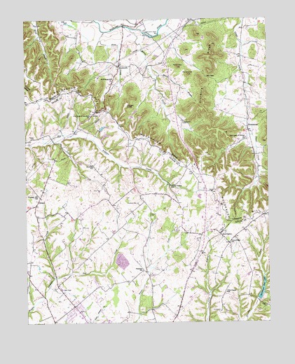
Spurlington, KY USGS Topographic Map
Click on map above to begin viewing in our Map Viewer.

This topographic map contains these locations and features:
Feature Name Type Latitude Longitude GNIS ID View Map
Benningfield CemeteryCemeteryN37.4578°W85.2925°486868View Map
Brookman CemeteryCemeteryN37.4242°W85.3174°487953View Map
Chestnut Grove SchoolSchoolN37.3928°W85.3736°489447View Map
Colvin CemeteryCemeteryN37.4301°W85.3358°489892View Map
Coxs LakeReservoirN37.4553°W85.3355°2742653View Map
Craig CreekStreamN37.4512°W85.3605°490270View Map
Dividing RidgeRidgeN37.4790°W85.2800°490913View Map
Feather CemeteryCemeteryN37.4517°W85.3722°492013View Map
FinleyPopulated PlaceN37.4615°W85.3394°492082View Map
Friendship Baptist Church-Sand Lick Meeting House Historical MarkerParkN37.4264°W85.3675°2744735View Map
Hills Chapel SchoolSchoolN37.3876°W85.2722°494270View Map
HobsonPopulated PlaceN37.4256°W85.3689°494325View Map
Hogan CemeteryCemeteryN37.3817°W85.2516°494350View Map
JessietownPopulated PlaceN37.4809°W85.3250°495253View Map
Kindness SchoolSchoolN37.4406°W85.3397°495734View Map
Knoops SchoolSchoolN37.4673°W85.3697°495851View Map
Knopps School (historical)SchoolN37.4665°W85.3699°2566875View Map
Mill GapGapN37.4770°W85.2805°498281View Map
Moore CreekStreamN37.4970°W85.3194°498550View Map
Muldraugh HillRidgeN37.4709°W85.3472°517062View Map
Muldraugh Hill ChurchChurchN37.4745°W85.3283°499077View Map
Mussin BranchStreamN37.4817°W85.3100°499140View Map
New Market DivisionCivilN37.4981°W85.3374°1937172View Map
Our Lady of Fatina ChurchChurchN37.4520°W85.2608°500038View Map
Our Lady of the Hills ChurchChurchN37.4609°W85.3408°500036View Map
Owl CreekStreamN37.3940°W85.3600°500085View Map
Paine KnobSummitN37.4778°W85.2897°500113View Map
Palestine SchoolSchoolN37.3962°W85.3150°500136View Map
PhillipsburgPopulated PlaceN37.4565°W85.2600°500542View Map
Phillipsburg Post Office (historical)Post OfficeN37.4554°W85.2594°2566884View Map
Phillipsburg Railroad Station (historical)LocaleN37.4564°W85.2600°2566885View Map
Pitman Valley SchoolSchoolN37.4320°W85.3000°500780View Map
Pleasant Hill SchoolSchoolN37.4284°W85.3694°500878View Map
Rafferty CemeteryCemeteryN37.4198°W85.3102°501519View Map
Ridge (historical)Populated PlaceN37.4746°W85.3665°2566887View Map
Round KnobSummitN37.4778°W85.2897°502405View Map
Saint Francis CemeteryCemeteryN37.4126°W85.2983°502617View Map
Sanders Tavern Historical MarkerParkN37.4310°W85.3654°2744730View Map
Shingle KnobSummitN37.4651°W85.3214°503391View Map
Shively CemeteryCemeteryN37.3798°W85.2752°503401View Map
Slate CreekStreamN37.4948°W85.3327°503638View Map
Sportsman Club LakeReservoirN37.3877°W85.2538°504085View Map
SpurlingtonPopulated PlaceN37.4123°W85.2747°504189View Map
Union Ridge SchoolSchoolN37.4090°W85.2697°505813View Map

Note: Coordinates in the location and feature list above are referenced to NAD83 datum.


Copyright (C) 2008-2024 Ryan Niemi / Sunset Dynamics ... All Rights Reserved