TopoQuest Logo
Do you find TopoQuest useful?
Help keep TopoQuest running and adding new maps/features by donating!
Bitcoin:  19c7KJd3qBynnjoSw5npx9KScwjBe4ifkT
Litecoin:  LXs6TkuXGGXo1vDsWCkWVdjQX94eUKd6ui
Home View Maps Find Maps Find Places Resources & Links


Saloma, Kentucky Topographic Map

USGS Map Title: Saloma, KY
USGS Map MRC: 37085D4
DRG (GeoTIFF) Download: o37085d4.tif


Neighboring USGS Topographic Map Quads:


  Howardstown, KY  
37085E5
 

  Raywick, KY  
37085E4
 

  Lebanon West, KY  
37085E3
 

  Hibernia, KY  
37085D5
 

  Saloma, KY  
37085D4
 

  Spurlington, KY  
37085D3
 

  Summersville, KY  
37085C5
 

  Greensburg, KY  
37085C4
 

  Campbellsville, KY  
37085C3


Map MRC Location:

N38°
W86°
N38°
W85°
H8 H7 H6 H5 H4 H3 H2 H1
G8 G7 G6 G5 G4 G3 G2 G1
F8 F7 F6 F5 F4 F3 F2 F1
E8 E7 E6 E5 E4 E3 E2 E1
D8 D7 D6 D5 D4 D3 D2 D1
C8 C7 C6 C5 C4 C3 C2 C1
B8 B7 B6 B5 B4 B3 B2 B1
A8 A7 A6 A5 A4 A3 A2 A1
N37°
W86°
N37°
W85°

Saloma, KY USGS 1:24K Topographic Map Preview:
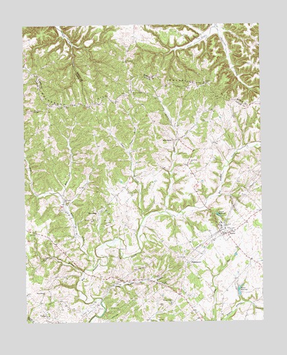
Saloma, KY USGS Topographic Map
Click on map above to begin viewing in our Map Viewer.

This topographic map contains these locations and features:
Feature Name Type Latitude Longitude GNIS ID View Map
Bull Tail CreekStreamN37.4287°W85.4802°488367View Map
Clear Creek (historical)Populated PlaceN37.4936°W85.4073°2566862View Map
DurhamtownPopulated PlaceN37.3998°W85.4139°507895View Map
Falling Timber BranchStreamN37.3842°W85.4597°491959View Map
Ferrill ReservoirReservoirN37.4198°W85.3981°492052View Map
Gilboa (historical)Populated PlaceN37.4739°W85.4068°2742293View Map
Good Hope Baptist ChurchChurchN37.4419°W85.4120°492957View Map
Jones CreekStreamN37.4187°W85.4377°495491View Map
Kerr CemeteryCemeteryN37.4603°W85.4058°495689View Map
McFarland BranchStreamN37.4494°W85.4199°2742656View Map
Mill CreekStreamN37.3981°W85.4641°485693View Map
Mount Carmel ChurchChurchN37.4262°W85.4789°498704View Map
Mount Gilboa ChurchChurchN37.4745°W85.4061°498727View Map
Mount Gilboa Lookout TowerTowerN37.4753°W85.4031°2566880View Map
Mount Roberts ChurchChurchN37.3873°W85.4900°498859View Map
Mount Washington CemeteryCemeteryN37.4726°W85.4416°498906View Map
Mount Washington ChurchChurchN37.4853°W85.4466°498908View Map
Muldraughs Mill CreekStreamN37.4422°W85.4219°2742657View Map
PitmanPopulated PlaceN37.3781°W85.4894°508830View Map
Pleasant Union ChurchChurchN37.3837°W85.4233°500916View Map
Porter ReservoirReservoirN37.3860°W85.3868°501151View Map
Saint Matthews Catholic Church (historical)ChurchN37.4831°W85.3791°2566900View Map
Saint Matthews CemeteryCemeteryN37.4834°W85.3794°502698View Map
SalomaPopulated PlaceN37.4120°W85.3927°502817View Map
Saloma DivisionCivilN37.4207°W85.4411°1937237View Map
Splatter BranchStreamN37.3959°W85.4691°504078View Map
Sullivans ProngStreamN37.4990°W85.3983°504722View Map
TGP HeliportAirportN37.4126°W85.3944°517350View Map
White RosePopulated PlaceN37.4212°W85.4611°509359View Map
WillowtownPopulated PlaceN37.4520°W85.4219°509379View Map
Willowtown CreekStreamN37.4211°W85.4262°506872View Map
Willowtown HillSummitN37.4536°W85.4273°2742660View Map

Note: Coordinates in the location and feature list above are referenced to NAD83 datum.


Copyright (C) 2008-2025 Ryan Niemi / Sunset Dynamics ... All Rights Reserved