TopoQuest Logo
Do you find TopoQuest useful?
Help keep TopoQuest running and adding new maps/features by donating!
Bitcoin:  19c7KJd3qBynnjoSw5npx9KScwjBe4ifkT
Litecoin:  LXs6TkuXGGXo1vDsWCkWVdjQX94eUKd6ui
Home View Maps Find Maps Find Places Resources & Links


Greensburg, Kentucky Topographic Map

USGS Map Title: Greensburg, KY
USGS Map MRC: 37085C4
DRG (GeoTIFF) Download: o37085c4.tif


Neighboring USGS Topographic Map Quads:


  Hibernia, KY  
37085D5
 

  Saloma, KY  
37085D4
 

  Spurlington, KY  
37085D3
 

  Summersville, KY  
37085C5
 

  Greensburg, KY  
37085C4
 

  Campbellsville, KY  
37085C3
 

  Exie, KY  
37085B5
 

  Gresham, KY  
37085B4
 

  Cane Valley, KY  
37085B3


Map MRC Location:

N38°
W86°
N38°
W85°
H8 H7 H6 H5 H4 H3 H2 H1
G8 G7 G6 G5 G4 G3 G2 G1
F8 F7 F6 F5 F4 F3 F2 F1
E8 E7 E6 E5 E4 E3 E2 E1
D8 D7 D6 D5 D4 D3 D2 D1
C8 C7 C6 C5 C4 C3 C2 C1
B8 B7 B6 B5 B4 B3 B2 B1
A8 A7 A6 A5 A4 A3 A2 A1
N37°
W86°
N37°
W85°

Greensburg, KY USGS 1:24K Topographic Map Preview:
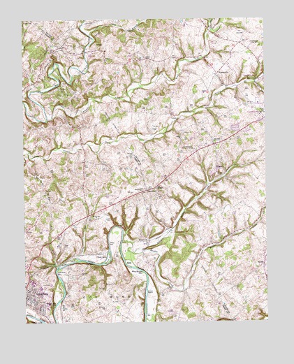
Greensburg, KY USGS Topographic Map
Click on map above to begin viewing in our Map Viewer.

This topographic map contains these locations and features:
Feature Name Type Latitude Longitude GNIS ID View Map
Anderson CemeteryCemeteryN37.2701°W85.4708°485935View Map
Beech Grove ChurchChurchN37.3042°W85.4386°486723View Map
BengalPopulated PlaceN37.3592°W85.4572°507494View Map
Black GnatPopulated PlaceN37.3042°W85.4364°507513View Map
Blakeman CemeteryCemeteryN37.2559°W85.4586°487447View Map
Bluff BoomPopulated PlaceN37.2778°W85.4611°507539View Map
Boom HoleLakeN37.2826°W85.4561°487681View Map
Buck Horn CreekStreamN37.3491°W85.3800°488226View Map
BurdickPopulated PlaceN37.2737°W85.3761°507620View Map
Campbellsville Country ClubLocaleN37.3645°W85.3794°517107View Map
Campbellsville Memorial GardensCemeteryN37.3206°W85.4122°488744View Map
Chaney CemeteryCemeteryN37.3462°W85.4805°489329View Map
City of GreensburgCivilN37.2598°W85.4965°2403746View Map
Cowherd CemeteryCemeteryN37.3648°W85.4577°490201View Map
Cox BendBendN37.2603°W85.4586°490211View Map
Cox CemeteryCemeteryN37.2656°W85.4550°490219View Map
Cox HoleLakeN37.2742°W85.4644°490223View Map
Earlys ChapelChurchN37.3590°W85.4358°491423View Map
Flat RunStreamN37.3703°W85.4027°492216View Map
Full Gospel TabernacleChurchN37.3245°W85.4014°492605View Map
Green County Ambulance ServiceBuildingN37.2614°W85.4992°2719118View Map
GreensburgPopulated PlaceN37.2609°W85.4989°493339View Map
Greensburg - Green County Fire DepartmentBuildingN37.2614°W85.4992°2636543View Map
Greensburg DivisionCivilN37.2751°W85.4844°1937033View Map
Hobson IslandIslandN37.2509°W85.4941°494327View Map
Hogards ChapelChurchN37.3051°W85.4305°494353View Map
Lewis CemeteryCemeteryN37.2656°W85.4908°496319View Map
Little Meadow CreekStreamN37.2811°W85.4442°496796View Map
Locust Lick BranchStreamN37.3681°W85.4644°496964View Map
Marcum IslandIslandN37.2762°W85.4555°497533View Map
Marshall CemeteryCemeteryN37.3189°W85.4430°497577View Map
Marshall RidgeRidgeN37.3059°W85.4891°497583View Map
Meadow CreekStreamN37.2831°W85.4491°497983View Map
Middle Pitman CreekStreamN37.3340°W85.4872°498146View Map
Mill CreekStreamN37.2728°W85.4833°498240View Map
Miller CemeteryCemeteryN37.3134°W85.4558°498326View Map
Pleasant Run ChurchChurchN37.2926°W85.4627°500909View Map
Rocky RunStreamN37.2770°W85.4725°502263View Map
Russell IslandIslandN37.2748°W85.4777°502528View Map
Salem ChurchChurchN37.3692°W85.3855°502784View Map
Shiloh ChurchChurchN37.3256°W85.4180°503378View Map
Sinking Rock HoleLakeN37.2576°W85.4836°503573View Map
Skaggs CemeteryCemeteryN37.3745°W85.4966°503593View Map
Snaps IslandIslandN37.2623°W85.4369°503847View Map
Spillmans HoleLakeN37.2709°W85.4836°504077View Map
SweeneyvillePopulated PlaceN37.3523°W85.3991°509173View Map
Taylor CemeteryCemeteryN37.2562°W85.4813°505001View Map
WCKQ-FM (Campbellsville)TowerN37.3348°W85.3766°517932View Map
White IslandIslandN37.2745°W85.4458°506588View Map
White Springs HoleLakeN37.2706°W85.4386°506645View Map
WhitewoodPopulated PlaceN37.2837°W85.4361°509364View Map
WrightsPopulated PlaceN37.3126°W85.4000°509411View Map
WTCO-AM (Campbellsville)TowerN37.3348°W85.3766°517781View Map

Note: Coordinates in the location and feature list above are referenced to NAD83 datum.


Copyright (C) 2008-2025 Ryan Niemi / Sunset Dynamics ... All Rights Reserved