TopoQuest Logo
Do you find TopoQuest useful?
Help keep TopoQuest running and adding new maps/features by donating!
Bitcoin:  19c7KJd3qBynnjoSw5npx9KScwjBe4ifkT
Litecoin:  LXs6TkuXGGXo1vDsWCkWVdjQX94eUKd6ui
Home View Maps Find Maps Find Places Resources & Links


Squaw Creek Mesa, Arizona Topographic Map

USGS Map Title: Squaw Creek Mesa, AZ
USGS Map MRC: 34112A1
DRG (GeoTIFF) Download: o34112a1.tif


Neighboring USGS Topographic Map Quads:


  Bumble Bee, AZ  
34112B2
 

  Joes Hill, AZ  
34112B1
 

  Brooklyn Peak, AZ  
34111B8
 

  Black Canyon City, AZ  
34112A2
 

  Squaw Creek Mesa, AZ  
34112A1
 

  Cooks Mesa, AZ  
34111A8
 

  New River, AZ  
33112H2
 

  Daisy Mountain, AZ  
33112H1
 

  New River Mesa, AZ  
33111H8


Map MRC Location:

N35°
W113°
N35°
W112°
H8 H7 H6 H5 H4 H3 H2 H1
G8 G7 G6 G5 G4 G3 G2 G1
F8 F7 F6 F5 F4 F3 F2 F1
E8 E7 E6 E5 E4 E3 E2 E1
D8 D7 D6 D5 D4 D3 D2 D1
C8 C7 C6 C5 C4 C3 C2 C1
B8 B7 B6 B5 B4 B3 B2 B1
A8 A7 A6 A5 A4 A3 A2 A1
N34°
W113°
N34°
W112°

Squaw Creek Mesa, AZ USGS 1:24K Topographic Map Preview:
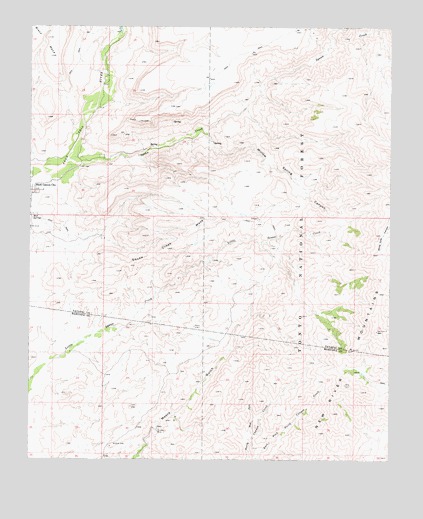
Squaw Creek Mesa, AZ USGS Topographic Map
Click on map above to begin viewing in our Map Viewer.

This topographic map contains these locations and features:
Feature Name Type Latitude Longitude GNIS ID View Map
Black Canyon City Census Designated PlaceCensusN34.0709°W112.1220°2407854View Map
Boteler PeakSummitN34.0684°W112.0374°40923View Map
Brushy CanyonValleyN34.1220°W112.0113°38276View Map
Brushy TanksReservoirN34.0248°W112.0099°40917View Map
Camp CanyonValleyN34.1067°W112.0465°38306View Map
Chino Corral SpringSpringN34.0418°W112.0253°40918View Map
Crizaba MineMineN34.0081°W112.0810°28175View Map
Cross Y Ranch Airport (historical)AirportN34.1167°W112.0957°45306View Map
Mud SpringsSpringN34.0706°W112.1243°32131View Map
New Cabin CorralLocaleN34.0589°W112.0404°40921View Map
New River MountainsRangeN34.0311°W112.0135°32294View Map
Orizaba MineMineN34.0084°W112.0813°40919View Map
Shortt Smith SpringSpringN34.0661°W112.0361°40922View Map
Squaw CreekStreamN34.0861°W112.1121°34767View Map
Squaw Creek MesaSummitN34.0698°W112.0596°34768View Map
Sycamore CanyonValleyN34.1014°W112.0518°38856View Map
Trails End Airstrip (historical)AirportN34.0925°W112.0743°38885View Map
West Fork North Canyon CreekStreamN34.0061°W112.0482°35981View Map
Willow Spring CanyonValleyN34.0953°W112.0660°36267View Map
Woody TankReservoirN34.0352°W112.0627°40920View Map

Note: Coordinates in the location and feature list above are referenced to NAD83 datum.


Copyright (C) 2008-2025 Ryan Niemi / Sunset Dynamics ... All Rights Reserved